1980s Maps of Acadia Parish, Louisiana
Explore 20 historic maps of Acadia Parish from the 1980s. These maps offer a rare glimpse into what life looked like during the 1980s — showing old roads, neighborhoods, homes, and landmarks that have changed or disappeared over time.
Whether you're researching your family's past, planning a metal detecting trip, or studying how Acadia Parish's landscape evolved across the 1980s, these high-resolution maps are a powerful tool for exploring the history of this region.
- Focus on a specific era: All maps on this page are from the 1980s, giving you a focused view of this time period.
- See what’s changed: Compare century-old streets, trails, and buildings to today's modern landscape using overlays and satellite layers.
- Research with precision: Use these maps for genealogy, historical research, land use analysis, or educational projects.
- View, download, or print: Maps are fully viewable online in high resolution, and can be downloaded or printed for your own records.
Start exploring Acadia Parish's history through authentic maps from the 1980s. This is your window into the past.
Acadia Parish, LA maps
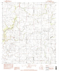
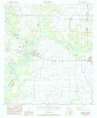
(20)- 1983 Map of Richard
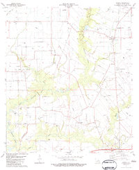
 1983 Richard1983 Print · USGSThe Acadia and St. Landry Parish line comes into focus in the early 1980s, showcasing a landscape of oil fields and prairie farms. Genealogists can locate family landmarks like Pitreville, the Acadia Academy, and Mt Calvary Cem.
 - 1983 Map of Crowley East
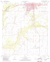
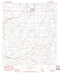
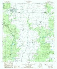
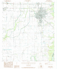
 1983 Crowley East1983 Print · USGSAcadia Parish at the start of the 1980s shows a landscape defined by the intersection of rail commerce and intensive agricultural irrigation. Researchers can trace historical family sites through St Joseph Cem and Notre Dame High Sch, or follow the industrial path of the Southern Pacific line.
 - 1983 Map of Crowley West
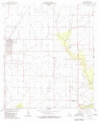
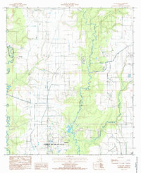
 1983 Crowley West1983 Print · USGSAcadia Parish in the early 1980s reveals a sophisticated network of canals and flumes supporting the prairie rice country. Researchers can trace family history at Leger Cem or explore the rail-based growth of Estherwood, Midland, and the western edge of Crowley.2 unique versions available
 - 1983 Map of Church Point
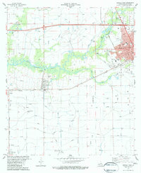
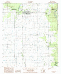
 1983 Church Point1983 Print · USGSAcadia and St. Landry parishes are captured here in the early eighties as a landscape of deep bayous and productive energy fields. Researchers can trace local heritage through sites like Our Mother of Peace Sch, McBride Cem, and the Missouri Pacific railroad corridor.
 - 1983 Map of Mire
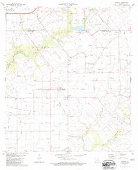
 1983 Mire1983 Print · USGSAcadia Parish and the borders of St. Landry and Lafayette parishes are captured in the early 1980s as the local energy economy flourished. Genealogists and historians can trace small communities like Mire and Higginbotham or locate landmarks such as Sunrise Ch and the Cankton Oil and Gas Field.
 - 1983 Map of Wright
 1983 Wright1983 Print · USGSThe Louisiana prairie between Acadia and Vermilion Parishes comes alive in the early 1980s, showing a landscape shaped by rice irrigation and rail. Local historians can trace family roots at Hanks Cem, locate the Jesse Owens Sch, or follow the Southern Pacific through Morse and Wright.2 unique versions available
 - 1983 Map of Eunice South
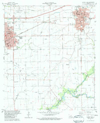
 1983 Eunice South1983 Print · USGSAcadia and St. Landry parishes are captured here in the early eighties as the town of Eunice expands into the surrounding oil fields. Researchers can trace rural landmarks from the St Lawrence Ch to legacy sites like the Riche Oil And Gas Field and Mowata.2 unique versions available
 - 1983 Map of Iota
 1983 Iota1983 Print · USGSAcadia Parish in the early eighties was a landscape of precision irrigation and rail-linked prairie towns. Genealogists and local researchers can trace family landmarks like McCain Cem, the rail siding at Ellis, and the winding course of Coulee Andre.2 unique versions available
 - 1983 Map of Branch
 1983 Branch1983 Print · USGSAcadia Parish in the early eighties shows a landscape of deep-rooted settlements and modern energy production. Researchers can locate family landmarks like Roberts Cove, several historic cemeteries such as Hookman Cem, and the North Crowley Oil and Gas Field.2 unique versions available
 - 1983 Map of Kaplan North
 1983 Kaplan North1983 Print · USGSVermilion Parish in the early eighties shows a landscape of prairie agriculture and water management north of the town center. Genealogists and local historians can locate family landmarks like Abshire Cem, the Meaux Landing Strip, and the winding Bayou Queue De Tortue.
 - 1983 Map of Duson
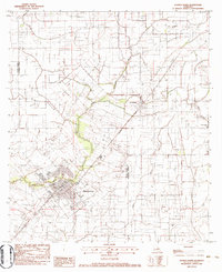
 1983 Duson1983 Print · USGSAcadiana's rural landscape comes into focus in the early 1980s as the railroad and bayous shape local life. Genealogists can trace family names at Bethel Cem or Anderson Cem and locate schools like Judice High Sch.
 - 1984 Map of Lake Arthur
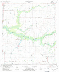
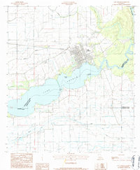 1984 Lake Arthur1984 Print · USGSThe marshy lowlands of Jefferson Davis Parish in the mid-1980s center on the waters of Lake Arthur and the Mermentau River. Researchers can trace the complex drainage networks, local cemeteries like Cem, and the settlement at Klondike.
 - 1984 Map of Gueydan, 1985 Print
 1984 Gueydan1985 Print · USGSGueydan and the surrounding Louisiana wetlands were captured in the early eighties as a complex hub of irrigation and air strips. Genealogists and historians can trace the rice-farming infrastructure around Riceville, Morse, and the banks of Bayou Queue de Tortue.2 unique versions available
 - 1984 Map of Mermentau, 1985 Print
 1984 Mermentau1985 Print · USGSThe Mermentau River basin in the early eighties serves as a perfect record of the transition between historic bayou life and modern agriculture. Genealogists can locate specific burial sites at Indian Cem or Quebodaux Cem, while following the L I & M rail line through Egan and Midland.2 unique versions available
 - 1985 Map of Basile
 1985 Basile1985 Print · USGSLouisiana's prairie and oil country come into focus in the mid-eighties as parish lines meet near Basile. Researchers can trace the industrial footprint of the Oil Field and find small settlements like Tepetate and Barwick along the bayous.2 unique versions available
 - 1985 Map of Evangeline
 1985 Evangeline1985 Print · USGSAcadia Parish in the mid-1980s reveals a productive landscape shaped by petroleum and irrigation. Genealogists and researchers can locate family land near Evangeline, the Jennings Oil and Gas Field, or the small community of Iota.
 - 1985 Map of Elton
 1985 Elton1985 Print · USGSElton and the surrounding parish borders are captured here in the mid-1980s, showcasing the region's mix of prairie agriculture and energy production. Genealogists and historians can trace family locations near China, Barnsdall, and the Oil And Gas Field.
 - 1985 Map of Jennings
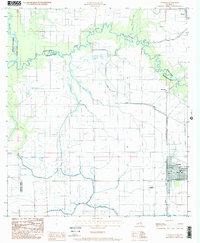
 1985 Jennings1985 Print · USGSJennings and the surrounding Louisiana prairie are captured in the mid-eighties as a hub of energy and agriculture. Researchers can trace the sprawling Lake Arthur Oil and Gas Field or locate family sites at Roanoke and local Cem markers.2 unique versions available
 - 1985 Map of Hathaway
 1985 Hathaway1985 Print · USGSJefferson Davis Parish in the mid-1980s shows a landscape transformed by intensive irrigation and rural industry. Genealogists and researchers can trace local landmarks like Hathaway and Panchoville, alongside the Tiptop Canal and family cemeteries.
 - 1985 Map of Crowley, 1986 Print
 1985 Crowley1986 Print · USGSCoastal prairie and bayou country are captured in the mid-eighties as the rice-and-rail economy defined South Louisiana life. Genealogists and researchers can trace family lands and rural hubs from Crowley to Jennings, following the paths of the Southern Pacific Railroad and the winding Mermentau River.2 unique versions available
End of results
Showing maps 1-20 of 20
Top cities of Acadia Parish
- Crowley historical maps
- Rayne historical maps
- Church Point historical maps
- Iota historical maps
- Estherwood historical maps
- Mermentau historical maps
See more
Frequently asked questions
- What are the different types of historical maps available for Acadia Parish?
- What is the oldest map of Acadia Parish?
- Where can I purchase historical maps of Acadia Parish for my home or office?
- Where can I download high-res historical maps of Acadia Parish?
- Are there historical topographic maps available for Acadia Parish?
- Is there historical aerial imagery available for Acadia Parish?
- Where are historical maps of Acadia Parish sourced from?