1900s (20th Century) Maps of DeRidder, Louisiana
Explore 13 historic maps of DeRidder from the 1900s (20th Century). These maps offer a rare glimpse into what life looked like during the 1900s — showing old roads, neighborhoods, homes, and landmarks that have changed or disappeared over time.
Whether you're researching your family's past, planning a metal detecting trip, or studying how DeRidder's landscape evolved across the 1900s, these high-resolution maps are a powerful tool for exploring the history of this region.
- Focus on a specific era: All maps on this page are from the 1900s, giving you a focused view of this time period.
- See what’s changed: Compare century-old streets, trails, and buildings to today's modern landscape using overlays and satellite layers.
- Research with precision: Use these maps for genealogy, historical research, land use analysis, or educational projects.
- View, download, or print: Maps are fully viewable online in high resolution, and can be downloaded or printed for your own records.
Start exploring DeRidder's history through authentic maps from the 1900s. This is your window into the past.
DeRidder, LA maps
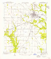
(13)- 1947 Map of DeRidder
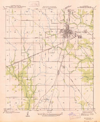 1947 DeRidder1947 Print · USGSBeauregard Parish in the mid-1940s was a critical juncture for the timber and rail industries. Genealogists and historians can locate defunct logging camps and community landmarks such as Grabow, Bon Ami, and the Old Hickman Sch along the Kansas City Southern tracks.
 - 1947 Map of Rosepine
 1947 Rosepine1947 Print · USGSLouisiana's western pine forests come into focus in the mid-1940s as the logging industry evolved along the rail corridors. Genealogists and researchers can trace the old paths between Neame and Rosepine, locating family landmarks like Walnut Grove Ch and Miller Cem.
 - 1952 Map of Lake Charles
 1952 Lake Charles1952 Print · USGSSouthwest Louisiana is captured here in the mid-fifties, showing a landscape defined by the rise of the petrochemical industry and deep-water navigation. Researchers can trace family roots through numerous small-town settlements and oil developments like Nibletts Bluff, the Lockport Oil Field, and Starks.
 - 1954 Map of DeRidder
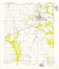 1954 DeRidder1954 Print · USGSDe Ridder and Beauregard Parish are shown here during the mid-century, highlighting a landscape shaped by rail and timber. Researchers can trace historic sites like Old Hickman Sch, the settlement of Bon Ami, and extensive Old Logging Railroad Grades.
 - 1954 Map of Rosepine
 1954 Rosepine1954 Print · USGSThe pine woods of western Louisiana are captured here during a period of transition for the local timber industry. Researchers can trace the legacy of old company towns and rural life through landmarks like Neame, the Old Logging Railroad, and Cypress Creek Ch.
 - 1954 Map of Lake Charles, 1964 Print
 1954 Lake Charles1964 Print · USGSSouthwest Louisiana in the mid-fifties is defined by its massive petroleum industry and its complex network of bayous and rail lines. Researchers can trace the development of the Sulphur Mines Oil Field or locate historic settlements like Longville and De Quincy.3 unique versions available
 - 1956 Map of DeRidder
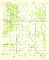
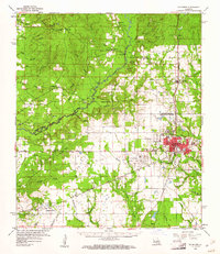
 1956 DeRidder1956 Print · USGSBeauregard Parish in the mid-1930s was a critical rail junction where timber and transport intersected. Genealogists and historians can locate rural landmarks like Pine Ridge Ch and Old Hickman Sch or trace the Old Logging Railroad Grade near Carson.
 - 1960 Map of De Ridder, 1961 Print
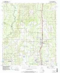
 1960 De Ridder1961 Print · USGSBeauregard Parish at the start of the 1960s shows a landscape shaped by timber, rail, and emerging oil interests. Genealogists can trace family roots through rural landmarks like Lillie Ch, Knight, and the settlements of Rosepine and Bon Ami.2 unique versions available
 - 1984 Map of Deridder, 1997 Print
 1984 Deridder1997 Print · USGSLouisiana's timber and aviation history converge in this mid-1980s look at Beauregard Parish. Researchers can trace the legacy of smaller communities like Bon Ami and Carson or locate local landmarks like the Beauregard Parish Airport and Hickory Branch.
 - 1986 Map of Rosepine
 1986 Rosepine1986 Print · USGSThe Vernon and Beauregard Parish line comes into focus in the mid-1980s, showcasing the rural landscape surrounding Rosepine and De Ridder. Researchers can trace old gravel operations at the Gravel Pits or locate local landmarks like the Cem and Ludington.2 unique versions available
 - 1986 Map of DeRidder
 1986 DeRidder1986 Print · USGSThe Louisiana-Texas borderlands come to life in the mid-eighties, showcasing the timber country and rail corridors of the Sabine River valley. Researchers can trace the legacy of small communities and transit lines through Merryville, Holly Springs, and the Missouri Pacific railroad.2 unique versions available
 - 1986 Map of De Ridder
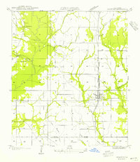
 1986 De Ridder1986 Print · USGSDe Ridder and its surrounding piney woods parishes are captured here in the mid-1980s. Genealogists and local historians can trace old transit routes like the Old RR Grade or locate landmarks such as Bon Ami, Carson, and the Fair Ground.
 - 1994 Map of Rosepine, 1997 Print
 1994 Rosepine1997 Print · USGSRosepine and the northern outskirts of Deridder are captured in the mid-nineties, documenting the transition between Vernon and Beauregard Parishes. Researchers can trace the winding course of the Anacoco River and locate local landmarks such as the Minnow Ponds, Ludington, and Pinewood.
End of results
Showing maps 1-13 of 13
Top cities near DeRidder
Top neighborhoods of DeRidder
Frequently asked questions
- What are the different types of historical maps available for DeRidder?
- What is the oldest map of DeRidder?
- Where can I purchase historical maps of DeRidder for my home or office?
- Where can I download high-res historical maps of DeRidder?
- Are there historical topographic maps available for DeRidder?
- Is there historical aerial imagery available for DeRidder?
- Where are historical maps of DeRidder sourced from?