Old Maps of Kernan, Louisiana for Metal Detecting
Plan your next treasure hunt with 12 historic maps of Kernan. Find old homesites, ghost towns, trails, and gathering spots that may be lost to time — perfect for identifying promising metal detecting locations.
- Locate forgotten sites: Uncover places like long-lost settlements, abandoned rail lines, or gathering spots.
- Plan better hunts: Use map overlays combined with LiDAR or satellite views to narrow in on historically rich areas.
- Made for detectorists: Thousands of hobbyists use these maps to discover relics, coins, and hidden history.
Use these historic maps to boost your research and find new opportunities beneath the surface of Kernan.
Kernan, LA maps
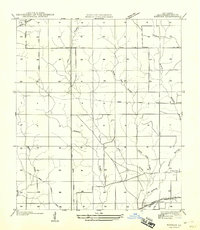
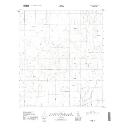
(12)- 1947 Map of Kernan
 1947 Kernan1947 Print · USGSBeauregard Parish was a landscape of timber and transit in the late 1940s, where rural life centered on rail sidings and creek crossings. You can trace the Old Logging Railroad Grade across the parish or locate Kernan near the Bear Ch.
 - 1949 Map of Kernan
 1949 Kernan1949 Print · USGSBeauregard Parish in the late 1940s reveals a landscape shifting from timber extraction to modern transit. Researchers can trace the Old Logging Railroad Grade and locate community landmarks like Bear Ch and the settlement of Kernan.2 unique versions available
 - 1952 Map of Lake Charles
 1952 Lake Charles1952 Print · USGSSouthwest Louisiana is captured here in the mid-fifties, showing a landscape defined by the rise of the petrochemical industry and deep-water navigation. Researchers can trace family roots through numerous small-town settlements and oil developments like Nibletts Bluff, the Lockport Oil Field, and Starks.
 - 1954 Map of Lake Charles, 1964 Print
 1954 Lake Charles1964 Print · USGSSouthwest Louisiana in the mid-fifties is defined by its massive petroleum industry and its complex network of bayous and rail lines. Researchers can trace the development of the Sulphur Mines Oil Field or locate historic settlements like Longville and De Quincy.3 unique versions available
 - 1961 Map of Singer, 1963 Print
 1961 Singer1963 Print · USGSBeauregard Parish in the early sixties is a landscape of timbered branches and emerging oil fields along the Southern Kansas City railroad. Genealogists and local historians can locate rural landmarks like Holly Grove Ch, Juanita, and the Oretta Cem.2 unique versions available
 - 1986 Map of DeRidder
 1986 DeRidder1986 Print · USGSThe Louisiana-Texas borderlands come to life in the mid-eighties, showcasing the timber country and rail corridors of the Sabine River valley. Researchers can trace the legacy of small communities and transit lines through Merryville, Holly Springs, and the Missouri Pacific railroad.2 unique versions available
 - 1986 Map of Kernan
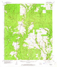
 1986 Kernan1986 Print · USGSBeauregard Parish in the mid-1980s shows a landscape defined by its waterways and nascent industry. Local historians can trace the rural settlements of Poley and Greenhead alongside landmarks like the Oil Refinery and Gravel Pit.
 - 2012 Map of Kernan, 2012 Print
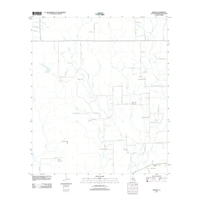 2012 Kernan2012 Print · USGSCovers Kernan, including Beauregard Parish, United States, and other nearby areas
 - 2015 Map of Kernan, 2015 Print
 2015 Kernan2015 Print · USGSCovers Kernan, including Beauregard Parish, United States, and other nearby areas
 - 2018 Map of Kernan, 2018 Print
 2018 Kernan2018 Print · USGSCovers Kernan, including Beauregard Parish, United States, and other nearby areas
 - 2020 Map of Kernan, 2020 Print
 2020 Kernan2020 Print · USGSCovers Kernan, including Beauregard Parish, United States, and other nearby areas
 - 2024 Map of Kernan, 2024 Print
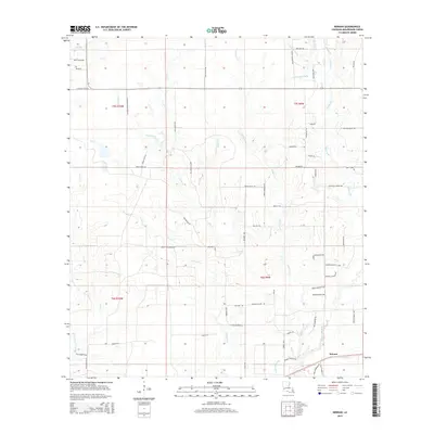
 2024 Kernan2024 Print · USGSBeauregard Parish enters the mid-twenties as a landscape of interconnected wetlands and rural timber routes. Genealogists and researchers can trace family-named lanes like Wesley Coleman Rd and Monty Rigmaiden Rd near the settlement of Kernan.
End of results
Showing maps 1-12 of 12
Top cities near Kernan
Frequently asked questions
- What are the different types of historical maps available for Kernan?
- What is the oldest map of Kernan?
- Where can I purchase historical maps of Kernan for my home or office?
- Where can I download high-res historical maps of Kernan?
- Are there historical topographic maps available for Kernan?
- Is there historical aerial imagery available for Kernan?
- Where are historical maps of Kernan sourced from?