Old Maps of Vanceville, Louisiana for Academic Research
Study the evolution of Vanceville with 17 high-resolution historic maps. Whether you're teaching, researching, or modeling changes in land use, these maps provide essential visual documentation of urban, environmental, and geographic change.
- Analyze long-term change: Track patterns in development, transportation, and natural features.
- Ideal for environmental or urban studies: Support academic projects with primary historical map data.
- Use in the classroom or lab: Educators and researchers rely on these maps to bring historical context to life.
These maps are a powerful tool for teaching, research, and visualizing how Vanceville has changed over the decades.
Vanceville, LA maps
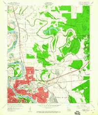
(17)- 1932 Map of Bossier SW
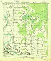 1932 Bossier SW1932 Print · USGSShreveport and Bossier City appear during an era of significant growth, with the newly established Barksdale Field taking shape. Genealogists can trace family footprints at Vanceville, Scottville, and churches like Friendship Ch.
 - 1948 Map of Bossier City
 1948 Bossier City1948 Print · USGSNorthwestern Louisiana during the late 1940s reveals a landscape shaped by the Red River and the expansion of the Bossier City area. Researchers can trace rural family sites near Benton or locate historical landmarks like Barksdale Field and Red River Ch.
 - 1955 Map of Shreveport
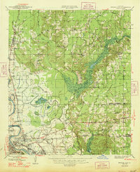
 1955 Shreveport1955 Print · USGSNorthern Louisiana in the mid-fifties is captured here as a landscape of military bases, vast oil fields, and burgeoning college towns. Genealogists and historians can trace the rail-and-river economy through the Monroe Gas Field, Grambling College, and Barksdale Air Force Base.3 unique versions available
 - 1955 Map of Bossier City, 1956 Print
 1955 Bossier City1956 Print · USGSThe Red River valley comes to life in the mid-fifties as the rail-driven economies of Bossier City and Shreveport expand. Genealogists and local historians can trace family roots through neighborhood landmarks like Waller Sch, Greenwood Cemetery, and the historic Mt Zion Ch.
 - 1955 Map of Bossier City, 1956 Print
 1955 Bossier City1956 Print · USGSBossier Parish at the height of the post-war era shows a landscape balancing military aviation and the oil industry with traditional rural settlements. Researchers can trace family roots at Macanesea Cem, locate the Benton Oil and Gas Field, or find the Pleasant Hill Sch (Abandoned).2 unique versions available
 - 1956 Map of Shreveport
 1956 Shreveport1956 Print · USGSNorthern Louisiana during the mid-fifties presents a complex landscape of booming oil fields and strategic military installations. Genealogists and historians can trace the infrastructure of the Monroe Gas Field and family-named locales from Cotton Valley to Jonesboro.
 - 1960 Map of Bossier City
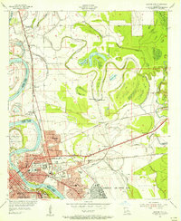
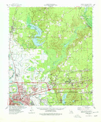
 1960 Bossier City1960 Print · USGSBossier City and Shreveport are shown at a peak of post-war growth as the urban center expands toward the Red River. Researchers can trace mid-century neighborhoods near Plantation Park Sch or locate rural landmarks like Mt Zion Ch and Vanceville.2 unique versions available
 - 1975 Map of Bossier City, 1976 Print
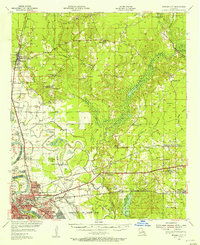
 1975 Bossier City1976 Print · USGSBossier Parish and the Red River banks are captured in high-detail aerial photography during the mid-seventies growth of the Shreveport area. Researchers can trace the development of Bossier City, the sprawling footprint of Barksdale Air Force Base, and the rural character of Brownlee.3 unique versions available
 - 1978 Map of Bossier City
 1978 Bossier City1978 Print · USGSBossier City and its surrounding parishes are shown during a period of rapid development and infrastructure growth in the late seventies. Genealogists and local historians can trace family locations near Hillcrest Memorial Park Cem, the historic settlement of Bellevue, or the rural Macedonia Cem.2 unique versions available
 - 1984 Map of Shreveport
 1984 Shreveport1984 Print · USGSNorthern Louisiana at the peak of the 1980s reveals a landscape of massive water management projects and Cold War military hubs. Trace the rail lines of the Kansas City Southern Ry past Barksdale Air Force Base and the high ground of Driskill Mountain.2 unique versions available
 - 1986 Map of Shreveport North
 1986 Shreveport North1986 Print · USGSNorthern Louisiana in the mid-eighties shows a landscape of expansive river bottoms and growing suburban centers. Genealogists and historians can trace the development of Shreveport, the infrastructure of Barksdale Air Force Base, and rural life in Rocky Mount.2 unique versions available
 - 1998 Map of Bossier City, 2003 Print
 1998 Bossier City2003 Print · USGSBossier City and Shreveport's suburban expansion is captured in the late nineties as the urban landscape pushed into the Red River's oxbows. Researchers can locate family landmarks such as Greenwood Cemetery, St Judes Ch, and Rusheon Jr High Sch.
 - 2012 Map of Bossier City, 2012 Print
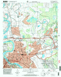
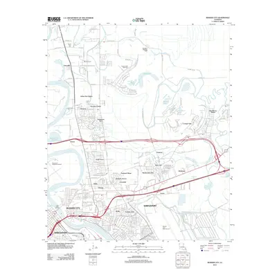 2012 Bossier City2012 Print · USGSCovers Vanceville, including Shreveport, Bossier City, and other nearby areas
 - 2015 Map of Bossier City, 2015 Print
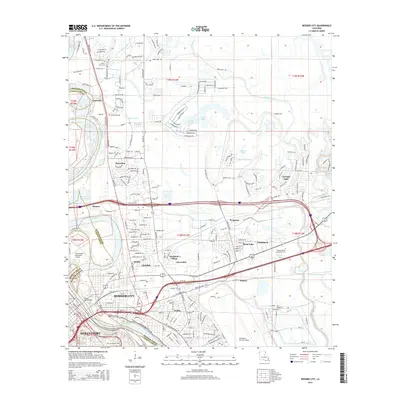 2015 Bossier City2015 Print · USGSCovers Vanceville, including Shreveport, Bossier City, and other nearby areas
 - 2018 Map of Bossier City, 2018 Print
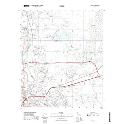 2018 Bossier City2018 Print · USGSCovers Vanceville, including Shreveport, Bossier City, and other nearby areas
 - 2020 Map of Bossier City, 2020 Print
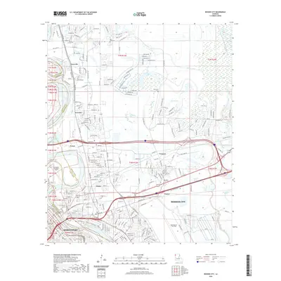 2020 Bossier City2020 Print · USGSCovers Vanceville, including Shreveport, Bossier City, and other nearby areas
 - 2024 Map of Bossier City, 2024 Print
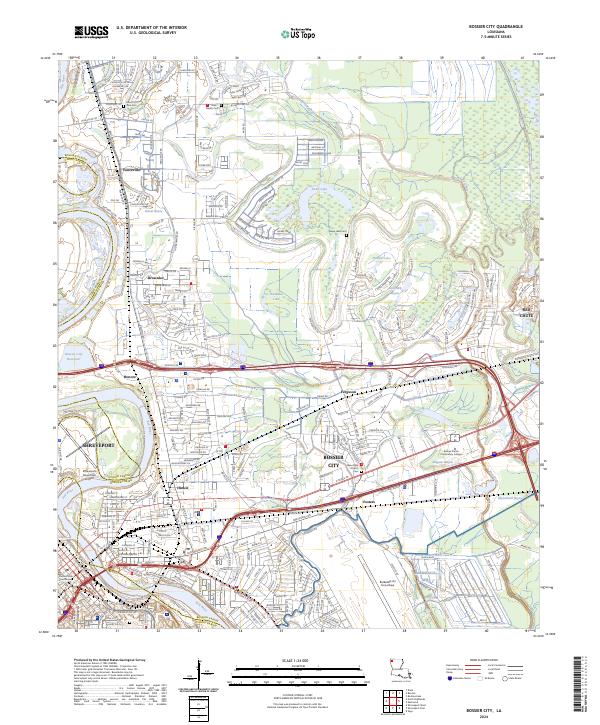 2024 Bossier City2024 Print · USGSBossier City and Shreveport are shown in their modern industrial and suburban complexity just east of the Red River. Researchers can trace family history at Mount Zion Cem, locate Bossier Parish Community College, or study the footprint of Barksdale AFB.
End of results
Showing maps 1-17 of 17
Top cities near Vanceville
- Shreveport historical maps
- Bossier City historical maps
- Haughton historical maps
- Blanchard historical maps
- Greenwood historical maps
- Benton historical maps
See more
Frequently asked questions
- What are the different types of historical maps available for Vanceville?
- What is the oldest map of Vanceville?
- Where can I purchase historical maps of Vanceville for my home or office?
- Where can I download high-res historical maps of Vanceville?
- Are there historical topographic maps available for Vanceville?
- Is there historical aerial imagery available for Vanceville?
- Where are historical maps of Vanceville sourced from?