Old Maps of Blanchard, Louisiana for Hiking & Exploration
Hike through history with 28 historic maps of Blanchard. Explore old trails, ghost towns, and forgotten backroads — perfect for outdoor adventurers and local explorers.
- Rediscover forgotten places: Map out old mining camps, roads, and footpaths that no longer exist on modern maps.
- Layer with modern tools: Combine with LiDAR or satellite views to plan hikes through historical terrain.
- Made for exploration: Popular among hikers, overlanders, and local history lovers.
Use these maps to find adventure and explore the hidden past of Blanchard.
Blanchard, LA maps
(28)- 1932 Map of Shreveport SE
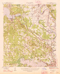
 1932 Shreveport SE1932 Print · USGSNorthwest Louisiana's river country is captured here in the early thirties, showcasing a landscape defined by shifting bayous and new infrastructure. Trace the early growth of Shreveport alongside the Albany Ferry and landmarks like St Matthews Ch and the Rosenwald Sch.
 - 1948 Map of Mooringsport
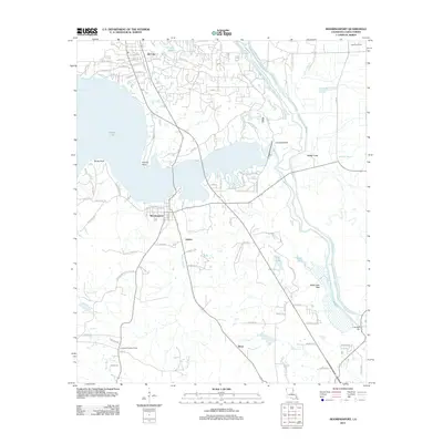
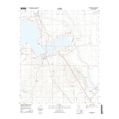
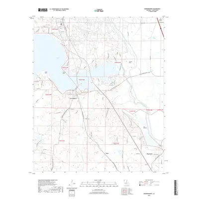
 1948 Mooringsport1948 Print · USGSNorthwest Louisiana's oil and river country is captured here during the late 1940s, showing the early growth of Mooringsport and Oil City. Researchers can trace rural lineages through numerous local landmarks like the Evening Star Sch and Albany Ferry.
 - 1955 Map of Shreveport
 1955 Shreveport1955 Print · USGSNorthern Louisiana in the mid-fifties is captured here as a landscape of military bases, vast oil fields, and burgeoning college towns. Genealogists and historians can trace the rail-and-river economy through the Monroe Gas Field, Grambling College, and Barksdale Air Force Base.3 unique versions available
 - 1955 Map of North Shreveport, 1956 Print
 1955 North Shreveport1956 Print · USGSShreveport's northern expansion is frozen in time during the mid-fifties as industrial rail lines and oil fields began to press into the Caddo Parish countryside. Genealogists can trace a wealth of community landmarks, from Walker Hill Cemetery to several rural schoolhouses like Center Point School and Round Grove School.
 - 1955 Map of Mooringsport, 1956 Print
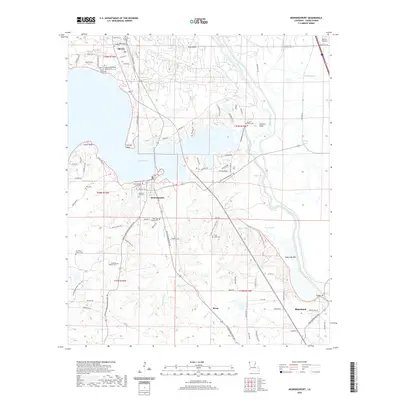
 1955 Mooringsport1956 Print · USGSNorth of Shreveport in the mid-fifties, the landscape was a complex mix of active oil fields, bayou drainage projects, and rural plantations. Researchers can trace family sites at Sentell Plantation, Walker Hill Cem, or the Reed Spring Sch.3 unique versions available
 - 1956 Map of Shreveport
 1956 Shreveport1956 Print · USGSNorthern Louisiana during the mid-fifties presents a complex landscape of booming oil fields and strategic military installations. Genealogists and historians can trace the infrastructure of the Monroe Gas Field and family-named locales from Cotton Valley to Jonesboro.
 - 1960 Map of North Highlands
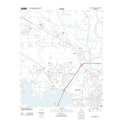
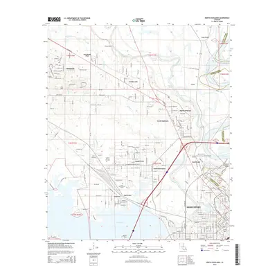
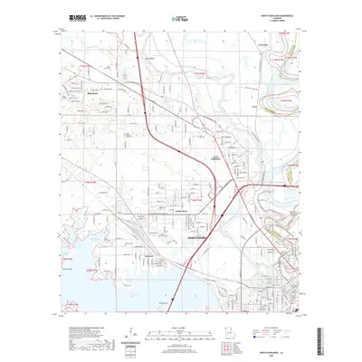
 1960 North Highlands1960 Print · USGSShreveport and its northern suburbs reached toward the Red River in the early sixties as new infrastructure transformed the Caddo Parish landscape. Genealogists and local historians can trace the foundations of neighborhoods near Northside Sch, locate family plots at Walker Hill Cem, and follow the old rail lines of the Texas and Pacific.2 unique versions available
 - 1975 Map of North Highlands, 1976 Print
 1975 North Highlands1976 Print · USGSNorthwestern Louisiana comes into focus in the mid-seventies as the urban landscape expands along the Red River corridor. Trace the shoreline of Cross Lake and the development of North Highlands in this detailed aerial perspective.
 - 1980 Map of North Highlands, 1981 Print
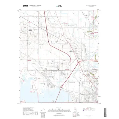
 1980 North Highlands1981 Print · USGSShreveport and North Highlands are shown in a period of significant suburban and industrial expansion in the early eighties. Genealogists and local historians can locate many community landmarks, including Walker Hill Cem, Southern University, and St Luke Ch.3 unique versions available
 - 1982 Map of Mooringsport
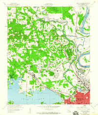
 1982 Mooringsport1982 Print · USGSMooringsport and Oil City appear in the early eighties as industrial and lakeside hubs along the shores of CADDO LAKE. Trace old family landmarks and local waterways like Myricks, PINE ISLAND, and the engineering of the SHREVEPORT WATERWAY.2 unique versions available
 - 1982 Map of Blanchard
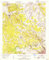
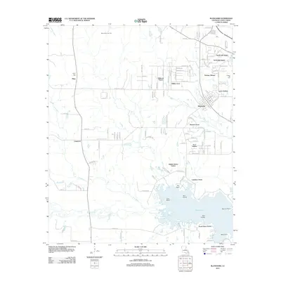
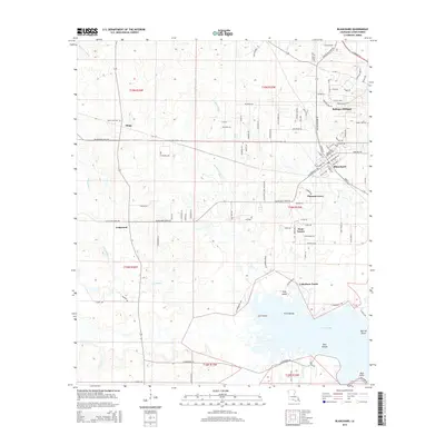
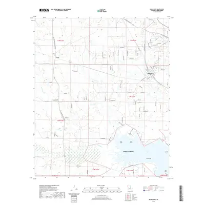
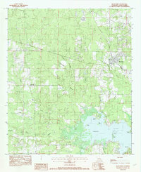 1982 Blanchard1982 Print · USGSCaddo Parish in the early 1980s shows the growth of Blanchard and the rural character of Longwood near the shoreline. Trace the winding paths of Piney Bayou and Republican Bayou as they reach the islands and points of Cross Lake.2 unique versions available
 - 1984 Map of Shreveport
 1984 Shreveport1984 Print · USGSNorthern Louisiana at the peak of the 1980s reveals a landscape of massive water management projects and Cold War military hubs. Trace the rail lines of the Kansas City Southern Ry past Barksdale Air Force Base and the high ground of Driskill Mountain.2 unique versions available
 - 1986 Map of Shreveport North
 1986 Shreveport North1986 Print · USGSNorthern Louisiana in the mid-eighties shows a landscape of expansive river bottoms and growing suburban centers. Genealogists and historians can trace the development of Shreveport, the infrastructure of Barksdale Air Force Base, and rural life in Rocky Mount.2 unique versions available
 - 2012 Map of Mooringsport, 2012 Print
 2012 Mooringsport2012 Print · USGSCovers Blanchard, including Oil City, Mooringsport, and other nearby areas
 - 2012 Map of Blanchard, 2012 Print
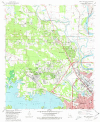
 2012 Blanchard2012 Print · USGSCovers Blanchard, including Shreveport, North Park Estates, and other nearby areas
 - 2012 Map of North Highlands, 2012 Print
 2012 North Highlands2012 Print · USGSCovers Blanchard, including Shreveport, Northwoods, and other nearby areas
 - 2015 Map of Blanchard, 2015 Print
 2015 Blanchard2015 Print · USGSCovers Blanchard, including Shreveport, North Park Estates, and other nearby areas
 - 2015 Map of Mooringsport, 2015 Print
 2015 Mooringsport2015 Print · USGSCovers Blanchard, including Oil City, Mooringsport, and other nearby areas
 - 2015 Map of North Highlands, 2015 Print
 2015 North Highlands2015 Print · USGSCovers Blanchard, including Shreveport, Northwoods, and other nearby areas
 - 2018 Map of North Highlands, 2018 Print
 2018 North Highlands2018 Print · USGSCovers Blanchard, including Shreveport, Northwoods, and other nearby areas
 - 2018 Map of Blanchard, 2018 Print
 2018 Blanchard2018 Print · USGSCovers Blanchard, including Shreveport, North Park Estates, and other nearby areas
 - 2018 Map of Mooringsport, 2018 Print
 2018 Mooringsport2018 Print · USGSCovers Blanchard, including Oil City, Mooringsport, and other nearby areas
 - 2020 Map of North Highlands, 2020 Print
 2020 North Highlands2020 Print · USGSCovers Blanchard, including Shreveport, Northwoods, and other nearby areas
 - 2020 Map of Mooringsport, 2020 Print
 2020 Mooringsport2020 Print · USGSCovers Blanchard, including Oil City, Mooringsport, and other nearby areas
 - 2020 Map of Blanchard, 2020 Print
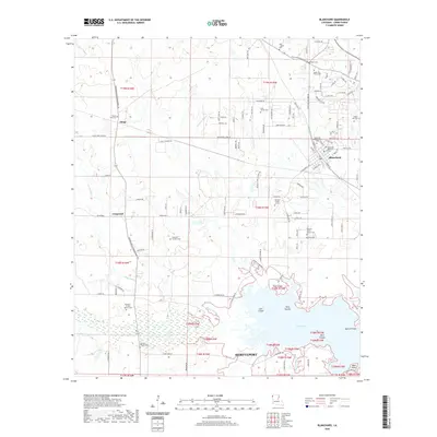 2020 Blanchard2020 Print · USGSCovers Blanchard, including Shreveport, North Park Estates, and other nearby areas
Showing maps 1-25 of 28
Top cities near Blanchard
- Shreveport historical maps
- Bossier City historical maps
- Vivian historical maps
- Greenwood historical maps
- Waskom historical maps
- Benton historical maps
See more
Top neighborhoods of Blanchard
Frequently asked questions
- What are the different types of historical maps available for Blanchard?
- What is the oldest map of Blanchard?
- Where can I purchase historical maps of Blanchard for my home or office?
- Where can I download high-res historical maps of Blanchard?
- Are there historical topographic maps available for Blanchard?
- Is there historical aerial imagery available for Blanchard?
- Where are historical maps of Blanchard sourced from?