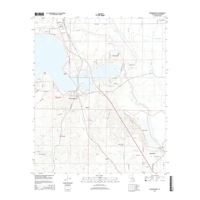
2015 Map of Mooringsport
USGS Topo · Published 2015About this map
Caddo Lake and its intricate network of inlets and points dominate this portion of Caddo Parish, where the local landscape is defined by the legacy of the northwestern Louisiana oil industry. The settlement of Oil City is visible at the northern edge, while Mooringsport occupies a strategic peninsula further south. The map illustrates a transition from the wooded peninsulas of Rocky Point and Stormy Point to the expansive drainage area of the Soda Lake Bed. This geographic shift is marked by numerous bayous, including Black Bayou, Twelvemile Bayou, and Walnut Bayou. Cultural and genealogical landmarks are interspersed throughout the area, such as St Johns Church Rd and Evans Cemetery Rd, while the southern reaches show the growth of Blanchard and smaller locales like Brian and Arlatex.
Find a feature on this map
81 named features on this map. Tap any name to fly to it.
Don’t see what you’re looking for? This feature index may not catch every label — zoom into the map to look around manually.
Map Details
Editions of this 2015 Mooringsport Map
This is the sole edition of this map. No revisions or reprints were ever made.
Other maps of this area

1932 · Shreveport SE
USGS Topo · 1:31,680

1932 · Hosston SW
USGS Topo · 1:31,680

1932 · Hosston SE
USGS Topo · 1:31,680

1932 · Shreveport NE
USGS Topo · 1:31,680

1944 · Kildare
USGS Topo · 1:62,500

1944 · Caddo Lake
USGS Topo · 1:62,500

1946 · Caddo Lake
USGS Topo · 1:62,500

1948 · Kildare
USGS Topo · 1:62,500

1948 · Mooringsport
USGS Topo · 1:62,500

1948 · Vivian
USGS Topo · 1:62,500