Old Maps of Vinton, Louisiana for Genealogy
Trace your family roots with 15 historic maps of Vinton. These high-res maps reveal old neighborhoods, homesites, landmarks, and streets — helping you uncover where your ancestors lived and how the area evolved over time.
- Explore historic neighborhoods: Identify where your relatives may have lived in the 1800s or 1900s.
- Compare maps over time: Trace the changes in streets, buildings, and landmarks for multi-generational research.
- Perfect for genealogy & ancestry research: Used by family historians and researchers to map out lineage and migration.
These maps are an incredible resource for exploring your personal connection to Vinton's past.
Vinton, LA maps
(15)- 1932 Map of Orange
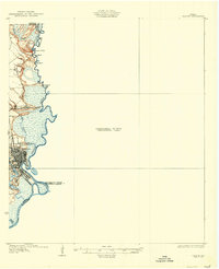 1932 Orange1932 Print · USGSSoutheastern Texas at the dawn of the 1930s is defined by the bustling riverfront of Orange and the intricate bends of the Sabine River. Researchers can trace the early street plan of the city, the Southern Pacific rail lines, and river landmarks like Morgan Bluff.2 unique versions available
 - 1947 Map of Vinton
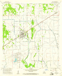
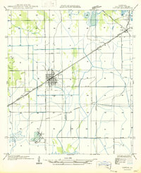 1947 Vinton1947 Print · USGSCalcasieu Parish comes to life in the late 1940s, showing the intersection of rail-era commerce and early coastal drainage engineering. Genealogists and historians can trace the street grids of Vinton and find smaller locales like Ged or the railway siding at Edgerly.
 - 1952 Map of Lake Charles
 1952 Lake Charles1952 Print · USGSSouthwest Louisiana is captured here in the mid-fifties, showing a landscape defined by the rise of the petrochemical industry and deep-water navigation. Researchers can trace family roots through numerous small-town settlements and oil developments like Nibletts Bluff, the Lockport Oil Field, and Starks.
 - 1954 Map of Vinton
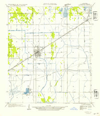 1954 Vinton1954 Print · USGSCoastal Louisiana prairie meets early industrial growth in the mid-fifties as the Southern Pacific railroad connects these Calcasieu Parish towns. Genealogists can locate family homes and properties in Vinton, Edgerly, and the small settlement of Ged near Ged Lake.
 - 1954 Map of Lake Charles, 1964 Print
 1954 Lake Charles1964 Print · USGSSouthwest Louisiana in the mid-fifties is defined by its massive petroleum industry and its complex network of bayous and rail lines. Researchers can trace the development of the Sulphur Mines Oil Field or locate historic settlements like Longville and De Quincy.3 unique versions available
 - 1955 Map of Orange, 1956 Print
 1955 Orange1956 Print · USGSThe Texas-Louisiana borderlands in the mid-fifties center on the industrial hubs and vast marshlands of the Sabine River. Genealogists and historians can locate community sites like Reed Cem, Crossroad Ch, and the Gum Cove Ferry crossing.
 - 1960 Map of Vinton, 1961 Print
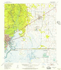
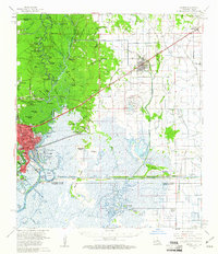
 1960 Vinton1961 Print · USGSCalcasieu Parish in the early sixties reveals a landscape shaped by oil production and heavy irrigation. Genealogists and industrial historians can trace the derrick-lined Vinton Oil Field and old settlements like Ged, Edgerly, and Hampton.4 unique versions available
 - 1960 Map of Orange, 1961 Print
 1960 Orange1961 Print · USGSThe Texas-Louisiana borderlands come alive in the early sixties, showing the industrial waterfront of Orange alongside the rail-tied towns of Vinton and Edgerly. Genealogists and historians can locate rural landmarks like Granger Cem, Manley Sch, and the riverside Niblett Bluff.2 unique versions available
 - 1986 Map of Lake Charles
 1986 Lake Charles1986 Print · USGSThe Louisiana-Texas borderlands are captured here in the mid-1980s, showcasing the industrial growth of the Lake Charles region and its rail-linked satellite towns. Trace the evolution of coastal settlements and family landmarks from Sulphur to the Highland Cem.2 unique versions available
 - 1994 Map of Vinton, 1996 Print
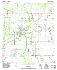 1994 Vinton1996 Print · USGSCoastal Louisiana in the mid-nineties shows a landscape defined by petroleum and water management. Trace the industrial footprint of the Vinton Oil Field and the complex drainage networks of the Vinton Canal and Sabine Canal.
 - 2012 Map of Vinton, 2012 Print
 2012 Vinton2012 Print · USGSCovers Vinton, including Ged, Edgerly, and other nearby areas
 - 2015 Map of Vinton, 2015 Print
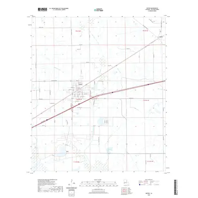
 2015 Vinton2015 Print · USGSCovers Vinton, including Ged, Edgerly, and other nearby areas
 - 2018 Map of Vinton, 2018 Print
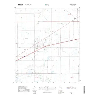 2018 Vinton2018 Print · USGSCovers Vinton, including Ged, Edgerly, and other nearby areas
 - 2020 Map of Vinton, 2020 Print
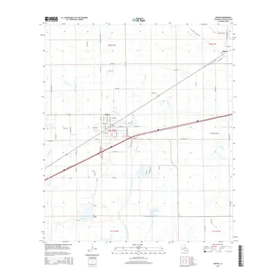
 2020 Vinton2020 Print · USGSCovers Vinton, including Ged, Edgerly, and other nearby areas
 - 2024 Map of Vinton, 2024 Print
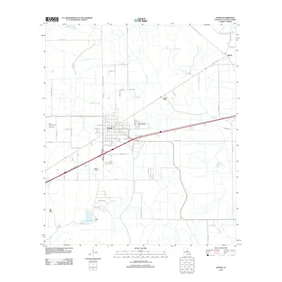
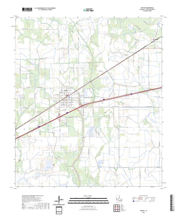 2024 Vinton2024 Print · USGSCalcasieu Parish comes into focus in this contemporary survey of the Louisiana prairie and marshlands near the Texas border. Trace the water management systems and rural road networks connecting Vinton, Edgerly, and the small settlement at Ged.
End of results
Showing maps 1-15 of 15
Top cities near Vinton
- Sulphur historical maps
- Orange historical maps
- Bridge City historical maps
- West Orange historical maps
- Pinehurst historical maps
Frequently asked questions
- What are the different types of historical maps available for Vinton?
- What is the oldest map of Vinton?
- Where can I purchase historical maps of Vinton for my home or office?
- Where can I download high-res historical maps of Vinton?
- Are there historical topographic maps available for Vinton?
- Is there historical aerial imagery available for Vinton?
- Where are historical maps of Vinton sourced from?