Old Maps of Larto, Louisiana for Genealogy
Trace your family roots with 14 historic maps of Larto. These high-res maps reveal old neighborhoods, homesites, landmarks, and streets — helping you uncover where your ancestors lived and how the area evolved over time.
- Explore historic neighborhoods: Identify where your relatives may have lived in the 1800s or 1900s.
- Compare maps over time: Trace the changes in streets, buildings, and landmarks for multi-generational research.
- Perfect for genealogy & ancestry research: Used by family historians and researchers to map out lineage and migration.
These maps are an incredible resource for exploring your personal connection to Larto's past.
Larto, LA maps
(14)- 1935 Map of Tooleys, 1936 Print
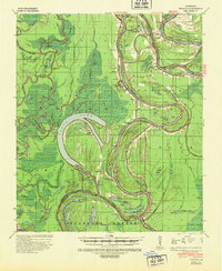
 1935 Tooleys1936 Print · USGSThe alluvial wetlands of Concordia and Catahoula Parishes are documented here during the mid-1930s when river life revolved around local landings. Researchers can trace family roots at Larto Sch, identify ancestral sites near the B M Graveyard, or locate early homesteads by Island Bayou Ldg.
 - 1941 Map of Tooleys, 1946 Print
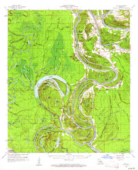
 1941 Tooleys1946 Print · USGSLouisiana's river country comes to life in the 1940s as the confluence of the Black and Red Rivers shapes the delta parishes. Genealogists and historians can locate numerous landings like McDonald Ldg, local schools including Boggy Bayou Sch, and the Indian Mounds.2 unique versions available
 - 1953 Map of Natchez, 1966 Print
 1953 Natchez1966 Print · USGSSouthwest Mississippi and the Louisiana border country come alive in this mid-century survey of the river valley and forest lands. Researchers can trace the rail lines of the Illinois Central RR and locate rural hubs like Gloster and Ferriday.3 unique versions available
 - 1956 Map of Natchez
 1956 Natchez1956 Print · USGSThe Mississippi River borderlands and the Pine Hills come alive in this mid-fifties study of the Natchez region. Genealogists and historians can trace rail-era towns along the Illinois Central RR and explore the oxbows of Lake Bruin and Lake Concordia.
 - 1959 Map of Natchez
 1959 Natchez1959 Print · USGSSouthwestern Mississippi and eastern Louisiana are captured in the late fifties, showing a landscape defined by the winding Mississippi River and the timbered Homochitto National Forest. Researchers can trace the sprawling Illinois Central RR and find rural landmarks like Union Church and Camp Van Dorn (Abandoned).
 - 1960 Map of Eva, 1961 Print
 1960 Eva1961 Print · USGSCatahoula and Concordia Parishes in the early sixties reveal a landscape defined by the winding Black River and the rural communities of Mayna and Acme. Genealogists and local historians can trace family-named landmarks, old cemeteries like Dewey Cem, and rural churches including Glade Ch.3 unique versions available
 - 1982 Map of Larto Lake South
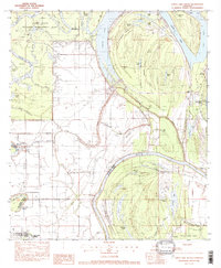 1982 Larto Lake South1982 Print · USGSThe alluvial wetlands of Catahoula Parish appear in the early 1980s as a complex network of bayous, brakes, and managed wildlife areas. Researchers can locate community anchors like Larto Ch and Central Sch or trace the family-named Pease Cem and Nichols Cem near the water.
 - 1984 Map of Woodville
 1984 Woodville1984 Print · USGSThe Mississippi-Louisiana borderlands in the mid-eighties show a landscape defined by the shifting MISSISSIPPI RIVER and sprawling timberlands. Researchers can trace the ILLINOIS CENTRAL GULF railroad through Gloster or locate historic river points like Fort Adams and Point Breeze.
 - 1991 Map of Woodville
 1991 Woodville1991 Print · USGSWilkinson County and the Louisiana borderlands appear here in the early nineties, where the bluffs meet the Mississippi River floodplain. Trace the sites of old river landings and rural outposts like Fort Adams, Pinckneyville, and the remote Larto Lake community.
 - 2012 Map of Larto Lake South, 2012 Print
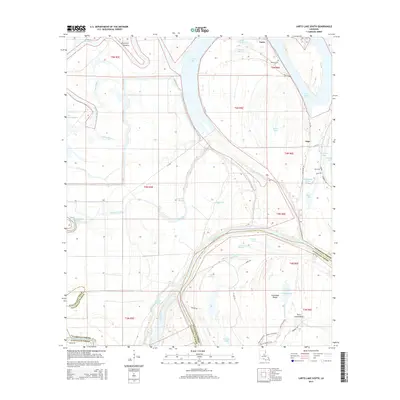
 2012 Larto Lake South2012 Print · USGSCovers Larto, including Argo, Avoyelles Parish, and other nearby areas
 - 2015 Map of Larto Lake South, 2015 Print
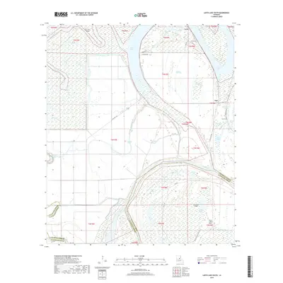
 2015 Larto Lake South2015 Print · USGSCovers Larto, including Argo, Avoyelles Parish, and other nearby areas
 - 2018 Map of Larto Lake South, 2018 Print
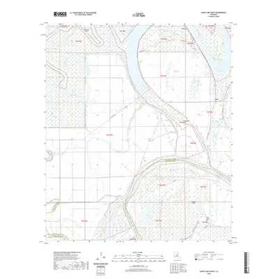
 2018 Larto Lake South2018 Print · USGSCovers Larto, including Argo, Avoyelles Parish, and other nearby areas
 - 2020 Map of Larto Lake South, 2020 Print
 2020 Larto Lake South2020 Print · USGSCovers Larto, including Argo, Avoyelles Parish, and other nearby areas
 - 2024 Map of Larto Lake South, 2024 Print
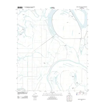
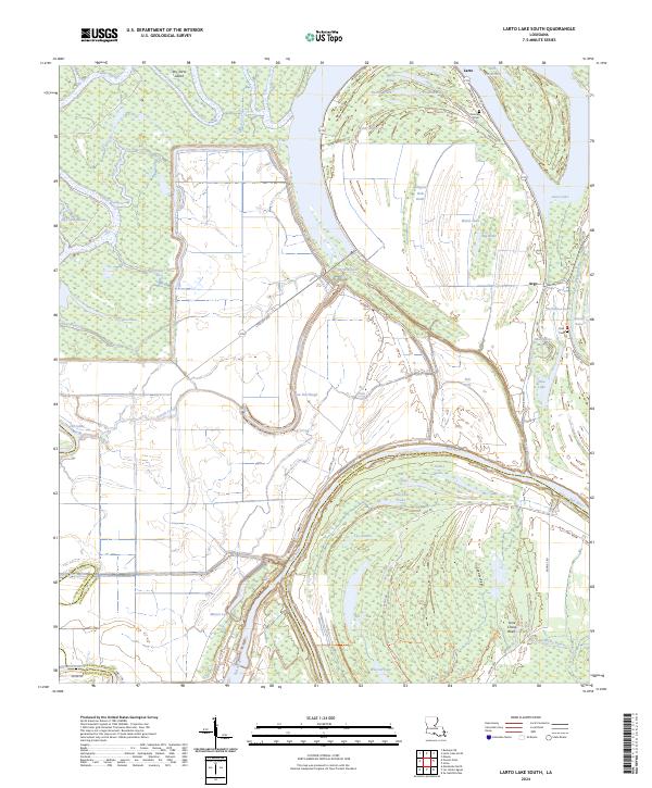 2024 Larto Lake South2024 Print · USGSCentral Louisiana's bottomlands come to life in this 2024 map of the Red River and Larto Lake region. Genealogists can locate Nichols Cem and Peas Cem, while historians can trace the intricate waterways of Indigo Bayou and Alligator Hole Brake.
End of results
Showing maps 1-14 of 14
Top cities near Larto
Frequently asked questions
- What are the different types of historical maps available for Larto?
- What is the oldest map of Larto?
- Where can I purchase historical maps of Larto for my home or office?
- Where can I download high-res historical maps of Larto?
- Are there historical topographic maps available for Larto?
- Is there historical aerial imagery available for Larto?
- Where are historical maps of Larto sourced from?