Old Maps of Haynesville, Louisiana for Academic Research
Study the evolution of Haynesville with 18 high-resolution historic maps. Whether you're teaching, researching, or modeling changes in land use, these maps provide essential visual documentation of urban, environmental, and geographic change.
- Analyze long-term change: Track patterns in development, transportation, and natural features.
- Ideal for environmental or urban studies: Support academic projects with primary historical map data.
- Use in the classroom or lab: Educators and researchers rely on these maps to bring historical context to life.
These maps are a powerful tool for teaching, research, and visualizing how Haynesville has changed over the decades.
Haynesville, LA maps
(18)- 1952 Map of Homer, 1953 Print
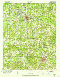 1952 Homer1953 Print · USGSClaiborne Parish in the early fifties shows a landscape transitioning between timber agriculture and a booming petroleum economy. Genealogists can trace family footprints across dozens of rural landmarks like Ward Chapel Sch, Shady Grove Cem, and the extensive Homer Oil Field.4 unique versions available
 - 1955 Map of Shreveport
 1955 Shreveport1955 Print · USGSNorthern Louisiana in the mid-fifties is captured here as a landscape of military bases, vast oil fields, and burgeoning college towns. Genealogists and historians can trace the rail-and-river economy through the Monroe Gas Field, Grambling College, and Barksdale Air Force Base.3 unique versions available
 - 1956 Map of Shreveport
 1956 Shreveport1956 Print · USGSNorthern Louisiana during the mid-fifties presents a complex landscape of booming oil fields and strategic military installations. Genealogists and historians can trace the infrastructure of the Monroe Gas Field and family-named locales from Cotton Valley to Jonesboro.
 - 1984 Map of Shreveport
 1984 Shreveport1984 Print · USGSNorthern Louisiana at the peak of the 1980s reveals a landscape of massive water management projects and Cold War military hubs. Trace the rail lines of the Kansas City Southern Ry past Barksdale Air Force Base and the high ground of Driskill Mountain.2 unique versions available
 - 1986 Map of Haynesville East
 1986 Haynesville East1986 Print · USGSEastern Claiborne Parish in the mid-1980s was a landscape defined by the thick timber of the Kisatchie National Forest and the winding Middle Fork Bayou D'Arbonne. Researchers can locate old settlements like Gordon and Oaks, or trace the rural geography surrounding the Wade State Correctional Center.
 - 1986 Map of Haynesville West
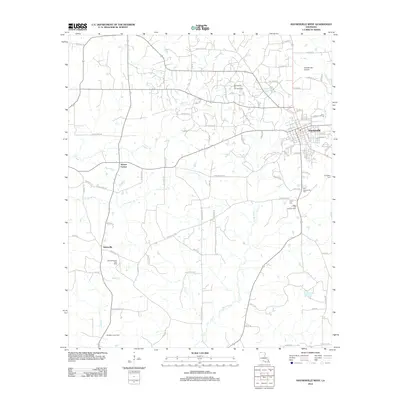
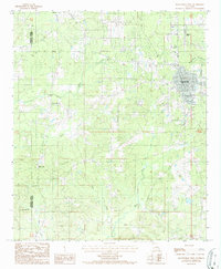 1986 Haynesville West1986 Print · USGSThe northern reaches of Claiborne Parish are captured in the mid-1980s, centered on the growing town of Haynesville and its surrounding woodlands. Researchers can trace rural settlement patterns near Millerton, find old gravel operations, or locate landmarks like the Haynesville Airport.
 - 1986 Map of Shreveport North
 1986 Shreveport North1986 Print · USGSNorthern Louisiana in the mid-eighties shows a landscape of expansive river bottoms and growing suburban centers. Genealogists and historians can trace the development of Shreveport, the infrastructure of Barksdale Air Force Base, and rural life in Rocky Mount.2 unique versions available
 - 2003 Map of Haynesville East, 2005 Print
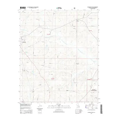
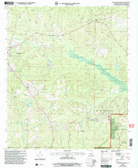 2003 Haynesville East2005 Print · USGSThe timberlands and oil fields of northern Louisiana come into focus at the turn of the millennium. Genealogists and historians can trace family-named landmarks and rural infrastructure near Haynesville, Gordon, and the winding Middle Fork Bayou D'Arbonne.
 - 2012 Map of Haynesville East, 2012 Print
 2012 Haynesville East2012 Print · USGSCovers Haynesville, including Gordon, Mahan, and other nearby areas
 - 2012 Map of Haynesville West, 2012 Print
 2012 Haynesville West2012 Print · USGSCovers Haynesville, including Norton Corner, Dykesville, and other nearby areas
 - 2015 Map of Haynesville East, 2015 Print
 2015 Haynesville East2015 Print · USGSCovers Haynesville, including Gordon, Mahan, and other nearby areas
 - 2015 Map of Haynesville West, 2015 Print
 2015 Haynesville West2015 Print · USGSCovers Haynesville, including Norton Corner, Dykesville, and other nearby areas
 - 2018 Map of Haynesville East, 2018 Print
 2018 Haynesville East2018 Print · USGSCovers Haynesville, including Gordon, Mahan, and other nearby areas
 - 2018 Map of Haynesville West, 2018 Print
 2018 Haynesville West2018 Print · USGSCovers Haynesville, including Norton Corner, Dykesville, and other nearby areas
 - 2020 Map of Haynesville West, 2020 Print
 2020 Haynesville West2020 Print · USGSCovers Haynesville, including Norton Corner, Dykesville, and other nearby areas
 - 2020 Map of Haynesville East, 2020 Print
 2020 Haynesville East2020 Print · USGSCovers Haynesville, including Gordon, Mahan, and other nearby areas
 - 2024 Map of Haynesville West, 2024 Print
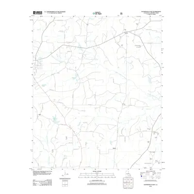
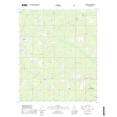
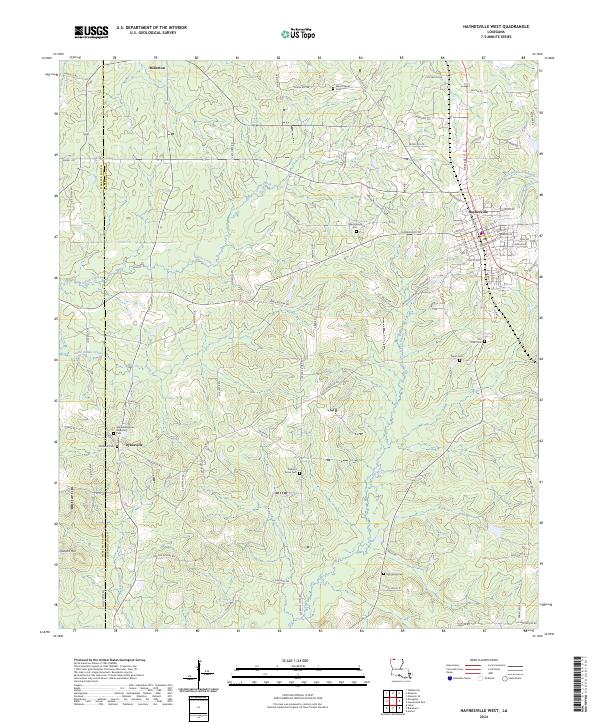 2024 Haynesville West2024 Print · USGSClaiborne Parish in the twenty-first century remains a landscape of deeply rooted rural communities and family-named roads. Genealogists can trace local heritage through numerous burial sites like Whitehall African American Cem, Old Town Cem, and the settlement of Dykesville.
 - 2024 Map of Haynesville East, 2024 Print
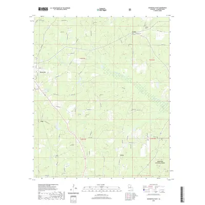
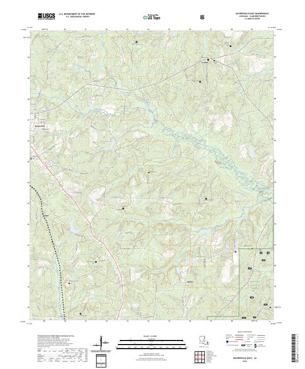 2024 Haynesville East2024 Print · USGSClaiborne Parish in the early 2020s remains a landscape of managed forests and historic family settlements. Researchers can trace generations of residents through landmarks like Gordon Heritage Cem, the community of Mahan, and the northern edge of Kisatchie National Forest.
End of results
Showing maps 1-18 of 18
Top cities near Haynesville
Frequently asked questions
- What are the different types of historical maps available for Haynesville?
- What is the oldest map of Haynesville?
- Where can I purchase historical maps of Haynesville for my home or office?
- Where can I download high-res historical maps of Haynesville?
- Are there historical topographic maps available for Haynesville?
- Is there historical aerial imagery available for Haynesville?
- Where are historical maps of Haynesville sourced from?