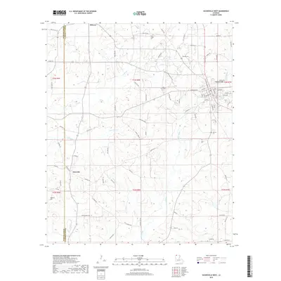
2018 Map of Haynesville West
USGS Topo · Published 2018About this map
Haynesville serves as the focal point for this western portion of the Louisiana-Arkansas borderlands, showing a landscape defined by small settlements and a network of parish roads. The terrain is structured by several key watercourses, including Indian Cr and Little Indian Cr in the north and the larger Black Bayou to the south. Local history is deeply embedded in the rural landscape, visible through numerous ancestral burial grounds such as Ward Chapel Cem and Shady Grove Cem. The presence of Old Town Cem and the settlement of Millerton suggest the long-standing community structure of Claiborne Parish. Further south, Dykesville and the topographic prominence of Duncan Hill mark the transition toward the Webster Parish line. This survey captures the region's character as a blend of wooded creeks and established rural road systems that have connected these family-centered communities for generations.
Find a feature on this map
89 named features on this map. Tap any name to fly to it.
Don’t see what you’re looking for? This feature index may not catch every label — zoom into the map to look around manually.
Map Details
Editions of this 2018 Haynesville West Map
This is the sole edition of this map. No revisions or reprints were ever made.
Other maps of this area

1922 · Sarepta
USGS Topo · 1:62,500

1924 · Sarepta
USGS Topo · 1:62,500

1952 · Homer
USGS Topo · 1:62,500

1953 · El Dorado
USGS Topo · 1:250,000

1955 · Shreveport
USGS Topo · 1:250,000

1956 · Shreveport
USGS Topo · 1:250,000

1956 · Sarepta
USGS Topo · 1:62,500

1957 · El Dorado
USGS Topo · 1:250,000

1958 · El Dorado
USGS Topo · 1:250,000

1960 · El Dorado
USGS Topo · 1:250,000