
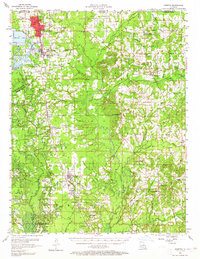
1956 Map of Sarepta
USGS Topo · Published 1957About this map
The Springhill Oil Field and the North Shongaloo Oil Field dominate the northern landscape of Webster Parish in the mid-1950s, illustrating the intense energy production era along the Louisiana-Arkansas border. This survey details a transition from dense timber and bayous to an industrial grid of oil wells and refineries, with the Kansas City Southern railroad serving as the primary corridor for commerce through Springhill and Cotton Valley. The presence of the Hopewell Sch (Aban'd) and multiple denominational landmarks like Union Springs Ch and New Zion Ch suggests shifting settlement patterns as rural populations moved toward industrial centers like Cullen. Significant water features including Bayou Dorcheat and Bodcau Bayou are meticulously mapped alongside local infrastructure like Sykes Ferry, providing a clear picture of the region's mid-century rural-to-industrial evolution.
Find a feature on this map
95 named features on this map. Tap any name to fly to it.
Don’t see what you’re looking for? This feature index may not catch every label — zoom into the map to look around manually.
Map Details
Editions of this 1956 Sarepta Map
2 editions found
Other maps of this area

1922 · Sarepta
USGS Topo · 1:62,500

1924 · Sarepta
USGS Topo · 1:62,500

1932 · Bossier NE
USGS Topo · 1:31,680

1947 · Minden
USGS Topo · 1:62,500

1948 · Bossier City
USGS Topo · 1:62,500

1949 · Minden
USGS Topo · 1:62,500

1949 · Gibsland
USGS Topo · 1:62,500

1950 · Plain Dealing NE
USGS Topo · 1:31,680

1950 · Plain Dealing SE
USGS Topo · 1:31,680

1950 · Gibsland
USGS Topo · 1:62,500