1956 Map of Sarepta
USGS Topo · Published 1965About this map
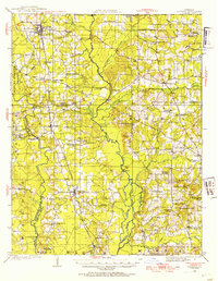
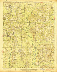
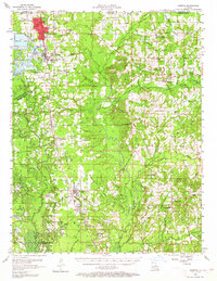
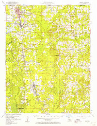
The Springhill Oil Field and surrounding petroleum grounds dominate this landscape during a period of significant industrial activity in Webster Parish. While the larger operations of the North Shongaloo Oil Field and Red Rock Oil Field underscore the region's economic engine, the local social fabric is preserved through a dense network of country institutions. Settlements like Cotton Valley and Springhill serve as hubs, while smaller crossroads like Couchwood and Shongaloo maintain a distinct local identity. The mapping reveals a rural landscape defined by religious and educational centers, including the Saints Rest Ch and the Rosenwald Sch, reflecting the community's mid-century distribution. Transport is anchored by the Louisiana & Arkansas Ry and historic crossings like Sykes Ferry over Bayou Dorcheat, providing a clear record of the area's movement and industry.
Find a feature on this map
84 named features on this map. Tap any name to fly to it.
Don’t see what you’re looking for? This feature index may not catch every label — zoom into the map to look around manually.
Map Details
Editions of this 1956 Sarepta Map
2 editions found
Historical Maps of Springhill Through Time
3 maps found