1990s Maps of Concordia Parish, Louisiana
Explore 11 historic maps of Concordia Parish from the 1990s. These maps offer a rare glimpse into what life looked like during the 1990s — showing old roads, neighborhoods, homes, and landmarks that have changed or disappeared over time.
Whether you're researching your family's past, planning a metal detecting trip, or studying how Concordia Parish's landscape evolved across the 1990s, these high-resolution maps are a powerful tool for exploring the history of this region.
- Focus on a specific era: All maps on this page are from the 1990s, giving you a focused view of this time period.
- See what’s changed: Compare century-old streets, trails, and buildings to today's modern landscape using overlays and satellite layers.
- Research with precision: Use these maps for genealogy, historical research, land use analysis, or educational projects.
- View, download, or print: Maps are fully viewable online in high resolution, and can be downloaded or printed for your own records.
Start exploring Concordia Parish's history through authentic maps from the 1990s. This is your window into the past.
Concordia Parish, LA maps
(11)- 1991 Map of Woodville
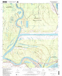
 1991 Woodville1991 Print · USGSWilkinson County and the Louisiana borderlands appear here in the early nineties, where the bluffs meet the Mississippi River floodplain. Trace the sites of old river landings and rural outposts like Fort Adams, Pinckneyville, and the remote Larto Lake community.
 - 1991 Map of Natchez, 1992 Print
 1991 Natchez1992 Print · USGSThe Mississippi River valley at the turn of the nineties reveals a landscape of oxbow lakes, river landings, and bustling bluff-top towns. Genealogists and historians can trace the rail corridors of the Illinois Central Gulf Railroad through Fayette or locate family roots in riverside settlements like Waterproof and St Joseph.
 - 1994 Map of Frogmore, 1997 Print
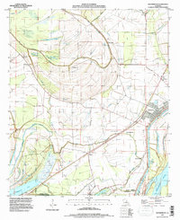
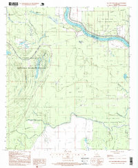
 1994 Frogmore1997 Print · USGSIn the mid-1990s, the bottomlands of Concordia Parish were a landscape of managed wetlands and scattered bayou settlements. Genealogists can trace family landmarks like Mt Moriah Cem and Warren Cem, or locate the historic sites of Athlone and Stacy.
 - 1994 Map of Waterproof, 1997 Print
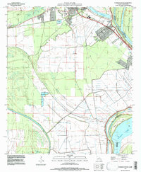
 1994 Waterproof1997 Print · USGSThe Louisiana delta along the Tensas and Concordia parish line shows a landscape of river-driven agriculture and engineering in the 1990s. Researchers can trace the footprints of major landholdings like Arcola Plantation, the remote settlement of Azucena, and the namesake town of Waterproof.
 - 1995 Map of Ferriday South, 1997 Print
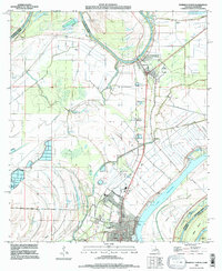
 1995 Ferriday South1997 Print · USGSConcordia Parish sits along a dynamic stretch of the Mississippi during the 1990s, where river chutes and bayous shape the land. Researchers can find precise locations for St James Cem, Ridgecrest street layouts, and family-named landmarks like Sawyer Cem.
 - 1995 Map of Ferriday North, 1997 Print
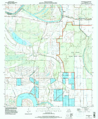
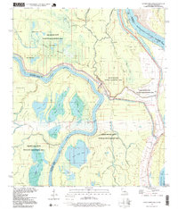
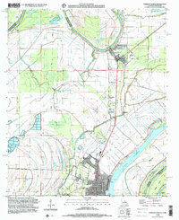
 1995 Ferriday North1997 Print · USGSConcordia Parish in the mid-nineties is defined by its intricate delta waterways and the protective reach of the river levees. Genealogists and researchers can trace the neighborhoods of Ferriday or locate rural landmarks like Calhoun Cem and Red Gum.
 - 1996 Map of Turnbull Island, 1999 Print
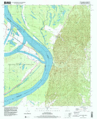
 1996 Turnbull Island1999 Print · USGSThe intricate waterways at the junction of the Mississippi and Red Rivers are captured here in the late twentieth century. Genealogists and historians can locate Oak Grove Ch, the Old Railroad Grade, and several cemeteries amidst the backwaters of Turnbull Island.
 - 1996 Map of Ile Natchitoches, 1999 Print
 1996 Ile Natchitoches1999 Print · USGSAvoyelles and Concordia Parishes are captured in the late 1990s as a haven of managed wetlands and resource extraction along the Red River. Researchers can trace old drainage patterns and oil sites near Lake Ophelia and the Catfish Bayou Oil Field.
 - 1996 Map of Lower Sunk Lake, 1999 Print
 1996 Lower Sunk Lake1999 Print · USGSThe junction of the Red and Mississippi Rivers comes into focus in the mid-nineties, showing a landscape of backwater lakes and levee settlements. Genealogists and researchers can locate Union Point, Shaw, and Cocodrie Ch among the winding bayous.
 - 1996 Map of Fort Adams, 2000 Print
 1996 Fort Adams2000 Print · USGSThe bluffs of Wilkinson County meet the Mississippi River floodplain in the late nineties, documenting a landscape shaped by water and history. Researchers can locate the historic Fort Adams settlement, trace river controls, and find Riverside Cem or Clarksville Cem.
 - 1999 Map of Ferriday North, 2000 Print
 1999 Ferriday North2000 Print · USGSThe Louisiana-Mississippi borderlands come into focus at the end of the century, showing the intricate wetlands of the Mississippi floodplain. Genealogists and researchers can trace family landmarks like Rogers Cem and the riverfront streets of Ferriday.
End of results
Showing maps 1-11 of 11
Top cities of Concordia Parish
Frequently asked questions
- What are the different types of historical maps available for Concordia Parish?
- What is the oldest map of Concordia Parish?
- Where can I purchase historical maps of Concordia Parish for my home or office?
- Where can I download high-res historical maps of Concordia Parish?
- Are there historical topographic maps available for Concordia Parish?
- Is there historical aerial imagery available for Concordia Parish?
- Where are historical maps of Concordia Parish sourced from?