Old Maps of Iatt, Louisiana for Hiking & Exploration
Hike through history with 13 historic maps of Iatt. Explore old trails, ghost towns, and forgotten backroads — perfect for outdoor adventurers and local explorers.
- Rediscover forgotten places: Map out old mining camps, roads, and footpaths that no longer exist on modern maps.
- Layer with modern tools: Combine with LiDAR or satellite views to plan hikes through historical terrain.
- Made for exploration: Popular among hikers, overlanders, and local history lovers.
Use these maps to find adventure and explore the hidden past of Iatt.
Iatt, LA maps
(13)- 1932 Map of Colfax NW
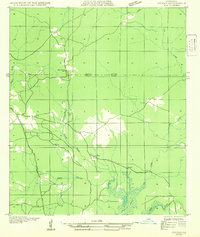 1932 Colfax NW1932 Print · USGSGrant and Winn Parishes come into focus during the early thirties, showing a rural Louisiana landscape defined by its bayous and creek bottoms. Local researchers can trace the locations of the Oak Grove School, Latt Church, and the winding course of Parasol Bayou.
 - 1936 Map of Colfax
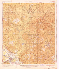 1936 Colfax1936 Print · USGSGrant Parish in the mid-1930s is defined by the sweeping course of the Red River and the expanding reaches of Lake Iatt. Local researchers can trace old family sites and rural institutions like Parsons Cem, Summerfield, and the Oak Grove Sch.2 unique versions available
 - 1953 Map of Alexandria, 1963 Print
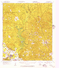
 1953 Alexandria1963 Print · USGSCentral Louisiana during the early fifties is mapped here at the intersection of the piney woods and the Red River valley. Genealogists and historians can trace the rail-and-river network connecting towns like Alexandria, Natchitoches, and the grounds of Camp Beauregard.3 unique versions available
 - 1955 Map of Alexandria
 1955 Alexandria1955 Print · USGSCentral Louisiana in the mid-fifties is a landscape of river-port cities, sprawling timberlands, and massive military reservations. Genealogists and historians can trace the rail networks of the Texas & Pacific RR and locate sites like Camp Polk Military Reservation and Natchitoches.
 - 1956 Map of Colfax, 1957 Print
 1956 Colfax1957 Print · USGSGrant and Winn Parishes come into focus during the mid-1950s, showing a landscape defined by forest reserves and rail-line settlements. Genealogists and historians can trace local roots through landmarks like Hebron Ch & Cem, Summerfield Sch, and McNeeley.3 unique versions available
 - 1985 Map of Savage Creek
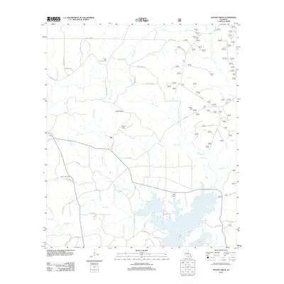
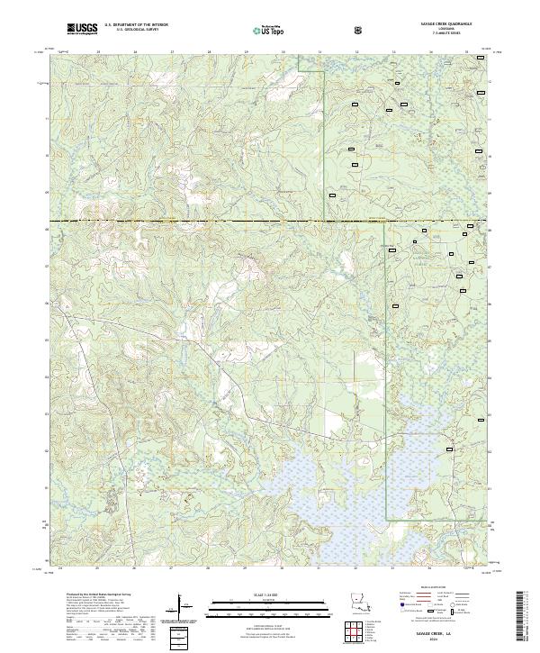
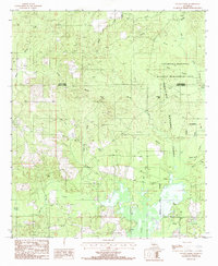 1985 Savage Creek1985 Print · USGSGrant and Winn Parishes are captured here in the mid-1980s, showing a landscape defined by the expansive Iatt Lake and protected timberlands. Researchers can trace the rural settlement of Hurley or locate historic landmarks like Potato Hill and the Boat Ramp.
 - 1986 Map of Winnfield
 1986 Winnfield1986 Print · USGSCentral Louisiana in the mid-1980s was a landscape of timber towns and rail junctions woven through the Kisatchie National Forest. Researchers can trace the legacy of the lumber and rail eras through settlements like Good Pine, Packton, and Zenoria.2 unique versions available
 - 2003 Map of Savage Creek, 2005 Print
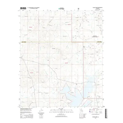
 2003 Savage Creek2005 Print · USGSLouisiana's northern timberlands and wetlands are captured here at the turn of the millennium. Local researchers can trace the shoreline of Lake Iatt, locate a quiet Cem near Blue Lick Creek, and explore the roads of the Kisatchie National Forest.
 - 2012 Map of Savage Creek, 2012 Print
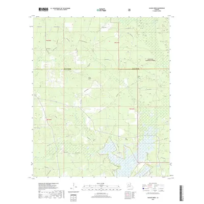
 2012 Savage Creek2012 Print · USGSCovers Iatt, including Grant Parish, Winn Parish, and other nearby areas
 - 2015 Map of Savage Creek, 2015 Print
 2015 Savage Creek2015 Print · USGSCovers Iatt, including Grant Parish, Winn Parish, and other nearby areas
 - 2018 Map of Savage Creek, 2018 Print
 2018 Savage Creek2018 Print · USGSCovers Iatt, including Grant Parish, Winn Parish, and other nearby areas
 - 2020 Map of Savage Creek, 2020 Print
 2020 Savage Creek2020 Print · USGSCovers Iatt, including Grant Parish, Winn Parish, and other nearby areas
 - 2024 Map of Savage Creek, 2024 Print
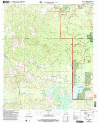
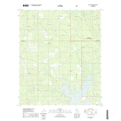
 2024 Savage Creek2024 Print · USGSThe Grant and Winn Parish borderlands are shown here in the contemporary era, dominated by the timberlands and wetlands surrounding Lake Iatt. Researchers can locate rural landmarks like Iatt Church and Shady Grove Cemetary among the creeks and ridges.
End of results
Showing maps 1-13 of 13
Top cities near Iatt
- Winnfield historical maps
- Colfax historical maps
- Montgomery historical maps
- Dry Prong historical maps
- Atlanta historical maps
Frequently asked questions
- What are the different types of historical maps available for Iatt?
- What is the oldest map of Iatt?
- Where can I purchase historical maps of Iatt for my home or office?
- Where can I download high-res historical maps of Iatt?
- Are there historical topographic maps available for Iatt?
- Is there historical aerial imagery available for Iatt?
- Where are historical maps of Iatt sourced from?