Old Maps of Pesson, Louisiana for Hiking & Exploration
Hike through history with 14 historic maps of Pesson. Explore old trails, ghost towns, and forgotten backroads — perfect for outdoor adventurers and local explorers.
- Rediscover forgotten places: Map out old mining camps, roads, and footpaths that no longer exist on modern maps.
- Layer with modern tools: Combine with LiDAR or satellite views to plan hikes through historical terrain.
- Made for exploration: Popular among hikers, overlanders, and local history lovers.
Use these maps to find adventure and explore the hidden past of Pesson.
Pesson, LA maps
(14)- 1937 Map of Derouen, 1963 Print
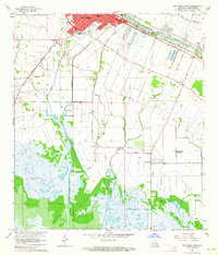
 1937 Derouen1963 Print · USGSCoastal Louisiana in the late 1930s is revealed here as a landscape of salt domes and sugarcane plantations linked by rail and marsh. Genealogists and historians can trace family locations through Duboin Plantation, St Helens Church, and the settlement of Delcambre.
 - 1945 Map of New Orleans
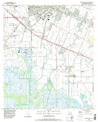
 1945 New Orleans1945 Print · USGSCoastal Louisiana and the Mississippi delta are captured here just after the war, showing the region's transition into a modern industrial and transit hub. Genealogists can trace family settlements along Bayou Teche or identify rail stops for the Illinois Central and Texas & Pacific lines.
 - 1963 Map of New Orleans
 1963 New Orleans1963 Print · USGSCoastal Louisiana in the mid-twentieth century reveals a complex world of bayou settlements, expanding oil fields, and vital rail networks. Genealogists and historians can trace family roots through river towns like Thibodaux or follow the Southern Pacific line through Franklin and Patterson.4 unique versions available
 - 1963 Map of New Iberia South, 1964 Print
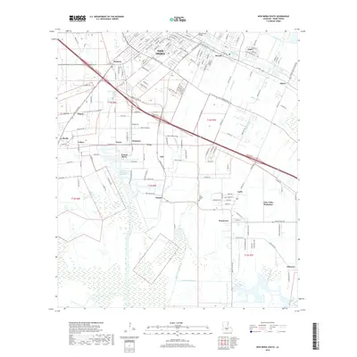
 1963 New Iberia South1964 Print · USGSSouthern Iberia Parish in the early 1960s reveals a landscape where the historic influence of Bayou Teche meets a modern industrial economy. Researchers can trace family-named sites like Duboin Plantation, Peebles Sch, and the riverside community of Berard.2 unique versions available
 - 1963 Map of Derouen, 1968 Print
 1963 Derouen1968 Print · USGSCoastal Iberia Parish comes into focus during the early 1960s, showing the intersection of salt dome industry and traditional bayou life. Genealogists and researchers can trace family lands near Duboin Plantation, New Iberia, and the historic St Joseph Cem.
 - 1966 Map of Derouen
 1966 Derouen1966 Print · USGSThe coastal marshlands and industrial salt domes of South Louisiana are captured here in the mid-1960s. Genealogists and local historians can trace family-named sites like Broussville and Migues, or explore industrial landmarks at Avery Island and the Port of New Iberia.
 - 1966 Map of New Orleans
 1966 New Orleans1966 Print · USGSCoastal Louisiana in the mid-1960s reveals a transition from traditional bayou life to an intensive offshore oil and gas economy. Researchers can trace the rail lines of the Southern Pacific RR through Morgan City or locate the Eugene Island Lighthouse among the delta's shifting marshes.
 - 1983 Map of Morgan City
 1983 Morgan City1983 Print · USGSThe Louisiana coast in the early eighties reveals a landscape shaped by water and industry, from the salt domes to the sugar parishes. Trace the historic corridor of the Bayou Teche, the rail lines through Morgan City, and the wetlands of Weeks Island.2 unique versions available
 - 1994 Map of New Iberia South, 1998 Print
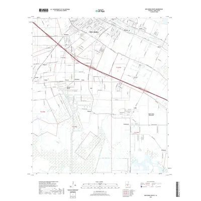
 1994 New Iberia South1998 Print · USGSIberia Parish in the mid-1990s reveals a landscape of industrial growth and deep-rooted agricultural heritage. Genealogists and historians can trace family-named sites from Duboin Plantation to Lydia, and locate the old Olivier Station along the bayou.
 - 2012 Map of New Iberia South, 2012 Print
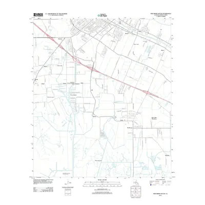 2012 New Iberia South2012 Print · USGSCovers Pesson, including New Iberia, Olivier, and other nearby areas
 - 2015 Map of New Iberia South, 2015 Print
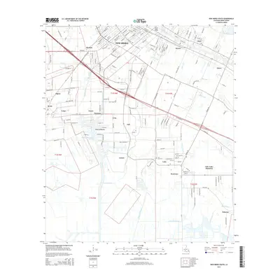 2015 New Iberia South2015 Print · USGSCovers Pesson, including New Iberia, Olivier, and other nearby areas
 - 2018 Map of New Iberia South, 2018 Print
 2018 New Iberia South2018 Print · USGSCovers Pesson, including New Iberia, Olivier, and other nearby areas
 - 2020 Map of New Iberia South, 2020 Print
 2020 New Iberia South2020 Print · USGSCovers Pesson, including New Iberia, Olivier, and other nearby areas
 - 2024 Map of New Iberia South, 2024 Print
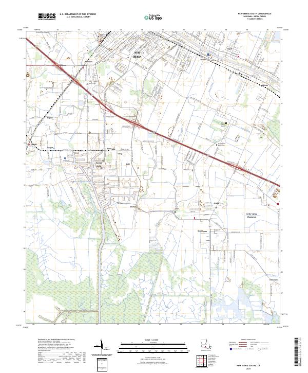 2024 New Iberia South2024 Print · USGSCoastal Louisiana's industrial and agricultural heritage is on full display in this modern survey of the Iberia Parish wetlands. Genealogists and historians can trace family roots through Little Valley Plantation and numerous burial sites like Saint Thomas Baptist Cem and Mount Calvary Cem 2.
End of results
Showing maps 1-14 of 14
Top cities near Pesson
- Lafayette historical maps
- New Iberia historical maps
- Jeanerette historical maps
- Youngsville historical maps
- Erath historical maps
- Loreauville historical maps
Frequently asked questions
- What are the different types of historical maps available for Pesson?
- What is the oldest map of Pesson?
- Where can I purchase historical maps of Pesson for my home or office?
- Where can I download high-res historical maps of Pesson?
- Are there historical topographic maps available for Pesson?
- Is there historical aerial imagery available for Pesson?
- Where are historical maps of Pesson sourced from?