Old Maps of Iberia Parish, Louisiana
Explore 219 old maps of Iberia Parish, spanning from 1932 to today. These high-resolution historic maps reveal how streets, neighborhoods, landmarks, and natural features evolved over time — perfect for genealogy, metal detecting, research, and local history exploration.
What you can do with these maps:
- See how Iberia Parish changed over time: Compare historical maps to modern-day views to trace roads, homesites, rail lines & more.
- View detailed metadata: Each map includes creators, publishers, year, scale, and archive source.
- Overlay maps with satellite & LiDAR: Visualize the past alongside modern tools to explore terrain & human change.
- Trusted historical sources: Maps sourced from the USGS, Library of Congress, and other archives.
- Access maps your way: View online, download high-res files, or order prints for personal or research use.
Start exploring old maps of Iberia Parish to uncover forgotten places, hidden landmarks, and the deep history beneath your feet.
Iberia Parish, LA maps
(219)- 1932 Map of Bayou Blanc
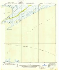
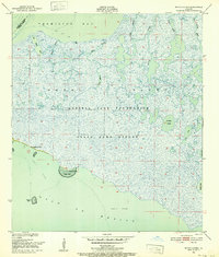
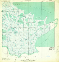 1932 Bayou Blanc1932 Print · USGSLouisiana’s coastal wetlands are captured here in the early 1930s, showing the complex hydrology of the Iberia Parish shore. Researchers can trace the natural layout of Marsh Island and its many interior waters, including Lake Sand and Mound Point.
 - 1935 Map of Chicot Lake, 1938 Print
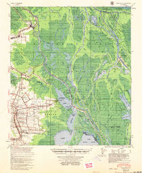
 1935 Chicot Lake1938 Print · USGSInland Iberville Parish in the 1930s reveals a complex delta landscape managed by the Corps of Engineers. Researchers can trace the river-bound economy of the era through the Jack Miller Store, the Indian Mound, and the dredging of the Logging Canal.
 - 1936 Map of White Castle, 1937 Print
 1936 White Castle1937 Print · USGSThe Mississippi River corridor and its sprawling plantation estates are captured here in the mid-1930s. Researchers can trace family roots at Pierre Part Settlement or locate landmarks like the Leper Colony and St Marys Ch & Cem.2 unique versions available
 - 1937 Map of Bayou Sale, 1949 Print
 1937 Bayou Sale1949 Print · USGSSt. Mary Parish during the late 1930s reveals a coastal world of rail-fed settlements and winding bayous. Researchers can trace family ties at the South Bend Cem, locate the Midway Ch & Sch, and follow the Southern Pacific tracks through Ellerslie.
 - 1937 Map of Jeanerette, 1949 Print
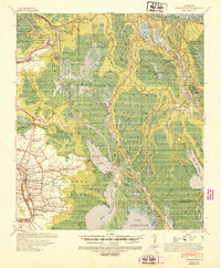
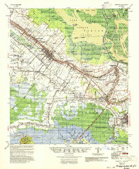
 1937 Jeanerette1949 Print · USGSCajun country comes alive in the late 1930s as plantations and rail lines dominate the banks of the Bayou Teche. Genealogists can trace family roots through numerous sites like St Nicholas Ch & Cem, the Rosenwald School, and the Bodin Plantation.
 - 1937 Map of Derouen, 1963 Print
 1937 Derouen1963 Print · USGSCoastal Louisiana in the late 1930s is revealed here as a landscape of salt domes and sugarcane plantations linked by rail and marsh. Genealogists and historians can trace family locations through Duboin Plantation, St Helens Church, and the settlement of Delcambre.
 - 1939 Map of St. Martinsville, 1946 Print
 1939 St. Martinsville1946 Print · USGSCajun country at the end of the 1930s reveals a landscape shaped by the Bayou Teche and the expansion of the regional oil and rail industries. Genealogists can locate family landmarks like the Girouard Ranch and rural centers such as Cecelia Ch & Sch or Billeaud.2 unique versions available
 - 1941 Map of Loreauville, 1943 Print
 1941 Loreauville1943 Print · USGSCoastal Louisiana in the early 1940s reveals a world of bayou settlements and swamp industry at the edge of the Atchafalaya. Genealogists can trace family names at St John Ch & Cem or Belle Chasse & Cem, while historians can locate the Broussard Switch and Bayou Chene.
 - 1945 Map of New Orleans
 1945 New Orleans1945 Print · USGSCoastal Louisiana and the Mississippi delta are captured here just after the war, showing the region's transition into a modern industrial and transit hub. Genealogists can trace family settlements along Bayou Teche or identify rail stops for the Illinois Central and Texas & Pacific lines.
 - 1946 Map of Redfish Point SE
 1946 Redfish Point SE1946 Print · USGSThe coastal marshes of Louisiana are frozen in time just after the war, showing the vital waterways between the gulf and the bay. Researchers can trace the historic Pirogue Trail and locate coastal landmarks like Lighthouse Point and Marsh Island.
 - 1948 Map of Foster, 1951 Print
 1948 Foster1951 Print · USGSSt. Martin and St. Mary Parishes are shown at a post-war turning point, where Bayou Teche's plantation heritage meets the industrial era. Family historians can locate specific sites like Verdunville, Butler Ch & Cem, and the river-based community at Irish Bend.
 - 1948 Map of Bayou Blanc, 1952 Print
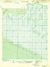
 1948 Bayou Blanc1952 Print · USGSCoastal Iberia Parish in the late 1940s was an expansive wetland environment defined by the Russell Sage Foundation State Game Refuge. Researchers can trace the shifting hydrologic patterns of Marsh Island through features like Lake Michael and the intricate forks of Oyster Bayou.2 unique versions available
 - 1948 Map of Cypremort Point, 1952 Print
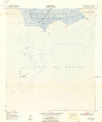
 1948 Cypremort Point1952 Print · USGSCoastal Louisiana in the late 1940s is defined here by the vast wetlands of Marsh Island and the open waters of the Gulf bays. Researchers can trace the early petroleum footprint at Oil well sites or locate the Conservation Camp near Bird I Bayou.2 unique versions available
 - 1949 Map of Cypremort Pt
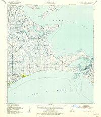
 1949 Cypremort Pt1949 Print · USGSThe Louisiana coast at the edge of St. Mary Parish is captured here during the late 1940s, showing a world of winding bayous and expansive bays. Researchers can trace the shifting shoreline near Cypremort Point, Oyster Lake, and the remote Dead Cypress Point.3 unique versions available
 - 1949 Map of Bayou Lucien
 1949 Bayou Lucien1949 Print · USGSMarsh Island was a remote landscape of tidal bayous and isolated chenier ridges in the late 1940s. Genealogists and historians can locate early coastal settlements at Chenier la Croix and trace the complex waterways of Bayou Lucien and Lucien Lake.
 - 1951 Map of Lake Point, 1952 Print
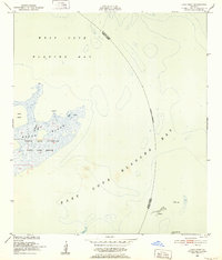 1951 Lake Point1952 Print · USGSThe Louisiana coastline at the start of the 1950s reveals a vast network of wetlands and open water at the edge of Iberia Parish. Trace the early boundaries of the Russell Sage Foundation State Game Refuge and coastal landmarks like Lake Point and Tom Hawkins Bayou.2 unique versions available
 - 1951 Map of Mound Point, 1952 Print
 1951 Mound Point1952 Print · USGSThe Louisiana coastline at Marsh Island was a landscape of conservation and coastal shifts in the early fifties. Researchers can map the hydrologic patterns of Oyster Bayou and locate historical boundaries for the Russell Sage Foundation State Game Refuge and Shell Keys Bird Reservation.2 unique versions available
 - 1951 Map of Bayou Lucien, 1952 Print
 1951 Bayou Lucien1952 Print · USGSThe coastal wetlands of Iberia Parish are documented here in the early fifties, showing the pristine state of the Marsh Island wildlife sanctuary. Explore the intricate bayou network of Bayou Lucien and landmarks like Cheniere la Croix and Oyster Reef.2 unique versions available
 - 1951 Map of Cheniere Au Tigre, 1955 Print
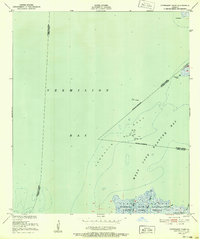
 1951 Cheniere Au Tigre1955 Print · USGSCoastal Vermilion Parish in the early fifties was a world of protected marsh and remote ridge settlements. Genealogists and researchers can trace the isolated community at Cheniere au Tigre or follow the historic Pirogue Trail through the State Game Refuge.3 unique versions available
 - 1954 Map of Chicot Lake
 1954 Chicot Lake1954 Print · USGSIberville and St. Martin Parishes are captured here in the mid-fifties, showing a watery landscape defined by the Atchafalaya Basin Floodway. Genealogists and historians can trace community landmarks like the Bayou Plaquemine Mission, the Jack Miller Store, and the Bayou Sorrel Baptist Hospital.
 - 1954 Map of Redfish Point SE
 1954 Redfish Point SE1954 Print · USGSCoastal Vermilion Parish in the early 1950s reveals a landscape of isolated marshes and maritime channels before modern erosion. Trace the historic Pirogue Trail and locate coastal landmarks like Lighthouse Point and Southwest Pass.
 - 1954 Map of Loreauville
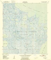
 1954 Loreauville1954 Print · USGSThe Acadiana wetlands and Bayou Teche corridor come alive in the mid-1950s, showing the intersection of rural agriculture and the emerging oil industry. Genealogists and local historians can trace family locations near Loreauville, Broussard Switch, and several rural sites like St John Ch & Cem.
 - 1954 Map of Jeanerette
 1954 Jeanerette1954 Print · USGSCoastal Louisiana parishes are captured here in the mid-fifties, where the bayou-based economy met the rising oil and gas industries. Researchers can trace family sites at St Peters Ch & Cem, explore the reaches of Grand Lake, or locate the Jeanerette Airfield.
 - 1954 Map of Port Arthur
 1954 Port Arthur1954 Print · USGSThe Texas and Louisiana coastlines meet here in the mid-fifties, showing the industrial rise of Port Arthur alongside vast wildlife preserves. Researchers can trace remote coastal settlements and infrastructure like Pecan Island, the Sabine Pass Lighthouse, and the North Island School.
 - 1954 Map of Baton Rouge, 1974 Print
 1954 Baton Rouge1974 Print · USGSSoutheast Louisiana in the mid-fifties is captured here during a period of transition for its river and rail economies. Researchers can trace the path of the Mississippi River and find landmarks like the Bonnet Carre Spillway and Bayou Plaquemine.2 unique versions available
Showing maps 1-25 of 219
Top cities of Iberia Parish
Frequently asked questions
- What are the different types of historical maps available for Iberia Parish?
- What is the oldest map of Iberia Parish?
- Where can I purchase historical maps of Iberia Parish for my home or office?
- Where can I download high-res historical maps of Iberia Parish?
- Are there historical topographic maps available for Iberia Parish?
- Is there historical aerial imagery available for Iberia Parish?
- Where are historical maps of Iberia Parish sourced from?