1990s Maps of Iberia Parish, Louisiana
Explore 14 historic maps of Iberia Parish from the 1990s. These maps offer a rare glimpse into what life looked like during the 1990s — showing old roads, neighborhoods, homes, and landmarks that have changed or disappeared over time.
Whether you're researching your family's past, planning a metal detecting trip, or studying how Iberia Parish's landscape evolved across the 1990s, these high-resolution maps are a powerful tool for exploring the history of this region.
- Focus on a specific era: All maps on this page are from the 1990s, giving you a focused view of this time period.
- See what’s changed: Compare century-old streets, trails, and buildings to today's modern landscape using overlays and satellite layers.
- Research with precision: Use these maps for genealogy, historical research, land use analysis, or educational projects.
- View, download, or print: Maps are fully viewable online in high resolution, and can be downloaded or printed for your own records.
Start exploring Iberia Parish's history through authentic maps from the 1990s. This is your window into the past.
Iberia Parish, LA maps
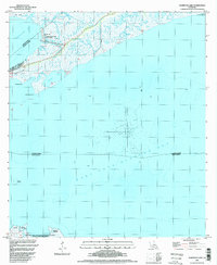
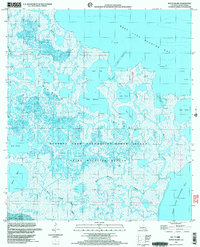
(14)- 1994 Map of Tigre Lagoon, 1998 Print
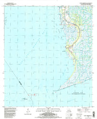
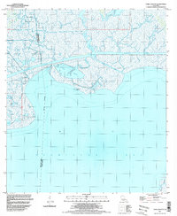 1994 Tigre Lagoon1998 Print · USGSThe Louisiana coastline in the late twentieth century reveals a landscape shaped by oil extraction and coastal navigation. Trace the intersection of industrial canals and natural bayous like Bayou Petite Anse and the South Tigre Lagoon Gas Field.
 - 1994 Map of Delcambre, 1998 Print
 1994 Delcambre1998 Print · USGSThe salt domes and marshes of Iberia and Vermilion parishes are captured here in the mid-nineties, showing a landscape defined by industrial canals and coastal wetlands. Researchers can locate family landmarks like Miguel Cem, the heights of Avery Island, and settlements such as Bob Acres and Broussville.
 - 1994 Map of Cypremort Point, 1998 Print
 1994 Cypremort Point1998 Print · USGSCoastal Louisiana near the meeting of the bays is documented here in the mid-nineties, showing the intersection of conservation and industry. You can trace the marshy geography of Marsh Island or locate the active Oil and Gas Field and Cypremort Point settlements.
 - 1994 Map of New Iberia South, 1998 Print
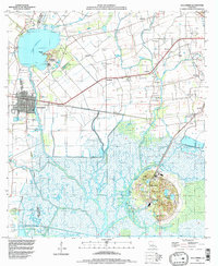
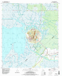
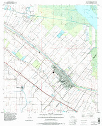
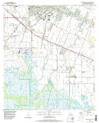 1994 New Iberia South1998 Print · USGSIberia Parish in the mid-1990s reveals a landscape of industrial growth and deep-rooted agricultural heritage. Genealogists and historians can trace family-named sites from Duboin Plantation to Lydia, and locate the old Olivier Station along the bayou.
 - 1994 Map of Weeks, 1998 Print
 1994 Weeks1998 Print · USGSThe coastal marsh and salt dome landscape of Iberia Parish is captured in the mid-1990s as the industrial and natural worlds intersect. Trace old family sites near Weeks and Ewing Cem, or explore the waterways of Weeks Island and the Intracostal Waterway.
 - 1994 Map of Hammock Lake, 1998 Print
 1994 Hammock Lake1998 Print · USGSThe Louisiana coast and its offshore energy fields are captured in the 1990s as industry met conservation. Trace the development of the West Cote Blanche Oil and Gas Field and the boundaries of Cypremort Point State Park.
 - 1994 Map of Kemper, 1998 Print
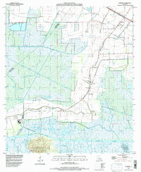 1994 Kemper1998 Print · USGSCoastal Louisiana near the Iberia Parish line is shown in the mid-1990s, where traditional settlements and sugar-country history meet modern maritime infrastructure. Researchers can trace the layout of small communities like Freetown, Four Corners, and Home Place while navigating the intricate channels of Bayou Cypremort.
 - 1994 Map of Marone Point, 1998 Print
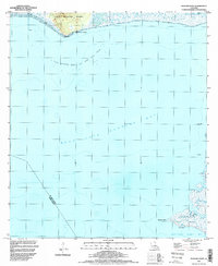 1994 Marone Point1998 Print · USGSSt. Mary Parish's coastal landscape is captured in the mid-nineties, showing the intersection of industrial energy and marshland geography. Trace the development of the Cote Blanche Island Oil and Gas Field and landmarks like Cote Blanche Landing.
 - 1994 Map of Point Chevreuil, 1998 Print
 1994 Point Chevreuil1998 Print · USGSCoastal St. Mary Parish in the mid-1990s reveals a landscape of tidal marshes and industrial oil fields at the edge of the Gulf. Trace the reach of the Bayou Sale Oil and Gas Field and locate local landmarks like the South Bend Cem and Luke Landing.
 - 1994 Map of Jeanerette, 1998 Print
 1994 Jeanerette1998 Print · USGSThe Bayou Teche corridor in the mid-nineties shows a landscape of deep-rooted sugar country and emerging energy infrastructure. Genealogists can locate family landmarks like Boynton Cem, the settlement of Patoutville, and the Iberia Oil and Gas Field.
 - 1998 Map of Bayou Lucien, 2003 Print
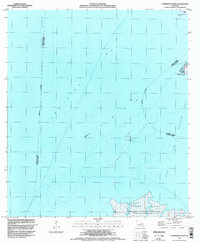
 1998 Bayou Lucien2003 Print · USGSThe Louisiana coastline at Marsh Island comes alive in the late 1990s as a haven for wildlife and industry. Trace the winding paths of Big Charles Bayou and Bayou Lucien or locate offshore landmarks like Diamond Reef and Shell Reef.
 - 1998 Map of Hell Hole Bayou, 2003 Print
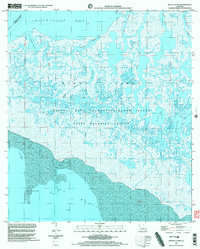
 1998 Hell Hole Bayou2003 Print · USGSCoastal wetlands near the turn of the millennium show a landscape of industrial energy and wildlife conservation. Trace the boundary between the Hell Hole Bayou Gas Field and the Paul J Rainey Wildlife Sanctuary, or locate landmarks like Tete Butte Reef and Deedman Island.
 - 1999 Map of Charenton, 2000 Print
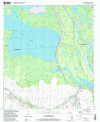 1999 Charenton2000 Print · USGSSt. Mary Parish at the close of the twentieth century shows a landscape defined by the winding Bayou Teche and the vast Atchafalaya Basin Floodway. Genealogists and historians can locate family landmarks in Charenton and Sorrel or trace the industrial footprints of the local Oil and Gas Field.
 - 1999 Map of Bayou Blanc, 2003 Print
 1999 Bayou Blanc2003 Print · USGSMarsh Island at the end of the twentieth century remains a vast mosaic of tidal wetlands and conservation land. Naturalists and researchers can trace the intricate waterways of Bayou Blanc or locate remote landmarks like Scat Lake and the various Shell Reefs.
End of results
Showing maps 1-14 of 14
Top cities of Iberia Parish
Frequently asked questions
- What are the different types of historical maps available for Iberia Parish?
- What is the oldest map of Iberia Parish?
- Where can I purchase historical maps of Iberia Parish for my home or office?
- Where can I download high-res historical maps of Iberia Parish?
- Are there historical topographic maps available for Iberia Parish?
- Is there historical aerial imagery available for Iberia Parish?
- Where are historical maps of Iberia Parish sourced from?