1980s Maps of Iberia Parish, Louisiana
Explore 6 historic maps of Iberia Parish from the 1980s. These maps offer a rare glimpse into what life looked like during the 1980s — showing old roads, neighborhoods, homes, and landmarks that have changed or disappeared over time.
Whether you're researching your family's past, planning a metal detecting trip, or studying how Iberia Parish's landscape evolved across the 1980s, these high-resolution maps are a powerful tool for exploring the history of this region.
- Focus on a specific era: All maps on this page are from the 1980s, giving you a focused view of this time period.
- See what’s changed: Compare century-old streets, trails, and buildings to today's modern landscape using overlays and satellite layers.
- Research with precision: Use these maps for genealogy, historical research, land use analysis, or educational projects.
- View, download, or print: Maps are fully viewable online in high resolution, and can be downloaded or printed for your own records.
Start exploring Iberia Parish's history through authentic maps from the 1980s. This is your window into the past.
Iberia Parish, LA maps
(6)- 1983 Map of Youngsville
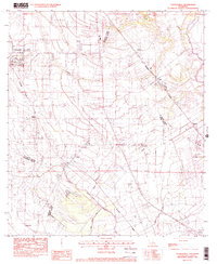 1983 Youngsville1983 Print · USGSYoungsville and the surrounding Acadiana prairies are captured in the early eighties as agricultural traditions met modern expansion. Researchers can trace the Southern Pacific rail corridor through old settlements like Cade, Duchamp, and Lozes.
 - 1983 Map of White Lake
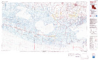 1983 White Lake1983 Print · USGSCoastal Louisiana at the start of the 1980s reveals a world of remote chenier settlements and vast marshlands. Genealogists and historians can trace family locations along Grand Chenier Ridge or explore the hubs of Abbeville and Intracoastal City.2 unique versions available
 - 1983 Map of Atchafalaya Bay
 1983 Atchafalaya Bay1983 Print · USGSCoastal Louisiana in the early eighties reveals a world of remote wetlands and wildlife refuges where the delta meets the gulf. Maritime researchers and genealogists can trace historical landmarks like the Lighthouse, Pelican Battery, and the expansive Point Au Fer Island.
 - 1983 Map of New Iberia North
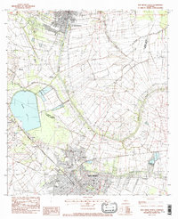 1983 New Iberia North1983 Print · USGSCajun country along the Bayou Teche in the early eighties shows the evolving landscape between St Martinville and New Iberia. Researchers can trace the path of the Southern Pacific railroad through crossroads like Segura and Daspit.
 - 1983 Map of Morgan City
 1983 Morgan City1983 Print · USGSThe Louisiana coast in the early eighties reveals a landscape shaped by water and industry, from the salt domes to the sugar parishes. Trace the historic corridor of the Bayou Teche, the rail lines through Morgan City, and the wetlands of Weeks Island.2 unique versions available
 - 1984 Map of Baton Rouge
 1984 Baton Rouge1984 Print · USGSBaton Rouge and the surrounding river country are captured in the mid-eighties as the industrial corridor met the deep wetlands of the basin. Researchers can trace the winding Bayou Teche, locate family roots in St Martinville, or study the massive Atchafalaya Basin Floodway.2 unique versions available
End of results
Showing maps 1-6 of 6
Top cities of Iberia Parish
Frequently asked questions
- What are the different types of historical maps available for Iberia Parish?
- What is the oldest map of Iberia Parish?
- Where can I purchase historical maps of Iberia Parish for my home or office?
- Where can I download high-res historical maps of Iberia Parish?
- Are there historical topographic maps available for Iberia Parish?
- Is there historical aerial imagery available for Iberia Parish?
- Where are historical maps of Iberia Parish sourced from?