1900s (20th Century) Maps of Iberia Parish, Louisiana
Explore 89 historic maps of Iberia Parish from the 1900s (20th Century). These maps offer a rare glimpse into what life looked like during the 1900s — showing old roads, neighborhoods, homes, and landmarks that have changed or disappeared over time.
Whether you're researching your family's past, planning a metal detecting trip, or studying how Iberia Parish's landscape evolved across the 1900s, these high-resolution maps are a powerful tool for exploring the history of this region.
- Focus on a specific era: All maps on this page are from the 1900s, giving you a focused view of this time period.
- See what’s changed: Compare century-old streets, trails, and buildings to today's modern landscape using overlays and satellite layers.
- Research with precision: Use these maps for genealogy, historical research, land use analysis, or educational projects.
- View, download, or print: Maps are fully viewable online in high resolution, and can be downloaded or printed for your own records.
Start exploring Iberia Parish's history through authentic maps from the 1900s. This is your window into the past.
Iberia Parish, LA maps
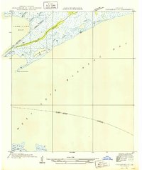
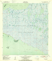
(89)- 1932 Map of Bayou Blanc
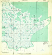 1932 Bayou Blanc1932 Print · USGSCovers Iberia Parish, including United States, Louisiana, and other nearby areas
 - 1935 Map of Chicot Lake, 1938 Print
 1935 Chicot Lake1938 Print · USGSCovers Iberia Parish, including Bayou Sorrel, Pigeon, and other nearby areas
 - 1936 Map of White Castle, 1937 Print
 1936 White Castle1937 Print · USGSCovers Iberia Parish, including Donaldsonville, White Castle, and other nearby areas2 unique versions available
 - 1937 Map of Bayou Sale, 1949 Print
 1937 Bayou Sale1949 Print · USGSCovers Iberia Parish, including Burns, Cote Blanche Landing, and other nearby areas
 - 1937 Map of Jeanerette, 1949 Print
 1937 Jeanerette1949 Print · USGSCovers Iberia Parish, including Franklin, Jeanerette, and other nearby areas
 - 1937 Map of Derouen, 1963 Print
 1937 Derouen1963 Print · USGSCovers Iberia Parish, including New Iberia, Avery Island, and other nearby areas
 - 1939 Map of St. Martinsville, 1946 Print
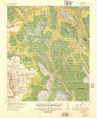
 1939 St. Martinsville1946 Print · USGSCovers Iberia Parish, including Lafayette, New Iberia, and other nearby areas2 unique versions available
 - 1941 Map of Loreauville, 1943 Print
 1941 Loreauville1943 Print · USGSCovers Iberia Parish, including Loreauville, Catahoula, and other nearby areas
 - 1945 Map of New Orleans
 1945 New Orleans1945 Print · USGSCovers Iberia Parish, including New Orleans, Metairie, and other nearby areas
 - 1946 Map of Redfish Point SE
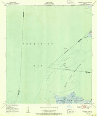
 1946 Redfish Point SE1946 Print · USGSCovers Iberia Parish, including Vermilion Parish, United States, and other nearby areas
 - 1948 Map of Foster, 1951 Print
 1948 Foster1951 Print · USGSCovers Iberia Parish, including Franklin, Oaklawn, and other nearby areas
 - 1948 Map of Bayou Blanc, 1952 Print
 1948 Bayou Blanc1952 Print · USGSCovers Iberia Parish, including United States, Louisiana, and other nearby areas2 unique versions available
 - 1948 Map of Cypremort Point, 1952 Print
 1948 Cypremort Point1952 Print · USGSCovers Iberia Parish, including Vermilion Parish, St. Mary Parish, and other nearby areas2 unique versions available
 - 1949 Map of Cypremort Pt
 1949 Cypremort Pt1949 Print · USGSCovers Iberia Parish, including Cypremort Point, St. Mary Parish, and other nearby areas3 unique versions available
 - 1949 Map of Bayou Lucien
 1949 Bayou Lucien1949 Print · USGSCovers Iberia Parish, including Vermilion Parish, United States, and other nearby areas
 - 1951 Map of Lake Point, 1952 Print
 1951 Lake Point1952 Print · USGSCovers Iberia Parish, including St. Mary Parish, United States, and other nearby areas2 unique versions available
 - 1951 Map of Mound Point, 1952 Print
 1951 Mound Point1952 Print · USGSCovers Iberia Parish, including United States, Louisiana, and other nearby areas2 unique versions available
 - 1951 Map of Bayou Lucien, 1952 Print
 1951 Bayou Lucien1952 Print · USGSCovers Iberia Parish, including Vermilion Parish, United States, and other nearby areas2 unique versions available
 - 1951 Map of Cheniere Au Tigre, 1955 Print
 1951 Cheniere Au Tigre1955 Print · USGSCovers Iberia Parish, including Cheniere au Tigre, Vermilion Parish, and other nearby areas3 unique versions available
 - 1954 Map of Chicot Lake
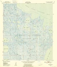
 1954 Chicot Lake1954 Print · USGSCovers Iberia Parish, including Bayou Sorrel, Pigeon, and other nearby areas
 - 1954 Map of Redfish Point SE
 1954 Redfish Point SE1954 Print · USGSCovers Iberia Parish, including Vermilion Parish, United States, and other nearby areas
 - 1954 Map of Loreauville
 1954 Loreauville1954 Print · USGSCovers Iberia Parish, including Loreauville, Catahoula, and other nearby areas
 - 1954 Map of Jeanerette
 1954 Jeanerette1954 Print · USGSCovers Iberia Parish, including Franklin, Jeanerette, and other nearby areas
 - 1954 Map of Port Arthur
 1954 Port Arthur1954 Print · USGSCovers Iberia Parish, including Port Arthur, Nederland, and other nearby areas
 - 1954 Map of Baton Rouge, 1974 Print
 1954 Baton Rouge1974 Print · USGSCovers Iberia Parish, including New Orleans, Baton Rouge, and other nearby areas2 unique versions available
Showing maps 1-25 of 89
Top cities of Iberia Parish
Frequently asked questions
- What are the different types of historical maps available for Iberia Parish?
- What is the oldest map of Iberia Parish?
- Where can I purchase historical maps of Iberia Parish for my home or office?
- Where can I download high-res historical maps of Iberia Parish?
- Are there historical topographic maps available for Iberia Parish?
- Is there historical aerial imagery available for Iberia Parish?
- Where are historical maps of Iberia Parish sourced from?