
1948 Map of Cypremort Point
USGS Topo · Published 1952About this map
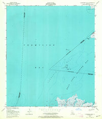
Marsh Island dominates the southern landscape of this coastal survey, where the Russell Sage Foundation State Game Refuge spans a complex network of wetlands and tidal channels. To the north, the waters of Vermilion Bay and West Cote Blanche Bay meet at the distinctive protrusion of Cypremort Point. The map documents early industrial activity in the Gulf, noting several Oil wells and platforms marked by Piling and Dolphin structures throughout the bays. On the island itself, a Conservation Camp is situated near the mouth of Bird I Bayou, illustrating the mid-century focus on wildlife management and coastal preservation. This survey captures a transitional moment for the Louisiana shoreline, detailing the shifting boundaries and maritime hazards like Terrapin Reef before later decades of erosion and development altered the coastal profile.
Find a feature on this map
19 named features on this map. Tap any name to fly to it.
Don’t see what you’re looking for? This feature index may not catch every label — zoom into the map to look around manually.
Map Details
Editions of this 1948 Cypremort Point Map
2 editions found
Other maps of this area

1932 · Bayou Blanc
USGS Topo · 1:31,680

1932 · Abbeville SE
USGS Topo · 1:31,680

1937 · Derouen
USGS Topo · 1:62,500

1945 · New Orleans
USGS Topo · 1:250,000

1946 · Redfish Point NE
USGS Topo · 1:31,680

1946 · Redfish Point SE
USGS Topo · 1:31,680
1948 · Bayou Blanc
USGS Topo · 1:24,000

1949 · Cypremort Pt
USGS Topo · 1:31,680

1949 · Bayou Lucien
USGS Topo · 1:31,680
1951 · Bayou Lucien
USGS Topo · 1:24,000