
1932 Map of Bayou Blanc
USGS Topo · Published 1932About this map
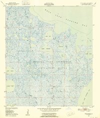
Marsh Island is depicted here as an intricate mosaic of wetlands and tidal waters at the edge of the Iberia Parish coast. The terrain is defined by a dense network of water bodies, including Lake Blanc, Lake Michael, and the elongated Lake Sand, which are linked by winding waterways like Bayou Blanc. The map reveals a landscape heavily shaped by coastal hydrology, where West Branch Oyster Bayou and its eastern counterpart drain into the Gulf of Mexico. Along the southern shoreline, distinctive landmarks such as Mound Point and South Point offer evidence of geographical relief in an otherwise low-lying environment. This survey captures the island before significant modern alterations, showing the complex natural channels and interior lakes like Lake Ferme and Oyster Lake that have long dictated the movement of wildlife and people through the Louisiana marshlands.
Find a feature on this map
25 named features on this map. Tap any name to fly to it.
Don’t see what you’re looking for? This feature index may not catch every label — zoom into the map to look around manually.
Map Details
Editions of this 1932 Bayou Blanc Map
This is the sole edition of this map. No revisions or reprints were ever made.
Other maps of this area

1937 · Bayou Sale
USGS Topo · 1:62,500

1945 · New Orleans
USGS Topo · 1:250,000
1948 · Bayou Blanc
USGS Topo · 1:24,000

1948 · Cypremort Point
USGS Topo · 1:24,000

1949 · Cypremort Pt
USGS Topo · 1:31,680

1949 · Bayou Lucien
USGS Topo · 1:31,680
1951 · Lake Point
USGS Topo · 1:24,000
1951 · Mound Point
USGS Topo · 1:24,000
1951 · Bayou Lucien
USGS Topo · 1:24,000

1957 · Bayou Sale
USGS Topo · 1:62,500