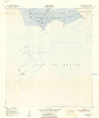
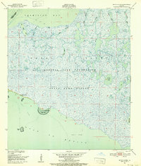
1951 Map of Mound Point
USGS Topo · Published 1952About this map
Russell Sage Foundation State Game Refuge dominates the northern portion of this coastal survey, where the wetland landscape of Marsh Island meets the open waters of the Gulf of Mexico. The area is defined by its intricate aquatic network, featuring the convergence of the West Branch and East Branch Oyster Bayou into the main channel of Oyster Bayou. To the south, the Shell Keys Bird Reservation and various Shell Reefs indicate the biological importance of these coastal barrier features in the early 1950s. Geologic landmarks like Mound Point and South Point serve as the primary terrestrial markers along this stretch of the Louisiana coast, where East Cote Blanche Bay opens to the east. This 1951 field check provides a detailed look at the shoreline before significant modern erosion, documenting the exact positions of oyster and shell reefs as they existed mid-century.
Find a feature on this map
18 named features on this map. Tap any name to fly to it.
Don’t see what you’re looking for? This feature index may not catch every label — zoom into the map to look around manually.
Map Details
Editions of this 1951 Mound Point Map
2 editions found
Other maps of this area

1932 · Bayou Blanc
USGS Topo · 1:31,680

1937 · Bayou Sale
USGS Topo · 1:62,500

1945 · New Orleans
USGS Topo · 1:250,000
1948 · Bayou Blanc
USGS Topo · 1:24,000

1949 · Bayou Lucien
USGS Topo · 1:31,680
1951 · Lake Point
USGS Topo · 1:24,000
1951 · Bayou Lucien
USGS Topo · 1:24,000

1957 · Bayou Sale
USGS Topo · 1:62,500

1963 · New Orleans
USGS Topo · 1:250,000

1966 · New Orleans
USGS Topo · 1:250,000