Old Maps of Grand River, Louisiana for Academic Research
Study the evolution of Grand River with 17 high-resolution historic maps. Whether you're teaching, researching, or modeling changes in land use, these maps provide essential visual documentation of urban, environmental, and geographic change.
- Analyze long-term change: Track patterns in development, transportation, and natural features.
- Ideal for environmental or urban studies: Support academic projects with primary historical map data.
- Use in the classroom or lab: Educators and researchers rely on these maps to bring historical context to life.
These maps are a powerful tool for teaching, research, and visualizing how Grand River has changed over the decades.
Grand River, LA maps
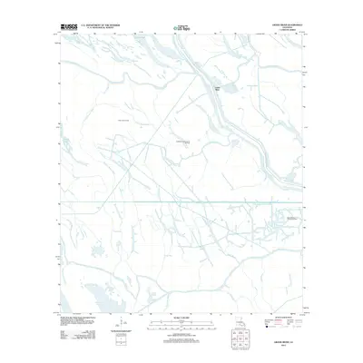
(17)- 1935 Map of Chicot Lake, 1938 Print
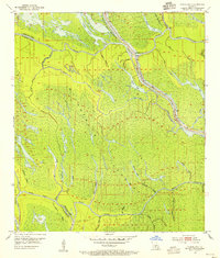
 1935 Chicot Lake1938 Print · USGSInland Iberville Parish in the 1930s reveals a complex delta landscape managed by the Corps of Engineers. Researchers can trace the river-bound economy of the era through the Jack Miller Store, the Indian Mound, and the dredging of the Logging Canal.
 - 1953 Map of Pigeon Bay, 1954 Print
 1953 Pigeon Bay1954 Print · USGSIberville and St. Martin parishes are shown in the early 1950s as a labyrinth of swamp and levee-protected waterways. Researchers can trace the legacy of basin life through sites like the Grand River Sch, the East Protection Levee, and Graveyard Bayou.2 unique versions available
 - 1954 Map of Chicot Lake
 1954 Chicot Lake1954 Print · USGSIberville and St. Martin Parishes are captured here in the mid-fifties, showing a watery landscape defined by the Atchafalaya Basin Floodway. Genealogists and historians can trace community landmarks like the Bayou Plaquemine Mission, the Jack Miller Store, and the Bayou Sorrel Baptist Hospital.
 - 1954 Map of Baton Rouge, 1974 Print
 1954 Baton Rouge1974 Print · USGSSoutheast Louisiana in the mid-fifties is captured here during a period of transition for its river and rail economies. Researchers can trace the path of the Mississippi River and find landmarks like the Bonnet Carre Spillway and Bayou Plaquemine.2 unique versions available
 - 1955 Map of Chicot Lake
 1955 Chicot Lake1955 Print · USGSIberville Parish and the deep Atchafalaya Basin are captured here in the mid-fifties, showing a landscape defined by oil fields and swamp settlements. Researchers can trace the vanished social hubs of the basin at the Jack Miller Store, the Bayou Pigeon Sch, and the Bayou Plaquemine Mission.
 - 1956 Map of Baton Rouge
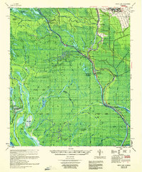
 1956 Baton Rouge1956 Print · USGSSouth Louisiana at the height of the mid-century oil boom shows a landscape of river oxbows and rising industry. Researchers can trace family roots through river towns like Scotlandville or locate early industrial sites and Oil wells near Lake Maurepas.
 - 1959 Map of Chicot Lake, 1960 Print
 1959 Chicot Lake1960 Print · USGSThe Atchafalaya Basin and its intricate swamp networks are meticulously detailed here during the late 1950s. Genealogists and researchers can trace riverside life through landmarks like Jack Miller Store, Crescent, and the Upper Grand River Sch.4 unique versions available
 - 1961 Map of Baton Rouge, 1966 Print
 1961 Baton Rouge1966 Print · USGSSoutheastern Louisiana in the early sixties remains a landscape of deep river bends and sprawling coastal lakes. Genealogists and historians can trace the rail-and-river economy through landmarks like Free-Nigger Point, Donaldsonville, and the Illinois Central Railroad.
 - 1962 Map of Baton Rouge
 1962 Baton Rouge1962 Print · USGSSouth Louisiana in the early sixties reveals a landscape of river-bend parishes and emerging interstate corridors. Genealogists and historians can trace family roots through historic river towns like Donaldsonville and Plaquemine, or follow the path of the Illinois Central Railroad through the swamp basins.
 - 1969 Map of Grand River, 1971 Print
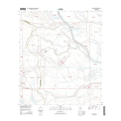
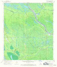 1969 Grand River1971 Print · USGSIberville and St. Martin Parishes are seen here in the late sixties, where the massive spillway infrastructure meets the burgeoning oil industry. Genealogists and historians can trace the intricate bayou networks and industrial landmarks like the Bayou Sorrel Oil and Gas Field, Graveyard Bayou, and the East Protection Levee.3 unique versions available
 - 1984 Map of Baton Rouge
 1984 Baton Rouge1984 Print · USGSBaton Rouge and the surrounding river country are captured in the mid-eighties as the industrial corridor met the deep wetlands of the basin. Researchers can trace the winding Bayou Teche, locate family roots in St Martinville, or study the massive Atchafalaya Basin Floodway.2 unique versions available
 - 1992 Map of Grand River
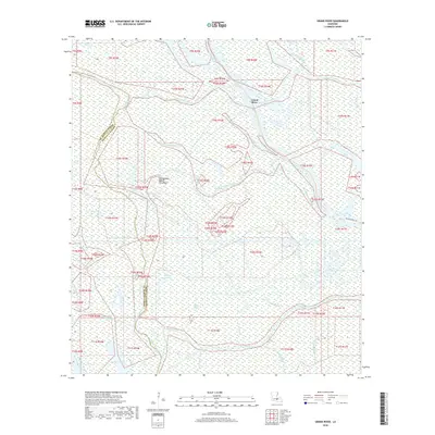
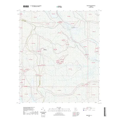
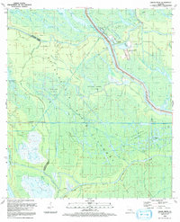 1992 Grand River1992 Print · USGSIberville and St. Martin Parishes are captured in the early nineties as a landscape defined by industrial energy and wetland management. Researchers can trace the massive Atchafalaya Basin Floodway alongside the Bayou Blue Oil and Gas Field and the settlement at Grand River.
 - 2012 Map of Grand River, 2012 Print
 2012 Grand River2012 Print · USGSCovers Grand River, including Saint Martin Parish, Iberville Parish, and other nearby areas
 - 2015 Map of Grand River, 2015 Print
 2015 Grand River2015 Print · USGSCovers Grand River, including Saint Martin Parish, Iberville Parish, and other nearby areas
 - 2018 Map of Grand River, 2018 Print
 2018 Grand River2018 Print · USGSCovers Grand River, including Saint Martin Parish, Iberville Parish, and other nearby areas
 - 2020 Map of Grand River, 2020 Print
 2020 Grand River2020 Print · USGSCovers Grand River, including Saint Martin Parish, Iberville Parish, and other nearby areas
 - 2024 Map of Grand River, 2024 Print
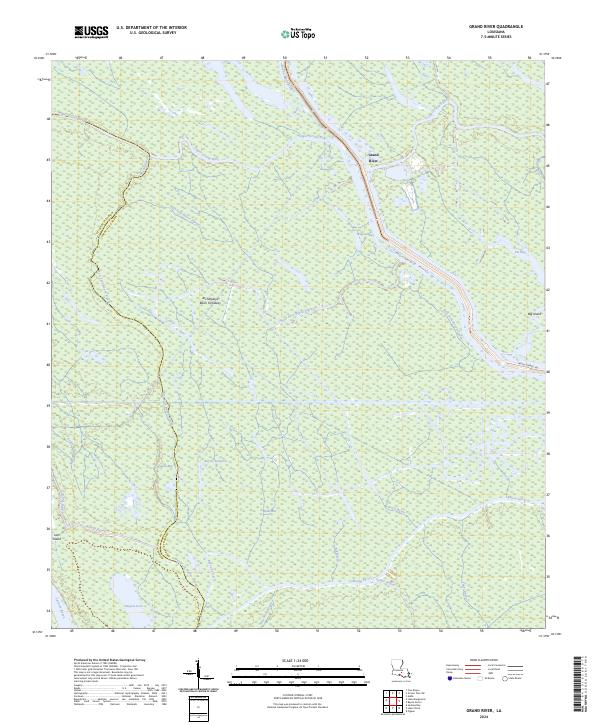 2024 Grand River2024 Print · USGSThe Atchafalaya Basin at the border of Iberville and St. Martin parishes is shown in this recent survey of its shifting waterways. Trace the network of the Upper Grand River as it meets Bayou Sorrel and the waters of Pigeon Bay.
End of results
Showing maps 1-17 of 17
Top cities near Grand River
- Baton Rouge historical maps
- Plaquemine historical maps
- Port Allen historical maps
- Addis historical maps
- Brusly historical maps
- Rosedale historical maps
See more
Frequently asked questions
- What are the different types of historical maps available for Grand River?
- What is the oldest map of Grand River?
- Where can I purchase historical maps of Grand River for my home or office?
- Where can I download high-res historical maps of Grand River?
- Are there historical topographic maps available for Grand River?
- Is there historical aerial imagery available for Grand River?
- Where are historical maps of Grand River sourced from?