Old Maps of Roanoke, Louisiana for Academic Research
Study the evolution of Roanoke with 13 high-resolution historic maps. Whether you're teaching, researching, or modeling changes in land use, these maps provide essential visual documentation of urban, environmental, and geographic change.
- Analyze long-term change: Track patterns in development, transportation, and natural features.
- Ideal for environmental or urban studies: Support academic projects with primary historical map data.
- Use in the classroom or lab: Educators and researchers rely on these maps to bring historical context to life.
These maps are a powerful tool for teaching, research, and visualizing how Roanoke has changed over the decades.
Roanoke, LA maps
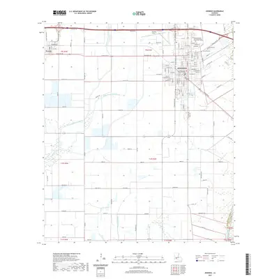
(13)- 1946 Map of Jennings
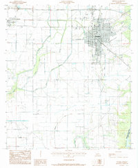
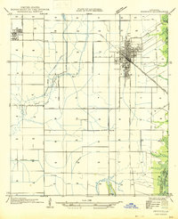 1946 Jennings1946 Print · USGSJefferson Davis Parish is documented here shortly after the war, showing the well-defined street layouts of Jennings and Roanoke. Genealogists and historians can trace property lines alongside the Southern Pacific railroad or follow the essential drainage of Sturdivant Canal.
 - 1952 Map of Lake Charles
 1952 Lake Charles1952 Print · USGSSouthwest Louisiana is captured here in the mid-fifties, showing a landscape defined by the rise of the petrochemical industry and deep-water navigation. Researchers can trace family roots through numerous small-town settlements and oil developments like Nibletts Bluff, the Lockport Oil Field, and Starks.
 - 1954 Map of Jennings
 1954 Jennings1954 Print · USGSJefferson Davis Parish in the mid-1930s shows a landscape of growing towns and extensive irrigation networks. Genealogists and historians can trace the early footprints of Jennings and Roanoke alongside vital waterways like Bayou Nezpique and the Sturdivant Canal.
 - 1954 Map of Lake Charles, 1964 Print
 1954 Lake Charles1964 Print · USGSSouthwest Louisiana in the mid-fifties is defined by its massive petroleum industry and its complex network of bayous and rail lines. Researchers can trace the development of the Sulphur Mines Oil Field or locate historic settlements like Longville and De Quincy.3 unique versions available
 - 1955 Map of Jennings, 1956 Print
 1955 Jennings1956 Print · USGSSouthwestern Louisiana's parish boundaries and bayous are captured here in the mid-fifties, showing the intersection of the oil industry and river life. Researchers can find old rural schoolhouses like Klondike Sch, early energy hubs like the Jennings Oil and Gas Field, and the Southern Pacific rail line.4 unique versions available
 - 1964 Map of Jennings
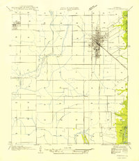
 1964 Jennings1964 Print · USGSJefferson Davis Parish in the mid-1930s is documented here as an emerging agricultural center defined by rail and irrigation. Genealogists can trace property lines and old routes through Roanoke or along the Sturdivant Canal and Southern Pacific rail line.
 - 1985 Map of Jennings
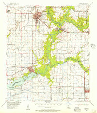
 1985 Jennings1985 Print · USGSJennings and the surrounding Louisiana prairie are captured in the mid-eighties as a hub of energy and agriculture. Researchers can trace the sprawling Lake Arthur Oil and Gas Field or locate family sites at Roanoke and local Cem markers.2 unique versions available
 - 1985 Map of Crowley, 1986 Print
 1985 Crowley1986 Print · USGSCoastal prairie and bayou country are captured in the mid-eighties as the rice-and-rail economy defined South Louisiana life. Genealogists and researchers can trace family lands and rural hubs from Crowley to Jennings, following the paths of the Southern Pacific Railroad and the winding Mermentau River.2 unique versions available
 - 2012 Map of Jennings, 2012 Print
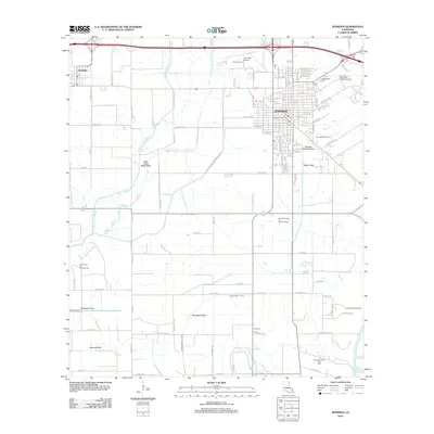 2012 Jennings2012 Print · USGSCovers Roanoke, including Jennings, Acadia Parish, and other nearby areas
 - 2015 Map of Jennings, 2015 Print
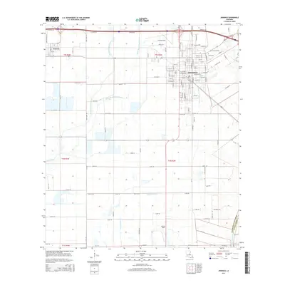 2015 Jennings2015 Print · USGSCovers Roanoke, including Jennings, Acadia Parish, and other nearby areas
 - 2018 Map of Jennings, 2018 Print
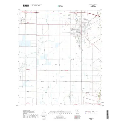 2018 Jennings2018 Print · USGSCovers Roanoke, including Jennings, Acadia Parish, and other nearby areas
 - 2020 Map of Jennings, 2020 Print
 2020 Jennings2020 Print · USGSCovers Roanoke, including Jennings, Acadia Parish, and other nearby areas
 - 2024 Map of Jennings, 2024 Print
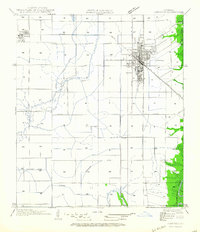
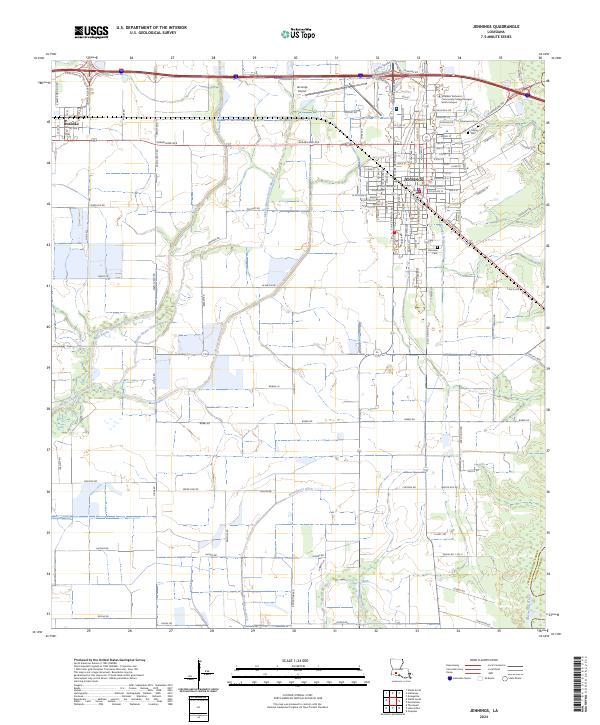 2024 Jennings2024 Print · USGSCoastal prairie life in Jefferson Davis Parish is captured here during the 2020s, centered on the growing community of Jennings. Researchers can trace local heritage at Greenwood Cem or explore the waterways of the Mermentau River and Bayou Chene.
End of results
Showing maps 1-13 of 13
Top cities near Roanoke
- Jennings historical maps
- Welsh historical maps
- Lake Arthur historical maps
- Hayes historical maps
- Mermentau historical maps
- Fenton historical maps
Frequently asked questions
- What are the different types of historical maps available for Roanoke?
- What is the oldest map of Roanoke?
- Where can I purchase historical maps of Roanoke for my home or office?
- Where can I download high-res historical maps of Roanoke?
- Are there historical topographic maps available for Roanoke?
- Is there historical aerial imagery available for Roanoke?
- Where are historical maps of Roanoke sourced from?