Old Maps of Westwego, Louisiana for Academic Research
Study the evolution of Westwego with 28 high-resolution historic maps. Whether you're teaching, researching, or modeling changes in land use, these maps provide essential visual documentation of urban, environmental, and geographic change.
- Analyze long-term change: Track patterns in development, transportation, and natural features.
- Ideal for environmental or urban studies: Support academic projects with primary historical map data.
- Use in the classroom or lab: Educators and researchers rely on these maps to bring historical context to life.
These maps are a powerful tool for teaching, research, and visualizing how Westwego has changed over the decades.
Westwego, LA maps
(28)- 1891 Map of New Orleans
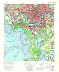
 1891 New Orleans1891 Print · USGSGreater New Orleans and the surrounding bayous are captured in the late Victorian era as the city's rail and canal networks expanded. Researchers can trace the development of riverfront communities like Gretna and Algiers or locate now-obscure landings such as Jesuit Bend and Amesville.5 unique versions available
 - 1932 Map of New Orleans NW
 1932 New Orleans NW1932 Print · USGSJefferson Parish is caught in a moment of rapid transformation in the early thirties as New Orleans expands westward. Researchers can trace the rise of early suburbs like Bonnabel Place, the construction of the Huey P Long Bridge, and the location of the historic Wedell Williams Airport.
 - 1932 Map of New Orleans SW
 1932 New Orleans SW1932 Print · USGSCoastal Louisiana marshes near the Jefferson and St. Charles Parish line are captured in the early thirties as dredging and canals reshaped the delta. Researchers can trace the original courses of Bayou Segnette and Bayou Couba near Woods Place.
 - 1938 Map of New Orleans West
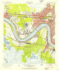
 1938 New Orleans West1938 Print · USGSJefferson Parish emerges as a vital transportation hub during the mid-thirties, dominated by the massive river bend and the rise of suburban Metairie. Genealogists and historians can trace the early footprints of Bonnabel Place and Kenner, or locate the historic Deckbar Sch and the U S Marine Hospital.3 unique versions available
 - 1942 Map of Lake Cataouatche East
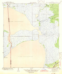 1942 Lake Cataouatche East1942 Print · USGSCoastal Jefferson and St. Charles Parishes are revealed in the early 1940s, documenting a landscape of expansive lakes and intricate bayous. Historians can trace early navigation routes through the Intracoastal Waterway and identify remote settlements like Bouquet des Chenes near Couba Island.
 - 1945 Map of New Orleans
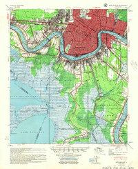
 1945 New Orleans1945 Print · USGSCoastal Louisiana and the Mississippi delta are captured here just after the war, showing the region's transition into a modern industrial and transit hub. Genealogists can trace family settlements along Bayou Teche or identify rail stops for the Illinois Central and Texas & Pacific lines.
 - 1950 Map of New Orleans, 1966 Print
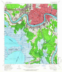 1950 New Orleans1966 Print · USGSMid-century New Orleans and its surrounding bayous are captured here at a peak of rail and river industry. Genealogists and historians can trace family roots through riverside settlements like McDonoghville and Arabi or locate landmarks like Olive Branch Cem and Rosethorn Sch.
 - 1951 Map of New Orleans West, 1953 Print
 1951 New Orleans West1953 Print · USGSMid-century Jefferson Parish is captured here at a peak of rail and aviation expansion along the Mississippi. Researchers can trace the early footprint of Moisant Airport and locate vanished local landmarks like Deckbar Sch and Pricetown.2 unique versions available
 - 1952 Map of Lake Cataouatche East, 1953 Print
 1952 Lake Cataouatche East1953 Print · USGSCoastal Louisiana marshes and vital waterways are captured here in the early fifties, showing the transition from natural bayous to industrial channels. Researchers can trace the development of the Bayou Couba Oil Field and old canal systems like Millaudon Canal.2 unique versions available
 - 1954 Map of New Orleans, 1955 Print
 1954 New Orleans1955 Print · USGSMid-century New Orleans and its surrounding parishes are shown here during a period of significant industrial and suburban expansion. Genealogists and researchers can locate neighborhood landmarks like Olive Branch Cem, early aviation hubs like Moisant Airport, and riverfront communities from McDonoghville to Bertrandville.
 - 1963 Map of New Orleans
 1963 New Orleans1963 Print · USGSCoastal Louisiana in the mid-twentieth century reveals a complex world of bayou settlements, expanding oil fields, and vital rail networks. Genealogists and historians can trace family roots through river towns like Thibodaux or follow the Southern Pacific line through Franklin and Patterson.4 unique versions available
 - 1965 Map of New Orleans West, 1966 Print
 1965 New Orleans West1966 Print · USGSThe Jefferson Parish suburbs and Mississippi West Bank are shown here during a period of intense mid-century growth. Genealogists and historians can trace the development of Bonnabel Place, identify family plots in Providence Memorial Park, and locate the old Westwego Airport.5 unique versions available
 - 1966 Map of New Orleans
 1966 New Orleans1966 Print · USGSCoastal Louisiana in the mid-1960s reveals a transition from traditional bayou life to an intensive offshore oil and gas economy. Researchers can trace the rail lines of the Southern Pacific RR through Morgan City or locate the Eugene Island Lighthouse among the delta's shifting marshes.
 - 1966 Map of Lake Cataouatche East, 1967 Print
 1966 Lake Cataouatche East1967 Print · USGSThe Louisiana wetlands south of New Orleans appear in transition during the mid-sixties as industrial oil fields expanded through the marsh. Trace the dredging of the Millaudon Canal and Estelle Canal or locate old sites like Woods Place.5 unique versions available
 - 1967 Map of New Orleans, 1969 Print
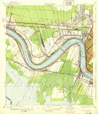
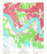
 1967 New Orleans1969 Print · USGSGreater New Orleans in the mid-1960s reveals a landscape of massive engineering and urban expansion along the Mississippi River. Genealogists and local historians can trace family roots through the grids of Metairie, Gretna, and Harvey, or locate specific sites like Metairie High Sch and St Vincent de Paul Cem.
 - 1983 Map of New Orleans
 1983 New Orleans1983 Print · USGSSoutheast Louisiana in the early eighties reveals a landscape where the urban density of New Orleans meets the vast wetlands of the Salvador State Wildlife Management Area. Genealogists and historians can trace the traditional bayou settlements of Houma and Thibodaux alongside major rail lines like the Southern Pacific.2 unique versions available
 - 1992 Map of New Orleans West
 1992 New Orleans West1992 Print · USGSGreater New Orleans is shown in high detail during the early nineties, centered on the river's sharp turns and industrial hubs. Genealogists and local historians can trace family roots through numerous parish schools and landmarks like Providence Memorial Park and the Huey P Long Bridge.2 unique versions available
 - 1998 Map of New Orleans West, 2000 Print
 1998 New Orleans West2000 Print · USGSJefferson Parish and the West Bank are shown in detail at the end of the millennium, as suburban growth met the industrial riverfront. Trace the intricate rail lines of the Illinois Central Gulf RR or locate family sites near Garden of Memories (Cem) and Lafreniere Park.
 - 2012 Map of Lake Cataouatche East, 2012 Print
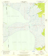
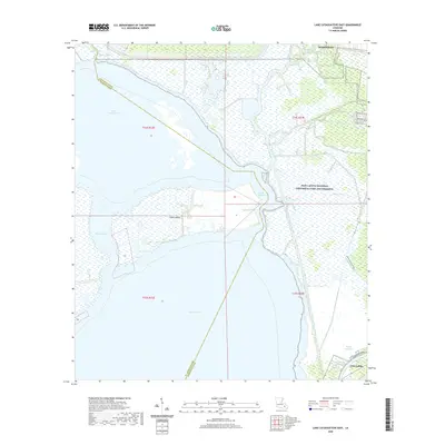
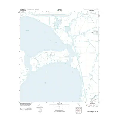 2012 Lake Cataouatche East2012 Print · USGSCovers Westwego, including Jean Lafitte, Jefferson Parish, and other nearby areas
 - 2012 Map of New Orleans West, 2012 Print
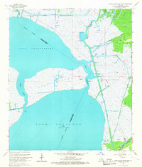
 2012 New Orleans West2012 Print · USGSCovers Westwego, including New Orleans, Metairie, and other nearby areas
 - 2015 Map of Lake Cataouatche East, 2015 Print
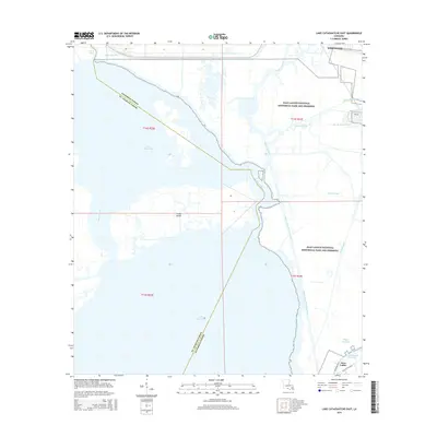 2015 Lake Cataouatche East2015 Print · USGSCovers Westwego, including Jean Lafitte, Jefferson Parish, and other nearby areas
 - 2015 Map of New Orleans West, 2015 Print
 2015 New Orleans West2015 Print · USGSCovers Westwego, including New Orleans, Metairie, and other nearby areas
 - 2018 Map of New Orleans West, 2018 Print
 2018 New Orleans West2018 Print · USGSCovers Westwego, including New Orleans, Metairie, and other nearby areas
 - 2018 Map of Lake Cataouatche East, 2018 Print
 2018 Lake Cataouatche East2018 Print · USGSCovers Westwego, including Jean Lafitte, Jefferson Parish, and other nearby areas
 - 2020 Map of Lake Cataouatche East, 2020 Print
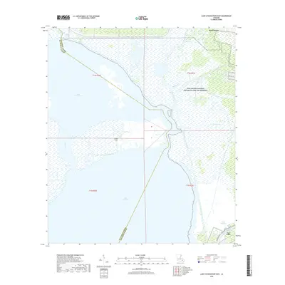
 2020 Lake Cataouatche East2020 Print · USGSCovers Westwego, including Jean Lafitte, Jefferson Parish, and other nearby areas
Showing maps 1-25 of 28
Top cities near Westwego
- New Orleans historical maps
- Metairie historical maps
- Kenner historical maps
- Algiers historical maps
- Chalmette historical maps
- Gretna historical maps
See more
Frequently asked questions
- What are the different types of historical maps available for Westwego?
- What is the oldest map of Westwego?
- Where can I purchase historical maps of Westwego for my home or office?
- Where can I download high-res historical maps of Westwego?
- Are there historical topographic maps available for Westwego?
- Is there historical aerial imagery available for Westwego?
- Where are historical maps of Westwego sourced from?