1980s Maps of Jena, Louisiana
Explore 3 historic maps of Jena from the 1980s. These maps offer a rare glimpse into what life looked like during the 1980s — showing old roads, neighborhoods, homes, and landmarks that have changed or disappeared over time.
Whether you're researching your family's past, planning a metal detecting trip, or studying how Jena's landscape evolved across the 1980s, these high-resolution maps are a powerful tool for exploring the history of this region.
- Focus on a specific era: All maps on this page are from the 1980s, giving you a focused view of this time period.
- See what’s changed: Compare century-old streets, trails, and buildings to today's modern landscape using overlays and satellite layers.
- Research with precision: Use these maps for genealogy, historical research, land use analysis, or educational projects.
- View, download, or print: Maps are fully viewable online in high resolution, and can be downloaded or printed for your own records.
Start exploring Jena's history through authentic maps from the 1980s. This is your window into the past.
Jena, LA maps
(3)- 1985 Map of Jena West
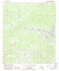 1985 Jena West1985 Print · USGSLaSalle Parish timber country comes into focus in the 1980s, centered on the western expansion of Jena. Genealogists and historians can trace old homesteads and the path of an Abandoned Railroad connecting Trout, Good Pine, and Webb Quarters.
 - 1985 Map of Jena East
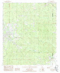 1985 Jena East1985 Print · USGSCentral Louisiana in the mid-1980s reveals a landscape defined by the drainage of Flat Creek and the growth of Jena. Genealogists and researchers can trace local landmarks like Blade, Rhinehart, and a prominent Gravel Pit near the parish line.
 - 1986 Map of Winnfield
 1986 Winnfield1986 Print · USGSCentral Louisiana in the mid-1980s was a landscape of timber towns and rail junctions woven through the Kisatchie National Forest. Researchers can trace the legacy of the lumber and rail eras through settlements like Good Pine, Packton, and Zenoria.2 unique versions available
End of results
Showing maps 1-3 of 3
Top cities near Jena
Frequently asked questions
- What are the different types of historical maps available for Jena?
- What is the oldest map of Jena?
- Where can I purchase historical maps of Jena for my home or office?
- Where can I download high-res historical maps of Jena?
- Are there historical topographic maps available for Jena?
- Is there historical aerial imagery available for Jena?
- Where are historical maps of Jena sourced from?