1980s Maps of Olla, Louisiana
Explore 4 historic maps of Olla from the 1980s. These maps offer a rare glimpse into what life looked like during the 1980s — showing old roads, neighborhoods, homes, and landmarks that have changed or disappeared over time.
Whether you're researching your family's past, planning a metal detecting trip, or studying how Olla's landscape evolved across the 1980s, these high-resolution maps are a powerful tool for exploring the history of this region.
- Focus on a specific era: All maps on this page are from the 1980s, giving you a focused view of this time period.
- See what’s changed: Compare century-old streets, trails, and buildings to today's modern landscape using overlays and satellite layers.
- Research with precision: Use these maps for genealogy, historical research, land use analysis, or educational projects.
- View, download, or print: Maps are fully viewable online in high resolution, and can be downloaded or printed for your own records.
Start exploring Olla's history through authentic maps from the 1980s. This is your window into the past.
Olla, LA maps
(4)- 1984 Map of Summerville, 1985 Print
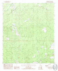 1984 Summerville1985 Print · USGSLaSalle Parish in the early 1980s reveals a landscape defined by the timbered basin of Funny Louis Bayou and active petroleum extraction. Researchers can trace the layout of small communities like Summerville and Franklin alongside a sprawling OIL AND GAS FIELD.
 - 1984 Map of Olla West, 1985 Print
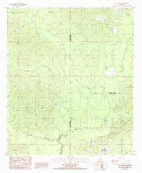 1984 Olla West1985 Print · USGSThe rural timberlands of Winn and La Salle parishes are captured in the mid-1980s just as these backcountry landscapes were being precisely surveyed. Researchers can trace the winding paths of Castor Creek, Yellow Jacket Creek, and the upland area of Richland.
 - 1984 Map of Olla East, 1985 Print
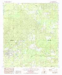 1984 Olla East1985 Print · USGSNorth central Louisiana during the 1980s shows a landscape still defined by its rail heritage and timbered creeks. Researchers can trace the Missouri Pacific line through Standard and Kelly, or locate landmarks like the Olla Airport and Lookout Tower.
 - 1986 Map of Winnfield
 1986 Winnfield1986 Print · USGSCentral Louisiana in the mid-1980s was a landscape of timber towns and rail junctions woven through the Kisatchie National Forest. Researchers can trace the legacy of the lumber and rail eras through settlements like Good Pine, Packton, and Zenoria.2 unique versions available
End of results
Showing maps 1-4 of 4
Top cities near Olla
- Jena historical maps
- Clarks historical maps
- Urania historical maps
- Grayson historical maps
- Columbia historical maps
- Tullos historical maps
See more
Frequently asked questions
- What are the different types of historical maps available for Olla?
- What is the oldest map of Olla?
- Where can I purchase historical maps of Olla for my home or office?
- Where can I download high-res historical maps of Olla?
- Are there historical topographic maps available for Olla?
- Is there historical aerial imagery available for Olla?
- Where are historical maps of Olla sourced from?