Old Maps of Kile, Louisiana for Genealogy
Trace your family roots with 13 historic maps of Kile. These high-res maps reveal old neighborhoods, homesites, landmarks, and streets — helping you uncover where your ancestors lived and how the area evolved over time.
- Explore historic neighborhoods: Identify where your relatives may have lived in the 1800s or 1900s.
- Compare maps over time: Trace the changes in streets, buildings, and landmarks for multi-generational research.
- Perfect for genealogy & ancestry research: Used by family historians and researchers to map out lineage and migration.
These maps are an incredible resource for exploring your personal connection to Kile's past.
Kile, LA maps
(13)- 1942 Map of Kisatchie
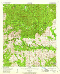
 1942 Kisatchie1942 Print · USGSThe timberlands of Natchitoches and Vernon Parishes are captured here in the early 1940s, showing the dense network of company towns and rail lines. Genealogists and researchers can locate timber settlements like Alco, Kurthwood, and Hutton, plus the CCC Camp and Silver Creek Church.
 - 1943 Map of Kisatchie
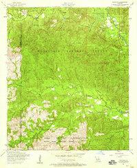
 1943 Kisatchie1943 Print · USGSDuring the early 1940s, this portion of Natchitoches Parish was a hive of timber activity centered around the Red River and Gulf Railroad. Researchers can trace old industry sites like Kurthwood and Alco or locate family sites at Robinson Cem and Kisatchie Union Ch.
 - 1953 Map of Alexandria, 1963 Print
 1953 Alexandria1963 Print · USGSCentral Louisiana during the early fifties is mapped here at the intersection of the piney woods and the Red River valley. Genealogists and historians can trace the rail-and-river network connecting towns like Alexandria, Natchitoches, and the grounds of Camp Beauregard.3 unique versions available
 - 1954 Map of Kisatchie, 1958 Print
 1954 Kisatchie1958 Print · USGSNatchitoches and Vernon Parishes come alive in this mid-century survey of timberlands and military training grounds. Genealogists can trace family names at the Billy Dowden Cem and West Cem, or locate lost homes near Kurthwood and the dismantled railroad.3 unique versions available
 - 1954 Map of Kisatchie, 1958 Print
 1954 Kisatchie1958 Print · USGSThe pine woods of Natchitoches Parish met military expansion in the mid-1950s as the national forest bordered the rising artillery ranges. Genealogists can locate several family burial sites including the Booty Cemetery and Billy Dowden Cemetery along Kisatchie Bayou.3 unique versions available
 - 1955 Map of Alexandria
 1955 Alexandria1955 Print · USGSCentral Louisiana in the mid-fifties is a landscape of river-port cities, sprawling timberlands, and massive military reservations. Genealogists and historians can trace the rail networks of the Texas & Pacific RR and locate sites like Camp Polk Military Reservation and Natchitoches.
 - 1986 Map of Leesville, 1988 Print
 1986 Leesville1988 Print · USGSThe Louisiana-Texas borderlands in the mid-eighties centered on the vast Toledo Bend Reservoir and the timber-rich piney woods. Researchers can trace the Kansas City Southern RR corridor or locate old communities like Wiergate, Rosevine, and Sandel.
 - 2003 Map of Kisatchie, 2005 Print
 2003 Kisatchie2005 Print · USGSCentral Louisiana’s pine forests and military training grounds are documented here at the turn of the millennium. Genealogists can trace family heritage through isolated sites like Old Bellwood Cem, Polly Mack Cem, and the settlement of Lotus.
 - 2012 Map of Kisatchie, 2012 Print
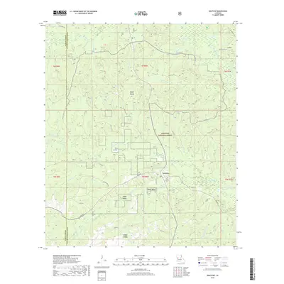
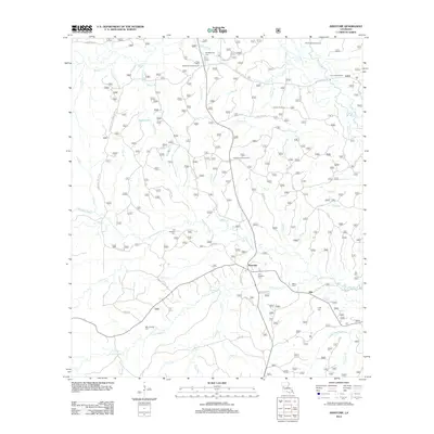 2012 Kisatchie2012 Print · USGSCovers Kile, including Kisatchie, Lotus, and other nearby areas
 - 2015 Map of Kisatchie, 2015 Print
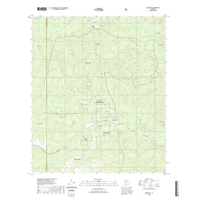
 2015 Kisatchie2015 Print · USGSCovers Kile, including Kisatchie, Lotus, and other nearby areas
 - 2018 Map of Kisatchie, 2018 Print
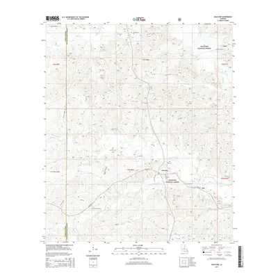
 2018 Kisatchie2018 Print · USGSCovers Kile, including Kisatchie, Lotus, and other nearby areas
 - 2020 Map of Kisatchie, 2020 Print
 2020 Kisatchie2020 Print · USGSCovers Kile, including Kisatchie, Lotus, and other nearby areas
 - 2024 Map of Kisatchie, 2024 Print
 2024 Kisatchie2024 Print · USGSNatchitoches Parish's forested uplands are documented here in the early twenty-first century, showing the intersection of military training grounds and long-standing rural communities. Genealogists can trace family sites at Old Kisatchie Cem and Booty Cem or locate the landmark Kisatchie Fall.
End of results
Showing maps 1-13 of 13
Top cities near Kile
Frequently asked questions
- What are the different types of historical maps available for Kile?
- What is the oldest map of Kile?
- Where can I purchase historical maps of Kile for my home or office?
- Where can I download high-res historical maps of Kile?
- Are there historical topographic maps available for Kile?
- Is there historical aerial imagery available for Kile?
- Where are historical maps of Kile sourced from?