Old Maps of Pike Fort, New Orleans
Explore 22 old maps of Pike Fort, spanning from 1893 to today. These high-resolution historic maps reveal how streets, neighborhoods, landmarks, and natural features evolved over time — perfect for genealogy, metal detecting, research, and local history exploration.
What you can do with these maps:
- See how Pike Fort changed over time: Compare historical maps to modern-day views to trace roads, homesites, rail lines & more.
- View detailed metadata: Each map includes creators, publishers, year, scale, and archive source.
- Overlay maps with satellite & LiDAR: Visualize the past alongside modern tools to explore terrain & human change.
- Trusted historical sources: Maps sourced from the USGS, Library of Congress, and other archives.
- Access maps your way: View online, download high-res files, or order prints for personal or research use.
Start exploring old maps of Pike Fort to uncover forgotten places, hidden landmarks, and the deep history beneath your feet.
Pike Fort, New Orleans maps
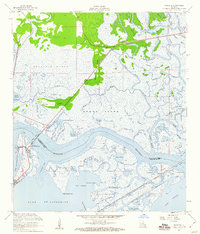
(22)- 1893 Map of Rigolets
 1893 Rigolets1893 Print · USGSCoastal Louisiana and Mississippi meet at the turn of the century along a labyrinth of marshlands and railroad trestles. Researchers can trace the early path of the Louisville and Nashville Railroad past Ft. Pike and through the Little Lake region.5 unique versions available
 - 1936 Map of Rigolets, 1949 Print
 1936 Rigolets1949 Print · USGSCoastal Louisiana and Mississippi meet in the mid-1930s where the Pearl River delta fragments into a maze of islands and bayous. Researchers can trace the early path of Highway No 90, the defenses at Fort Pike, and settlements like Pearlington or Baldwin Lodge.
 - 1946 Map of Rigolets
 1946 Rigolets1946 Print · USGSCoastal St. Tammany Parish at the end of the Second World War was a labyrinth of tidal passes and marsh ridges. Genealogists and historians can trace the strategic layout of Ft Pike, the small settlement at Rigolets, and the remote W Rigolets L H light station.
 - 1953 Map of Mobile, 1968 Print
 1953 Mobile1968 Print · USGSThe Gulf Coast comes alive in this mid-century survey, from the streets of Mobile to the marshes of New Orleans. Trace family roots in coastal towns like Pass Christian and Bayou La Batre or locate military landmarks including Keesler AFB.3 unique versions available
 - 1954 Map of Rigolets
 1954 Rigolets1954 Print · USGSCoastal Louisiana at the mid-century is defined by the critical deep-water passes between the great lakes and the Gulf. Genealogists and historians can trace the path of the Louisville and Nashville RR past Ft Pike and the remote outpost of Desert Id.
 - 1956 Map of Rigolets, 1960 Print
 1956 Rigolets1960 Print · USGSCoastal Louisiana at the height of the mid-century maritime era reveals a landscape of tidal passes and strategic rail corridors. Trace the path of the Louisville and Nashville railroad past Fort Pike State Monument and the historic Townes Mill Pond.2 unique versions available
 - 1956 Map of Rigolets, 1966 Print
 1956 Rigolets1966 Print · USGSThe coastal marshes of the Louisiana-Mississippi border come alive in this mid-century survey of the Pearl River delta. Researchers can trace the path of the L & N RR through Pearlington and locate the historic defenses at Fort Pike.
 - 1957 Map of Mobile
 1957 Mobile1957 Print · USGSThe Gulf Coast in the mid-1950s reveals a bustling corridor of rail-and-river commerce connecting Alabama to Louisiana. Genealogists and historians can trace old settlements and military hubs from Keesler Afb to the coastal reaches of Ship Island and Bogalusa.3 unique versions available
 - 1960 Map of Mobile
 1960 Mobile1960 Print · USGSThe Gulf Coast at the dawn of the sixties shows a landscape of busy ports, military airbases, and barrier islands. Trace the rail lines of the Louisville & Nashville through BILOXI and Pascagoula or find family history in towns like Bayou La Batre and Poplarville.
 - 1963 Map of Mobile
 1963 Mobile1963 Print · USGSThe Gulf Coast at the dawn of the sixties shows a thriving maritime and military corridor from Louisiana to Alabama. Genealogists and historians can trace rail lines like the Louisville & Nashville RR and find landmarks from Brookley AFB to Fort Morgan.
 - 1965 Map of Mobile
 1965 Mobile1965 Print · USGSThe Gulf Coast at mid-century reveals a landscape of expanding ports and vital military installations from Louisiana to Alabama. Genealogists and historians can trace the growth of Biloxi, Pascagoula, and Mobile, alongside the sprawling De Soto National Forest.
 - 1968 Map of Rigolets, 1969 Print
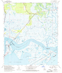 1968 Rigolets1969 Print · USGSThe Louisiana coast at the edge of the Rigolets shows a complex world of tidal passes and marsh islands in the late sixties. Trace the historic Fort Pike State Monument, the path of the Louisville and Nashville railroad, and landmarks like White Kitchen.4 unique versions available
 - 1969 Map of Rigolets, 1970 Print
 1969 Rigolets1970 Print · USGSThe Louisiana coast meets the Mississippi line in the late sixties, showing a landscape of tidal passes and railroad outposts. Researchers can trace the tracks of the Louisville and Nashville Railroad past English Lookout or locate the historic Port Pike State Monument.
 - 1982 Map of Gulfport, 1983 Print
 1982 Gulfport1983 Print · USGSThe Gulf Coast between Louisiana and Mississippi appears in the early eighties as a landscape of marshland and maritime industry. Researchers can trace the path of the Louisville and Nashville RR through towns like Waveland and De Lisle, or locate the sprawling National Space Technology Laboratories.2 unique versions available
 - 1984 Map of Mobile
 1984 Mobile1984 Print · USGSThe Gulf Coast at the height of the mid-eighties shows a landscape of rapid industrial growth and military significance. Researchers can trace the sprawling rail lines of the Illinois Central Gulf RR, locate the NASA Test Facility, or study the barrier island chain from Cat Island to Petit Bois Island.3 unique versions available
 - 1993 Map of Rigolets, 1995 Print
 1993 Rigolets1995 Print · USGSThe Louisiana coast near the Pearl River mouth comes to life in the early 1990s, where the deep-water passes of The Rigolets meet the marsh. Historians can trace the grounds of Fort Pike, locate the McKean Cem, and explore the maze of the Pearl River State Wildlife Management Area.
 - 1998 Map of Rigolets, 2002 Print
 1998 Rigolets2002 Print · USGSCoastal St. Tammany Parish at the close of the century is a complex network of bayous, islands, and historical defenses. You can trace the footprint of Fort Pike State Historic Site, locate White Kitchen, and explore the marshes of Weems Island.
 - 2012 Map of Rigolets, 2012 Print
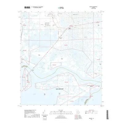
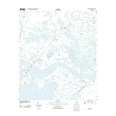 2012 Rigolets2012 Print · USGSCovers Pike Fort, including New Orleans, Avery Estates, and other nearby areas
 - 2015 Map of Rigolets, 2015 Print
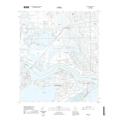
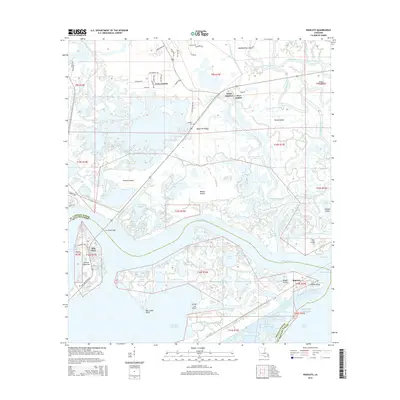 2015 Rigolets2015 Print · USGSCovers Pike Fort, including New Orleans, Avery Estates, and other nearby areas
 - 2018 Map of Rigolets, 2018 Print
 2018 Rigolets2018 Print · USGSCovers Pike Fort, including New Orleans, Avery Estates, and other nearby areas
 - 2020 Map of Rigolets, 2020 Print
 2020 Rigolets2020 Print · USGSCovers Pike Fort, including New Orleans, Avery Estates, and other nearby areas
 - 2024 Map of Rigolets, 2024 Print
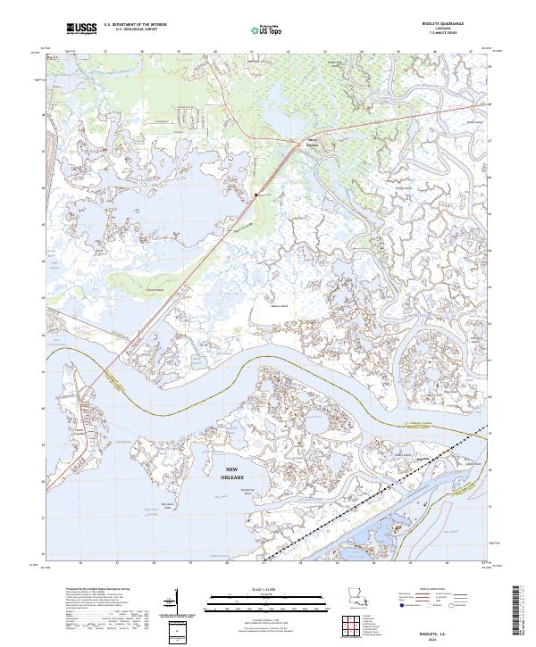 2024 Rigolets2024 Print · USGSSt. Tammany and Orleans Parishes appear here in their modern coastal character, defined by the meeting of the Pearl River delta and Lake Pontchartrain. Researchers can trace the legacy of early settlements and fortifications at Fort Pike, White Kitchen, and the McKean Cem.
End of results
Showing maps 1-22 of 22
Top cities near Pike Fort
- New Orleans historical maps
- Slidell historical maps
- Chalmette historical maps
- Pearlington historical maps
Frequently asked questions
- What are the different types of historical maps available for Pike Fort?
- What is the oldest map of Pike Fort?
- Where can I purchase historical maps of Pike Fort for my home or office?
- Where can I download high-res historical maps of Pike Fort?
- Are there historical topographic maps available for Pike Fort?
- Is there historical aerial imagery available for Pike Fort?
- Where are historical maps of Pike Fort sourced from?