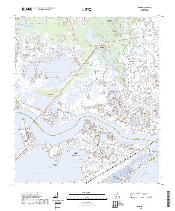
2024 Map of Rigolets
USGS Topo · Published 2024About this map
The salt marshes and intricate bayous of St. Tammany and Orleans Parishes dominate this landscape, where the West Pearl River and its numerous distributaries meet the open waters of Lake Pontchartrain and Lake Saint Catherine. The coastal settlement of Rigolets sits at a critical hydrologic junction, while historic sites like Fort Pike and the Petites Coquilles shell middens highlight the long human presence in this amphibious environment.
Find a feature on this map
92 named features on this map. Tap any name to fly to it.
Don’t see what you’re looking for? This feature index may not catch every label — zoom into the map to look around manually.
Map Details
Editions of this 2024 Rigolets Map
This is the sole edition of this map. No revisions or reprints were ever made.
Other maps of this area

1892 · Chef Menteur
USGS Topo · 1:62,500

1893 · Rigolets
USGS Topo · 1:62,500

1914 · Nicholson
USGS Topo · 1:62,500

1921 · Nicholson
USGS Topo · 1:62,500

1935 · Slidell
USGS Topo · 1:62,500

1935 · English Lookout
USGS Topo · 1:31,680

1936 · North Shore
USGS Topo · 1:31,680

1936 · Chef Menteur
USGS Topo · 1:62,500

1936 · Rigolets
USGS Topo · 1:62,500

1937 · Chef Menteur
USGS Topo · 1:31,680