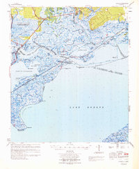
1969 Map of Rigolets
USGS Topo · Published 1970About this map
English Lookout and Pearlington sit at the northern edge of this coastal landscape, where the Pearl River system breaks into a complex network of bayous and marshes. The 1969 survey captures the critical transition between the freshwater Fritchie Marsh and the saltwater expanse of Lake Borgne, a divide marked by the historic Louisville and Nashville Railroad and the Intracoastal Waterway. This area is defined by its strategic navigational position, evidenced by the numerous navigational aids such as the W. Rigolets Lt 1 and various range lights that guide vessels through The Rigolets pass.
Find a feature on this map
109 named features on this map. Tap any name to fly to it.
Don’t see what you’re looking for? This feature index may not catch every label — zoom into the map to look around manually.
Map Details
Editions of this 1969 Rigolets Map
This is the sole edition of this map. No revisions or reprints were ever made.
Other maps of this area

1892 · Chef Menteur
USGS Topo · 1:62,500

1892 · St. Bernard
USGS Topo · 1:62,500

1893 · Rigolets
USGS Topo · 1:62,500

1893 · Shell Beach
USGS Topo · 1:62,500

1893 · Toulme
USGS Topo · 1:62,500

1895 · Bodreau
USGS Topo · 1:62,500

1914 · Nicholson
USGS Topo · 1:62,500

1921 · Nicholson
USGS Topo · 1:62,500

1935 · Slidell
USGS Topo · 1:62,500

1935 · English Lookout
USGS Topo · 1:31,680