Old Maps of New Roads, Louisiana for Metal Detecting
Plan your next treasure hunt with 16 historic maps of New Roads. Find old homesites, ghost towns, trails, and gathering spots that may be lost to time — perfect for identifying promising metal detecting locations.
- Locate forgotten sites: Uncover places like long-lost settlements, abandoned rail lines, or gathering spots.
- Plan better hunts: Use map overlays combined with LiDAR or satellite views to narrow in on historically rich areas.
- Made for detectorists: Thousands of hobbyists use these maps to discover relics, coins, and hidden history.
Use these historic maps to boost your research and find new opportunities beneath the surface of New Roads.
New Roads, LA maps
(16)- 1906 Map of Bayou Sara
 1906 Bayou Sara1906 Print · USGSThe Feliciana parishes and the Mississippi River bottomlands come to life in this early twentieth-century survey. Genealogists can trace family footprints through river-town settlements like St Francisville or find early rail stops such as Gayden Sta (Gurley P.O.) and Slaughter.3 unique versions available
 - 1953 Map of New Roads, 1954 Print
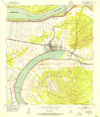 1953 New Roads1954 Print · USGSPointe Coupee Parish in the early fifties shows a landscape shaped by the massive curves of the False River and the active Mississippi River. Genealogists and local historians can trace family locations near NEW ROADS, St Catherine Chapel, and schools like Rosenwald Sch.
 - 1954 Map of Baton Rouge, 1974 Print
 1954 Baton Rouge1974 Print · USGSSoutheast Louisiana in the mid-fifties is captured here during a period of transition for its river and rail economies. Researchers can trace the path of the Mississippi River and find landmarks like the Bonnet Carre Spillway and Bayou Plaquemine.2 unique versions available
 - 1956 Map of Baton Rouge
 1956 Baton Rouge1956 Print · USGSSouth Louisiana at the height of the mid-century oil boom shows a landscape of river oxbows and rising industry. Researchers can trace family roots through river towns like Scotlandville or locate early industrial sites and Oil wells near Lake Maurepas.
 - 1961 Map of Baton Rouge, 1966 Print
 1961 Baton Rouge1966 Print · USGSSoutheastern Louisiana in the early sixties remains a landscape of deep river bends and sprawling coastal lakes. Genealogists and historians can trace the rail-and-river economy through landmarks like Free-Nigger Point, Donaldsonville, and the Illinois Central Railroad.
 - 1962 Map of Baton Rouge
 1962 Baton Rouge1962 Print · USGSSouth Louisiana in the early sixties reveals a landscape of river-bend parishes and emerging interstate corridors. Genealogists and historians can trace family roots through historic river towns like Donaldsonville and Plaquemine, or follow the path of the Illinois Central Railroad through the swamp basins.
 - 1962 Map of New Roads, 1964 Print
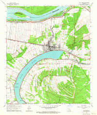 1962 New Roads1964 Print · USGSPointe Coupee Parish in the early sixties is shown here as a landscape shaped by the oxbow of the False River. Genealogists and historians can trace long-lot land patterns near New Roads and locate family landmarks like Parlange and St Catherine Chapel.4 unique versions available
 - 1963 Map of New Roads, 1967 Print
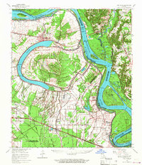 1963 New Roads1967 Print · USGSThe oxbows and river bends of Pointe Coupee and West Baton Rouge Parishes come to life in this mid-sixties survey. Researchers can trace family roots through numerous sites like Torbert P O, St Alma Sch, and the Port Hudson National Cem.2 unique versions available
 - 1965 Map of New Roads
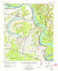 1965 New Roads1965 Print · USGSThe oxbow of False River and the Mississippi's ever-changing course dominate this mid-century survey of Pointe Coupee Parish. Genealogists and historians can trace the family names and rural hamlets of the plantation era, including New Roads, Port Hudson National Cem, and the St Ambrose Cem.
 - 1983 Map of New Roads
 1983 New Roads1983 Print · USGSThe river parishes of central Louisiana are documented in the early 1980s, showcasing the winding courses of the Atchafalaya and Mississippi. Genealogists and historians can trace rail-served river towns like Melville and Simmesport, or locate the Port Hudson National Cem and the State Penitentiary.2 unique versions available
 - 1996 Map of New Roads, 1999 Print
 1996 New Roads1999 Print · USGSPointe Coupee Parish in the mid-1990s shows a landscape shaped by the oxbow of the False River. Genealogists and historians can trace long-standing family land patterns in Jarreau and Parlange or locate landmarks like Zion Traveler Ch and Fairlane Cem.
 - 2012 Map of New Roads, 2012 Print
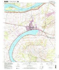
 2012 New Roads2012 Print · USGSCovers New Roads, including Patin, Brooks, and other nearby areas
 - 2015 Map of New Roads, 2015 Print
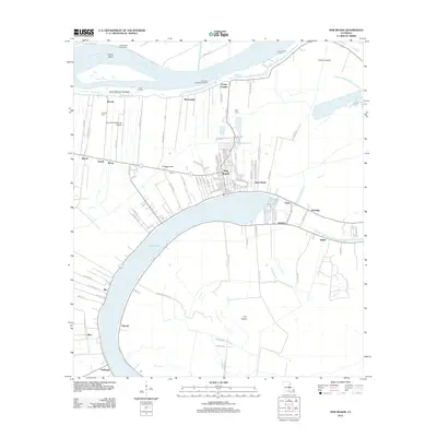
 2015 New Roads2015 Print · USGSCovers New Roads, including Patin, Brooks, and other nearby areas
 - 2018 Map of New Roads, 2018 Print
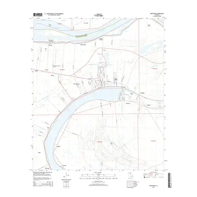
 2018 New Roads2018 Print · USGSCovers New Roads, including Patin, Brooks, and other nearby areas
 - 2020 Map of New Roads, 2020 Print
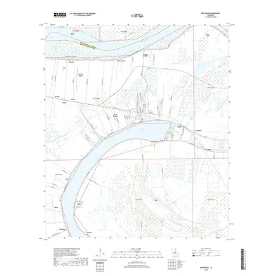
 2020 New Roads2020 Print · USGSCovers New Roads, including Patin, Brooks, and other nearby areas
 - 2024 Map of New Roads, 2024 Print
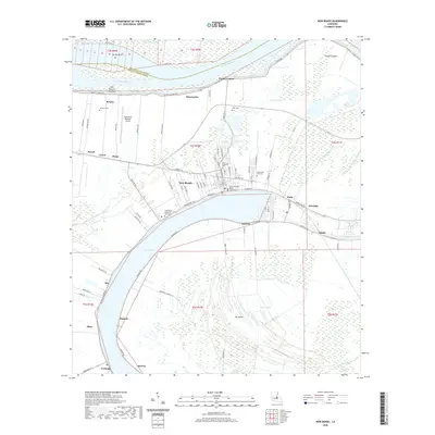
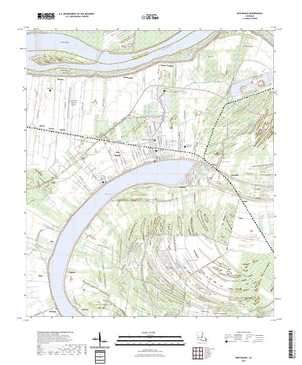 2024 New Roads2024 Print · USGSPointe Coupee Parish comes into sharp focus in this recent survey of the lands surrounding the False River oxbow. Family historians can trace local roots through numerous sites like Zion Cem, Parlange, and the Pointe Coupee Parish Courthouse.
End of results
Showing maps 1-16 of 16
Top cities near New Roads
- Baton Rouge historical maps
- Zachary historical maps
- Jackson historical maps
- Saint Francisville historical maps
- St. Francisville historical maps
- Livonia historical maps
See more
Top neighborhoods of New Roads
Frequently asked questions
- What are the different types of historical maps available for New Roads?
- What is the oldest map of New Roads?
- Where can I purchase historical maps of New Roads for my home or office?
- Where can I download high-res historical maps of New Roads?
- Are there historical topographic maps available for New Roads?
- Is there historical aerial imagery available for New Roads?
- Where are historical maps of New Roads sourced from?