1900s (20th Century) Maps of Campbell, Louisiana
Explore 8 historic maps of Campbell from the 1900s (20th Century). These maps offer a rare glimpse into what life looked like during the 1900s — showing old roads, neighborhoods, homes, and landmarks that have changed or disappeared over time.
Whether you're researching your family's past, planning a metal detecting trip, or studying how Campbell's landscape evolved across the 1900s, these high-resolution maps are a powerful tool for exploring the history of this region.
- Focus on a specific era: All maps on this page are from the 1900s, giving you a focused view of this time period.
- See what’s changed: Compare century-old streets, trails, and buildings to today's modern landscape using overlays and satellite layers.
- Research with precision: Use these maps for genealogy, historical research, land use analysis, or educational projects.
- View, download, or print: Maps are fully viewable online in high resolution, and can be downloaded or printed for your own records.
Start exploring Campbell's history through authentic maps from the 1900s. This is your window into the past.
Campbell, LA maps
(8)- 1937 Map of Chopin NE
 1937 Chopin NE1937 Print · USGSThe borderlands of Natchitoches and Rapides Parishes come into focus in the late 1930s, showing a rural landscape defined by the Cane River and the Texas and Pacific railroad. Researchers can trace the exact locations of family landmarks like Carnahan Cem, Galbraith Sch, and the community of Flatwoods.
 - 1944 Map of Chopin
 1944 Chopin1944 Print · USGSCentral Louisiana during the early 1940s shows a landscape defined by timber harvesting and the winding Red River. Local historians can trace logging tracks and old community centers like Zimmerman Camp, Mora Ch, and Galbraith Sta.
 - 1948 Map of Chopin, 1956 Print
 1948 Chopin1956 Print · USGSLouisiana's timber and rail history comes to life in this mid-century survey of the rural backcountry spanning Natchitoches and Rapides Parishes. Researchers can trace the legacy of small communities and family-named sites like Galbraith Sta, Temple Spur, and the Blackwell Cem.
 - 1953 Map of Alexandria, 1963 Print
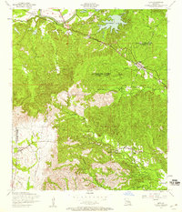
 1953 Alexandria1963 Print · USGSCentral Louisiana during the early fifties is mapped here at the intersection of the piney woods and the Red River valley. Genealogists and historians can trace the rail-and-river network connecting towns like Alexandria, Natchitoches, and the grounds of Camp Beauregard.3 unique versions available
 - 1954 Map of Lena, 1959 Print
 1954 Lena1959 Print · USGSCentral Louisiana in the mid-fifties reveals a landscape of parish border settlements and river-valley transport along the Cane River. Researchers can locate family landmarks like Bay Spring Cemetery and Wise Memorial Chapel or trace the Texas and Pacific rail line through Galbraith Station.3 unique versions available
 - 1954 Map of Chopin, 1959 Print
 1954 Chopin1959 Print · USGSCentral Louisiana in the mid-fifties shows a landscape defined by timber and the Cane River valley. Genealogists and historians can trace numerous remote cemeteries and churches, such as Gorum Cem, Holy Family Church, and the logging community at Zimmerman Camp.2 unique versions available
 - 1955 Map of Alexandria
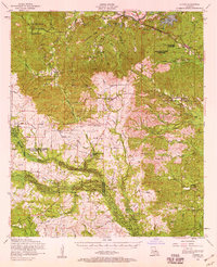
 1955 Alexandria1955 Print · USGSCentral Louisiana in the mid-fifties is a landscape of river-port cities, sprawling timberlands, and massive military reservations. Genealogists and historians can trace the rail networks of the Texas & Pacific RR and locate sites like Camp Polk Military Reservation and Natchitoches.
 - 1986 Map of Alexandria
 1986 Alexandria1986 Print · USGSCentral Louisiana in the mid-eighties shows a landscape of strategic military installations and deep river-valley agriculture. Researchers can trace the footprints of England Air Force Base, Camp Beauregard, and the extensive Kisatchie National Forest.2 unique versions available
End of results
Showing maps 1-8 of 8
Top cities near Campbell
Frequently asked questions
- What are the different types of historical maps available for Campbell?
- What is the oldest map of Campbell?
- Where can I purchase historical maps of Campbell for my home or office?
- Where can I download high-res historical maps of Campbell?
- Are there historical topographic maps available for Campbell?
- Is there historical aerial imagery available for Campbell?
- Where are historical maps of Campbell sourced from?