Old Maps of Big Branch, Louisiana for Hiking & Exploration
Hike through history with 17 historic maps of Big Branch. Explore old trails, ghost towns, and forgotten backroads — perfect for outdoor adventurers and local explorers.
- Rediscover forgotten places: Map out old mining camps, roads, and footpaths that no longer exist on modern maps.
- Layer with modern tools: Combine with LiDAR or satellite views to plan hikes through historical terrain.
- Made for exploration: Popular among hikers, overlanders, and local history lovers.
Use these maps to find adventure and explore the hidden past of Big Branch.
Big Branch, LA maps
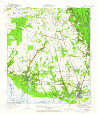
(17)- 1935 Map of Slidell
 1935 Slidell1935 Print · USGSCoastal Louisiana in the mid-thirties reveals a landscape of growing rail towns and bayou settlements tied to the Gulf and the Pearl River systems. Genealogists and local historians can trace family roots through the Welch Cem, the Peace Grove Sch, and vanished hubs like McClure City.3 unique versions available
 - 1939 Map of Slidell
 1939 Slidell1939 Print · USGSSt. Tammany Parish in the late thirties is a landscape of thriving bayou communities and expanding rail corridors near the lakefront. Genealogists can trace family landmarks like Crawford Cem, McClane City, and the Edgar Doucette Sch.
 - 1950 Map of Slidell, 1962 Print
 1950 Slidell1962 Print · USGSThe Northshore of Lake Pontchartrain comes into focus at mid-century, showing the growing rail hubs and marshland settlements. Genealogists can trace family footprints at Forest Glen School, the Parker Cemetery, and rural outposts like Hickory or Florenville.2 unique versions available
 - 1953 Map of Mobile, 1968 Print
 1953 Mobile1968 Print · USGSThe Gulf Coast comes alive in this mid-century survey, from the streets of Mobile to the marshes of New Orleans. Trace family roots in coastal towns like Pass Christian and Bayou La Batre or locate military landmarks including Keesler AFB.3 unique versions available
 - 1957 Map of Mobile
 1957 Mobile1957 Print · USGSThe Gulf Coast in the mid-1950s reveals a bustling corridor of rail-and-river commerce connecting Alabama to Louisiana. Genealogists and historians can trace old settlements and military hubs from Keesler Afb to the coastal reaches of Ship Island and Bogalusa.3 unique versions available
 - 1960 Map of Mobile
 1960 Mobile1960 Print · USGSThe Gulf Coast at the dawn of the sixties shows a landscape of busy ports, military airbases, and barrier islands. Trace the rail lines of the Louisville & Nashville through BILOXI and Pascagoula or find family history in towns like Bayou La Batre and Poplarville.
 - 1963 Map of Mobile
 1963 Mobile1963 Print · USGSThe Gulf Coast at the dawn of the sixties shows a thriving maritime and military corridor from Louisiana to Alabama. Genealogists and historians can trace rail lines like the Louisville & Nashville RR and find landmarks from Brookley AFB to Fort Morgan.
 - 1965 Map of Mobile
 1965 Mobile1965 Print · USGSThe Gulf Coast at mid-century reveals a landscape of expanding ports and vital military installations from Louisiana to Alabama. Genealogists and historians can trace the growth of Biloxi, Pascagoula, and Mobile, alongside the sprawling De Soto National Forest.
 - 1971 Map of Lacombe, 1972 Print
 1971 Lacombe1972 Print · USGSCoastal St. Tammany Parish is captured in the early seventies, showing the bayou communities as modern highways began to expand. Genealogists and historians can trace local landmarks like Lafere Cem, the Carmel Convent, and the Gulf Mobile and Ohio rail line.3 unique versions available
 - 1982 Map of Gulfport, 1983 Print
 1982 Gulfport1983 Print · USGSThe Gulf Coast between Louisiana and Mississippi appears in the early eighties as a landscape of marshland and maritime industry. Researchers can trace the path of the Louisville and Nashville RR through towns like Waveland and De Lisle, or locate the sprawling National Space Technology Laboratories.2 unique versions available
 - 1984 Map of Mobile
 1984 Mobile1984 Print · USGSThe Gulf Coast at the height of the mid-eighties shows a landscape of rapid industrial growth and military significance. Researchers can trace the sprawling rail lines of the Illinois Central Gulf RR, locate the NASA Test Facility, or study the barrier island chain from Cat Island to Petit Bois Island.3 unique versions available
 - 1998 Map of Lacombe, 2001 Print
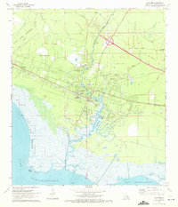
 1998 Lacombe2001 Print · USGSSt. Tammany Parish at the close of the century shows a blend of coastal marsh and growing inland settlements near the lake. Genealogists and historians can trace family sites like Cousin Cem and Williams Cem or locate the Seaplane Base along the shore.
 - 2012 Map of Lacombe, 2012 Print
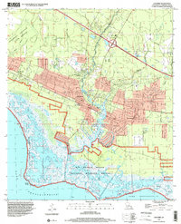
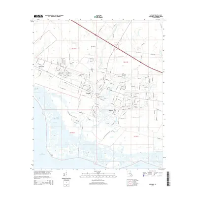
 2012 Lacombe2012 Print · USGSCovers Big Branch, including Lacombe, St. Tammany Parish, and other nearby areas
 - 2015 Map of Lacombe, 2015 Print
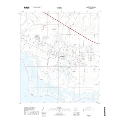
 2015 Lacombe2015 Print · USGSCovers Big Branch, including Lacombe, St. Tammany Parish, and other nearby areas
 - 2018 Map of Lacombe, 2018 Print
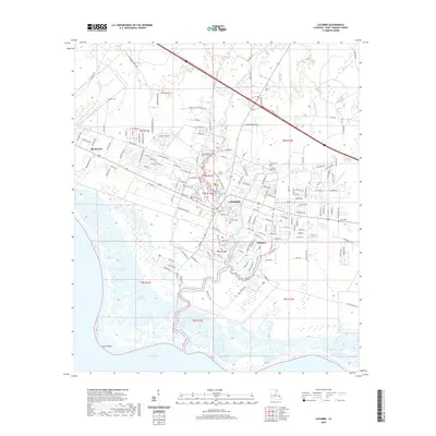
 2018 Lacombe2018 Print · USGSCovers Big Branch, including Lacombe, St. Tammany Parish, and other nearby areas
 - 2020 Map of Lacombe, 2020 Print
 2020 Lacombe2020 Print · USGSCovers Big Branch, including Lacombe, St. Tammany Parish, and other nearby areas
 - 2024 Map of Lacombe, 2024 Print
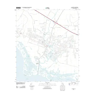
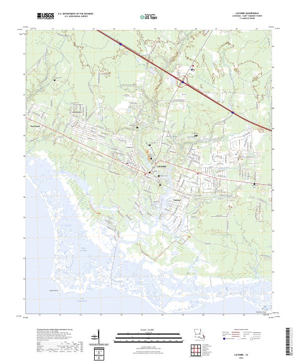 2024 Lacombe2024 Print · USGSSt. Tammany Parish's coastal wetlands meet the growing communities of Lacombe and Oaklawn in this modern survey. Genealogists and local historians can trace family landmarks and burial sites such as Lafontaine Cem, Cousin Cem, and James Todd Cem.
End of results
Showing maps 1-17 of 17
Top cities near Big Branch
- New Orleans historical maps
- Slidell historical maps
- Mandeville historical maps
- Covington historical maps
- Abita Springs historical maps
- Madisonville historical maps
Frequently asked questions
- What are the different types of historical maps available for Big Branch?
- What is the oldest map of Big Branch?
- Where can I purchase historical maps of Big Branch for my home or office?
- Where can I download high-res historical maps of Big Branch?
- Are there historical topographic maps available for Big Branch?
- Is there historical aerial imagery available for Big Branch?
- Where are historical maps of Big Branch sourced from?