Old Maps of Tensas Bluff, Louisiana for Metal Detecting
Plan your next treasure hunt with 13 historic maps of Tensas Bluff. Find old homesites, ghost towns, trails, and gathering spots that may be lost to time — perfect for identifying promising metal detecting locations.
- Locate forgotten sites: Uncover places like long-lost settlements, abandoned rail lines, or gathering spots.
- Plan better hunts: Use map overlays combined with LiDAR or satellite views to narrow in on historically rich areas.
- Made for detectorists: Thousands of hobbyists use these maps to discover relics, coins, and hidden history.
Use these historic maps to boost your research and find new opportunities beneath the surface of Tensas Bluff.
Tensas Bluff, LA maps
(13)- 1935 Map of Shackleford Lake, 1942 Print
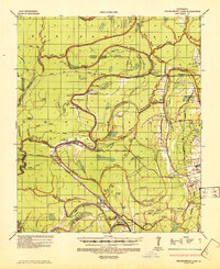 1935 Shackleford Lake1942 Print · USGSThe Tensas River basin in the 1930s shows a complex network of logging railroads and river landings essential to the local timber economy. Genealogists and local historians can trace family sites at Marydale Plantation, Stonewall Ch, and the settlement at Newlight.2 unique versions available
 - 1955 Map of Jackson
 1955 Jackson1955 Print · USGSThe Lower Mississippi Valley at the middle of the century reveals a landscape of deep river meanders and growing rail hubs. Genealogists and historians can trace the mid-century footprints of Vicksburg National Military Park, old river landings at Port Gibson, and the rail corridors of the Illinois Central Railroad.3 unique versions available
 - 1958 Map of Shackleford Lake
 1958 Shackleford Lake1958 Print · USGSTensas Parish was a landscape of timber and river landings in the mid-1950s, where the logging industry and the river's flow dictated local life. Genealogists and historians can trace the foundations of communities at Marydale Plantation, Magnolia Sch & Ch, and ancient sites like the Indian Mounds.
 - 1961 Map of Jackson
 1961 Jackson1961 Print · USGSThe Lower Mississippi Delta and the state capital area are captured here during the post-war era of infrastructure expansion. Researchers can trace the complex river oxbows and rail lines connecting Vicksburg, Yazoo City, and the Illinois Central Railroad network.
 - 1962 Map of Jackson
 1962 Jackson1962 Print · USGSThe Mississippi Delta and the state capital region are mapped here in the early sixties, showing a landscape defined by the great river and the growing city of JACKSON. Genealogists can trace family roots through numerous landmarks like Cedar Hill Cem, rural stops on the Illinois Central RR, and historic sites like Champion Hill.2 unique versions available
 - 1982 Map of Tallulah, 1983 Print
 1982 Tallulah1983 Print · USGSNortheast Louisiana in the early eighties was a landscape of intricate oxbow lakes and railroad towns. Researchers can trace the heritage of parish centers like Tallulah and Winnsboro, or locate rural landmarks near Yucatan Lake and the Illinois Central Gulf tracks.
 - 1987 Map of Tensas Bluff
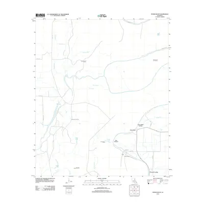
 1987 Tensas Bluff1987 Print · USGSThe Tensas River bottomlands in the late 1980s show a landscape of conservation and river-driven geography. Trace the Old RR Grade and discover family-named landmarks like Trusler Lake and the distinctive Tensas Bluff.
 - 1998 Map of Tensas Bluff, 2002 Print
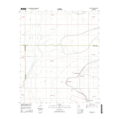
 1998 Tensas Bluff2002 Print · USGSThe Louisiana Delta at the close of the twentieth century shows a landscape of deep bayous and active oil exploration. Local researchers can trace the old river-crossing at the Ferry near Tensas Bluff or locate the Cem and Old RR Grade tucked into the wetlands.
 - 2012 Map of Tensas Bluff, 2012 Print
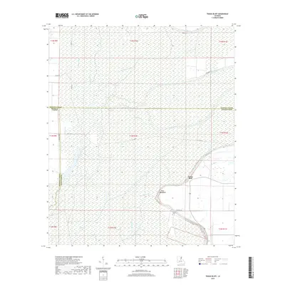
 2012 Tensas Bluff2012 Print · USGSCovers Tensas Bluff, including New Quarters, Hopewell Landing, and other nearby areas
 - 2015 Map of Tensas Bluff, 2015 Print
 2015 Tensas Bluff2015 Print · USGSCovers Tensas Bluff, including New Quarters, Hopewell Landing, and other nearby areas
 - 2018 Map of Tensas Bluff, 2018 Print
 2018 Tensas Bluff2018 Print · USGSCovers Tensas Bluff, including New Quarters, Hopewell Landing, and other nearby areas
 - 2020 Map of Tensas Bluff, 2020 Print
 2020 Tensas Bluff2020 Print · USGSCovers Tensas Bluff, including New Quarters, Hopewell Landing, and other nearby areas
 - 2024 Map of Tensas Bluff, 2024 Print
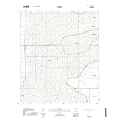
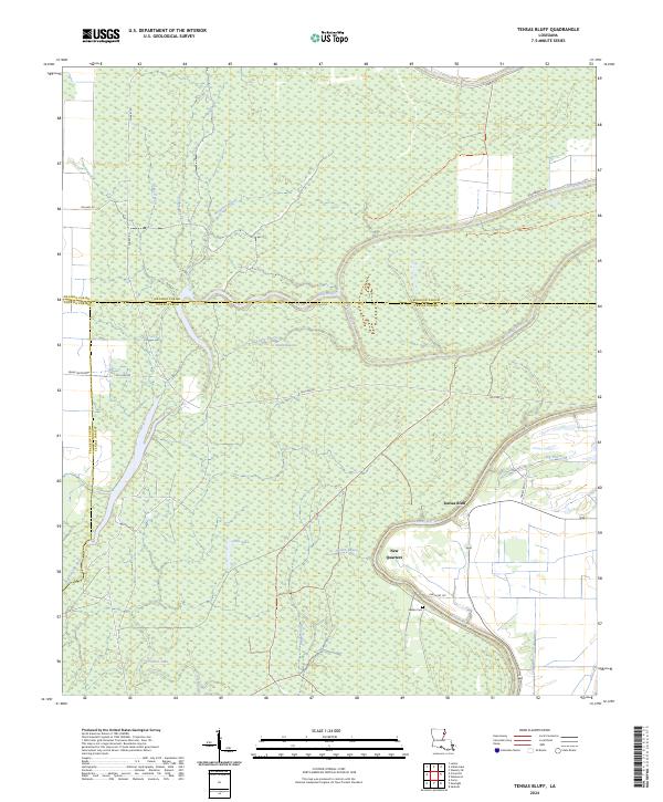 2024 Tensas Bluff2024 Print · USGSThe Louisiana delta landscape near the junction of Madison, Franklin, and Tensas Parishes is defined here by the winding Tensas River. Genealogists and local historians can locate the Jordan Cem and trace the small community at New Quarters among the wetlands.
End of results
Showing maps 1-13 of 13
Top cities near Tensas Bluff
Frequently asked questions
- What are the different types of historical maps available for Tensas Bluff?
- What is the oldest map of Tensas Bluff?
- Where can I purchase historical maps of Tensas Bluff for my home or office?
- Where can I download high-res historical maps of Tensas Bluff?
- Are there historical topographic maps available for Tensas Bluff?
- Is there historical aerial imagery available for Tensas Bluff?
- Where are historical maps of Tensas Bluff sourced from?