2020s Maps of Waterproof, Louisiana
Explore 4 historic maps of Waterproof from the 2020s. These maps offer a rare glimpse into what life looked like during the 2020s — showing old roads, neighborhoods, homes, and landmarks that have changed or disappeared over time.
Whether you're researching your family's past, planning a metal detecting trip, or studying how Waterproof's landscape evolved across the 2020s, these high-resolution maps are a powerful tool for exploring the history of this region.
- Focus on a specific era: All maps on this page are from the 2020s, giving you a focused view of this time period.
- See what’s changed: Compare century-old streets, trails, and buildings to today's modern landscape using overlays and satellite layers.
- Research with precision: Use these maps for genealogy, historical research, land use analysis, or educational projects.
- View, download, or print: Maps are fully viewable online in high resolution, and can be downloaded or printed for your own records.
Start exploring Waterproof's history through authentic maps from the 2020s. This is your window into the past.
Waterproof, LA maps
(4)- 2020 Map of Waterproof, 2020 Print
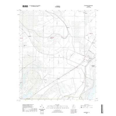 2020 Waterproof2020 Print · USGSCovers Waterproof, including Troy, Goldman, and other nearby areas
 - 2020 Map of Chamblee, 2020 Print
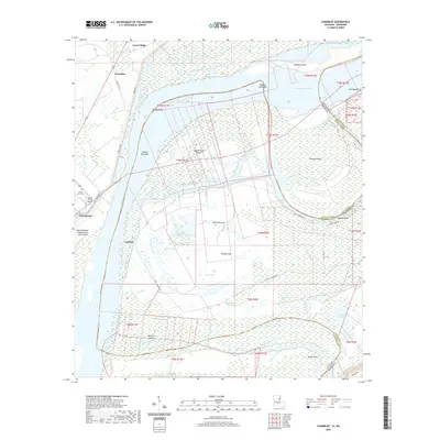 2020 Chamblee2020 Print · USGSCovers Waterproof, including Chamblee, Ashland, and other nearby areas
 - 2024 Map of Waterproof, 2024 Print
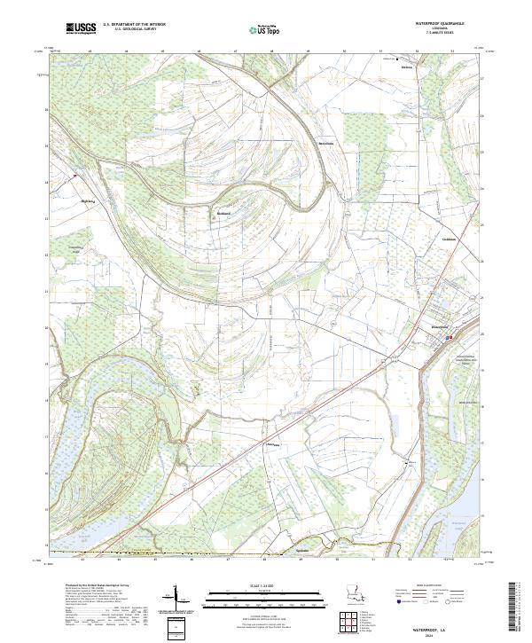 2024 Waterproof2024 Print · USGSNear the border of Tensas and Concordia Parishes, this area shows a landscape defined by the winding waters of the Mississippi River delta. Genealogists and local historians can trace the foundations of Waterproof, find family names at Winona Cem, and locate older landings like Goldman.
 - 2024 Map of Chamblee, 2024 Print
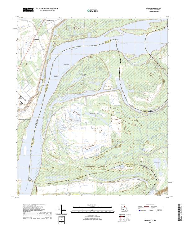 2024 Chamblee2024 Print · USGSThe Louisiana-Mississippi border comes alive in this contemporary survey of the river's winding path through Tensas Parish and Jefferson County. Genealogists and researchers can trace local landmarks like Myrtle Grove Cem and Chamblee amidst the oxbows of Bell Cow Lake and Rodney Island.
End of results
Showing maps 1-4 of 4
Top cities near Waterproof
- Natchez historical maps
- Ferriday historical maps
- Saint Joseph historical maps
- Ridgecrest historical maps
- Clayton historical maps
Frequently asked questions
- What are the different types of historical maps available for Waterproof?
- What is the oldest map of Waterproof?
- Where can I purchase historical maps of Waterproof for my home or office?
- Where can I download high-res historical maps of Waterproof?
- Are there historical topographic maps available for Waterproof?
- Is there historical aerial imagery available for Waterproof?
- Where are historical maps of Waterproof sourced from?