Old Maps of Montegut, Louisiana for Hiking & Exploration
Hike through history with 17 historic maps of Montegut. Explore old trails, ghost towns, and forgotten backroads — perfect for outdoor adventurers and local explorers.
- Rediscover forgotten places: Map out old mining camps, roads, and footpaths that no longer exist on modern maps.
- Layer with modern tools: Combine with LiDAR or satellite views to plan hikes through historical terrain.
- Made for exploration: Popular among hikers, overlanders, and local history lovers.
Use these maps to find adventure and explore the hidden past of Montegut.
Montegut, LA maps
(17)- 1894 Map of Dulac
 1894 Dulac1894 Print · USGSCoastal Terrebonne Parish appears here in the early 1890s, when life followed the natural rhythms of the bayous and marsh. Researchers can trace early water routes and family settlements near Montegut, Dulac, and the winding Bayou Grand Caillou.3 unique versions available
 - 1935 Map of Montegut
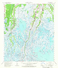
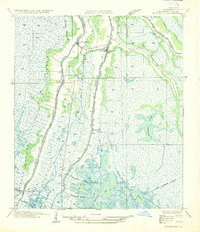 1935 Montegut1935 Print · USGSCoastal Terrebonne Parish comes to life in the mid-1930s, documenting a time when bayou-side settlements were the heart of the region. Genealogists and local historians can trace early footprints at Sarah Plantation, the Dugas Cem, and La Cache School.
 - 1941 Map of Dulac
 1941 Dulac1941 Print · USGSCoastal Louisiana in the late thirties reveals a world of water-based commerce and ridge-line settlements. Genealogists can trace family names at St Michaels Plantation, locate schools like Morning Star Sch, or study the Dugas Cem and Indian Mound.
 - 1944 Map of Dulac
 1944 Dulac1944 Print · USGSCoastal Terrebonne Parish in the 1940s is defined by its finger-like bayou settlements and expansive marshes. Genealogists can trace family roots at St Michaels Plantation, Theriot P O, and cemetery sites like Dugas Cem.
 - 1945 Map of New Orleans
 1945 New Orleans1945 Print · USGSCoastal Louisiana and the Mississippi delta are captured here just after the war, showing the region's transition into a modern industrial and transit hub. Genealogists can trace family settlements along Bayou Teche or identify rail stops for the Illinois Central and Texas & Pacific lines.
 - 1963 Map of New Orleans
 1963 New Orleans1963 Print · USGSCoastal Louisiana in the mid-twentieth century reveals a complex world of bayou settlements, expanding oil fields, and vital rail networks. Genealogists and historians can trace family roots through river towns like Thibodaux or follow the Southern Pacific line through Franklin and Patterson.4 unique versions available
 - 1963 Map of Montegut, 1966 Print
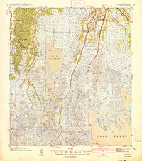
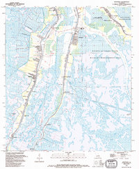
 1963 Montegut1966 Print · USGSThe coastal bayous of Terrebonne Parish in the early sixties reveal a landscape of ridge settlements and marshland industry. Genealogists and historians can trace family locations near Montegut, Chauvin, and Sarah Plantation, or locate landmarks like Dugas Cem and Sacred Heart Ch.3 unique versions available
 - 1964 Map of Dulac, 1966 Print
 1964 Dulac1966 Print · USGSCoastal Louisiana life in the mid-sixties centered on the long ribbons of land following the bayous through the Terrebonne marsh. Genealogists and researchers can trace family landmarks along these waterways, from Sarah Plantation to sites like Thibodaux Cem and Morning Star Ch.2 unique versions available
 - 1966 Map of New Orleans
 1966 New Orleans1966 Print · USGSCoastal Louisiana in the mid-1960s reveals a transition from traditional bayou life to an intensive offshore oil and gas economy. Researchers can trace the rail lines of the Southern Pacific RR through Morgan City or locate the Eugene Island Lighthouse among the delta's shifting marshes.
 - 1983 Map of Terrebonne Bay
 1983 Terrebonne Bay1983 Print · USGSThe Louisiana coast in the early 1980s reveals a labyrinth of bayous and barrier islands before decades of significant shoreline change. Researchers can trace the development of the energy industry and coastal settlements like Galliano and Montegut alongside the Isles Dernieres.
 - 1994 Map of Montegut
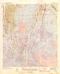
 1994 Montegut1994 Print · USGSCoastal Terrebonne Parish in the 1990s shows a landscape of bayou-side settlements and vast wetlands. Genealogists can trace family names at Sarah Plantation, Thibodaux Cem, and the St Charles Borromeo Ch along the Lafourche Parish line.
 - 1998 Map of Montegut, 2000 Print
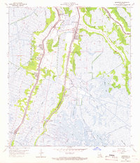
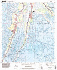 1998 Montegut2000 Print · USGSCoastal Louisiana life centers on the narrow levees of the bayous in the late nineties, where water and land are inextricably linked. Genealogists and local historians can trace family sites from Sarah Plantation to several local landmarks like St Joseph Cem and the Montegut Middle Sch.
 - 2012 Map of Montegut, 2012 Print
 2012 Montegut2012 Print · USGSCovers Montegut, including Chauvin, Point-Aux-Chenes, and other nearby areas
 - 2015 Map of Montegut, 2015 Print
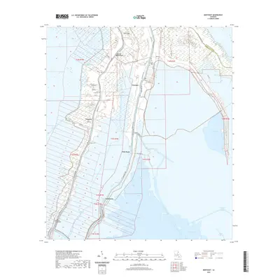
 2015 Montegut2015 Print · USGSCovers Montegut, including Chauvin, Point-Aux-Chenes, and other nearby areas
 - 2018 Map of Montegut, 2018 Print
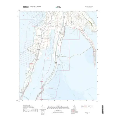 2018 Montegut2018 Print · USGSCovers Montegut, including Chauvin, Point-Aux-Chenes, and other nearby areas
 - 2020 Map of Montegut, 2020 Print
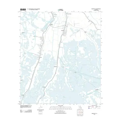
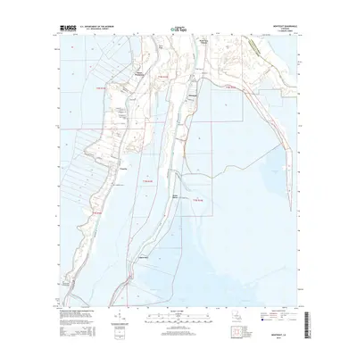
 2020 Montegut2020 Print · USGSCovers Montegut, including Chauvin, Point-Aux-Chenes, and other nearby areas
 - 2024 Map of Montegut, 2024 Print
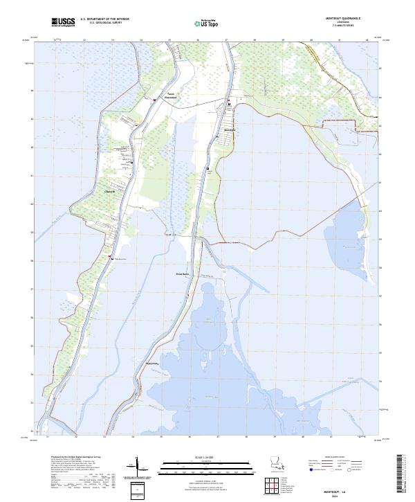 2024 Montegut2024 Print · USGSCoastal Louisiana's Terrebonne Parish comes to life in this recent survey of its bayou communities and vast marshlands. Genealogists and local historians can trace property and family roots near Sarah Plantation, Saint Joseph Cem, and the old fishing village of Point Barre.
End of results
Showing maps 1-17 of 17
Top cities near Montegut
Frequently asked questions
- What are the different types of historical maps available for Montegut?
- What is the oldest map of Montegut?
- Where can I purchase historical maps of Montegut for my home or office?
- Where can I download high-res historical maps of Montegut?
- Are there historical topographic maps available for Montegut?
- Is there historical aerial imagery available for Montegut?
- Where are historical maps of Montegut sourced from?