1980s Maps of Union Parish, Louisiana
Explore 29 historic maps of Union Parish from the 1980s. These maps offer a rare glimpse into what life looked like during the 1980s — showing old roads, neighborhoods, homes, and landmarks that have changed or disappeared over time.
Whether you're researching your family's past, planning a metal detecting trip, or studying how Union Parish's landscape evolved across the 1980s, these high-resolution maps are a powerful tool for exploring the history of this region.
- Focus on a specific era: All maps on this page are from the 1980s, giving you a focused view of this time period.
- See what’s changed: Compare century-old streets, trails, and buildings to today's modern landscape using overlays and satellite layers.
- Research with precision: Use these maps for genealogy, historical research, land use analysis, or educational projects.
- View, download, or print: Maps are fully viewable online in high resolution, and can be downloaded or printed for your own records.
Start exploring Union Parish's history through authentic maps from the 1980s. This is your window into the past.
Union Parish, LA maps
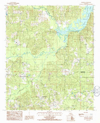
(29)- 1981 Map of Lockhart
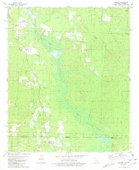 1981 Lockhart1981 Print · USGSThe Arkansas-Louisiana borderlands in the early eighties were defined by petroleum extraction and quiet rural parishes. Genealogists can trace the location of community centers like Lockhart and family-named sites such as Hillsboro Cem and Olive Branch Ch.
 - 1981 Map of Strong
 1981 Strong1981 Print · USGSThe Arkansas-Louisiana borderlands come into focus in the early eighties, centered on the rail-driven town of Strong. Researchers can trace old family burial sites and rural communities like Victoria or locate landmarks such as Batts Chapel and the Strong Oil Field.
 - 1981 Map of Junction City
 1981 Junction City1981 Print · USGSJunction City sits squarely on the Arkansas-Louisiana border in the early eighties, surrounded by oil fields and bayou country. Trace family roots at Graceland Cem and Caledonia Ch, or locate old homesites near Upland and Lamberton.
 - 1981 Map of Gardner
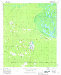
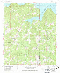
 1981 Gardner1981 Print · USGSUnion County and Union Parish sit at the state line in the early eighties, where timber and oil intersect with small-town life. Genealogists and historians can trace numerous rural sites like Pleasant Grove Cem, the settlement of Aurelle, and the Missouri Pacific line.
 - 1981 Map of Huttig
 1981 Huttig1981 Print · USGSThe Ouachita River borderlands near the Arkansas-Louisiana line come into focus during this early 1980s survey. Researchers can trace the timber and rail roots of Huttig or find local landmarks like the Old Lapile Cem and the Huttig Lookout Tower.
 - 1981 Map of Felsenthal Dam
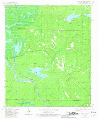 1981 Felsenthal Dam1981 Print · USGSThe Ouachita River bottomlands are captured here in the early eighties as new infrastructure began to reshape the landscape. Local historians can trace the transition from the Old Railroad Grade to modern works like the Felsenthal Lock and Dam and the Macedonia Cem.
 - 1982 Map of Calhoun
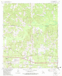 1982 Calhoun1982 Print · USGSOuachita Parish in the early eighties shows a landscape of petroleum extraction and rural communities. Genealogists can trace family landmarks like Spillers Cem and Aulds Chapel, or explore the rail corridor of the Illinois Central Gulf.
 - 1982 Map of Point
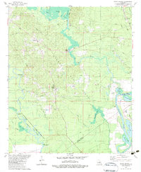
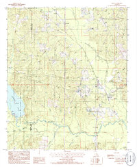
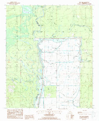
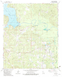 1982 Point1982 Print · USGSUnion Parish during the early eighties shows a landscape of bayous and managed wildlands. Genealogists can locate several family burial grounds like Morse Hill Cem and Carter Cem, or trace the rural settlement of Point.
 - 1982 Map of Downsville North, 1983 Print
 1982 Downsville North1983 Print · USGSUnion and Lincoln Parishes are captured here in the early eighties as the energy industry and timberlands defined the rural landscape. Researchers can locate family landmarks like the Feazel Cem, Cedar Grove Cem, and Millard Hill Ch near the banks of Bayou D'Arbonne Lake.
 - 1982 Map of Rocky Branch, 1983 Print
 1982 Rocky Branch1983 Print · USGSUnion Parish during the early 1980s reveals a landscape defined by the Monroe Gas Field and the winding Ouachita River. Genealogists and local historians can locate Cook Cem, the community of Rocky Branch, and the old rail corridor of the Missouri Pacific.
 - 1982 Map of Sterlington, 1983 Print
 1982 Sterlington1983 Print · USGSSterlington and the Ouachita River valley are shown here in the early eighties as a hub of river industry and parish history. Researchers can locate the Glendora Plantation, trace the Missouri Pacific rail line, and find old burial sites like Bartholomew Cem.
 - 1982 Map of Downsville South, 1983 Print
 1982 Downsville South1983 Print · USGSLincoln and Ouachita Parishes in the early eighties were shaped by a busy energy industry and deep-rooted rural communities. Trace family history and land use through Lanes Chapel Cemeteries, the Illinois Central Gulf rail line, and Choudrant School.
 - 1984 Map of Shreveport
 1984 Shreveport1984 Print · USGSNorthern Louisiana at the peak of the 1980s reveals a landscape of massive water management projects and Cold War military hubs. Trace the rail lines of the Kansas City Southern Ry past Barksdale Air Force Base and the high ground of Driskill Mountain.2 unique versions available
 - 1985 Map of Monroe North, 1986 Print
 1985 Monroe North1986 Print · USGSNorth-central Louisiana in the mid-eighties was a landscape defined by the growth of university towns and the expansion of the natural gas industry. Researchers can trace rural family roots through landmarks like Lisbon Cem, New Hope Ch, and the many schools in Farmerville or Bernice.2 unique versions available
 - 1985 Map of El Dorado, 1986 Print
 1985 El Dorado1986 Print · USGSSouth-central Arkansas and the Louisiana borderlands appear here in the mid-1980s, defined by the energy industry and river bottomlands. Genealogists and historians can locate rural landmarks like Old Parkers Chapel Cem, the Smackover Gas Field, and the El Dorado & Wesson RR.2 unique versions available
 - 1985 Map of Bernice, 1986 Print
 1985 Bernice1986 Print · USGSNorth Louisiana in the early eighties is captured here, centering on the grid of Bernice and the rural reaches of the surrounding parishes. Researchers can trace land ties along Middle Fork Bayou D'Arbonne or locate rural landmarks like Weldon and several old Cem sites.
 - 1985 Map of Shiloh, 1986 Print
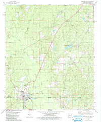
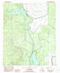
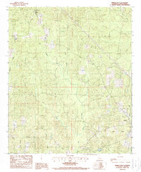
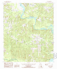 1985 Shiloh1986 Print · USGSUnion Parish during the 1980s shows a landscape shaped by the waters of the Bayou D'Arbonne. Researchers can trace rural lineages through the settlement of Shiloh or explore the early footprint of Lake D'Arbonne State Park and Corney Bayou.
 - 1985 Map of Lillie, 1986 Print
 1985 Lillie1986 Print · USGSNorthern Louisiana's timber and bayou country is documented here during the mid-1980s, centered on the community of Lillie. Researchers can trace local landmarks like Bethel church, find family sites near Rum Center, or explore the eastern edges of the Kisatchie National Forest.
 - 1985 Map of Spearsville, 1986 Print
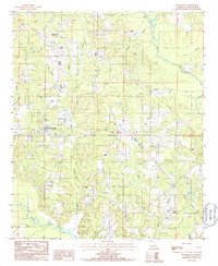 1985 Spearsville1986 Print · USGSSpearsville and the surrounding Louisiana parishes are captured here in the mid-1980s, revealing a landscape of dense creek networks and rural settlements. Researchers can trace family-named landmarks like Resinger Hollis and locate cemeteries near Mount Union and Taylortown.
 - 1985 Map of Cedarton, 1986 Print
 1985 Cedarton1986 Print · USGSLincoln and Union Parishes are captured in the mid-1980s as the landscape balances its rural roots with industrial infrastructure. Genealogists and local historians can trace family-named features like Mineral Springs, Colvin Creek, and several Cem locations.
 - 1987 Map of Fish Lake, 1988 Print
 1987 Fish Lake1988 Print · USGSThe Quachita River bottomlands in the late 1980s reveal a complex network of wetlands and industrial gas fields. Researchers can trace remote sites like Brantley Landing, the Potato Patch, and the oxbows of Horseshoe Lake along the parish line.
 - 1988 Map of Harrell Lake
 1988 Harrell Lake1988 Print · USGSThe Louisiana river bottomlands come to life in this late-century survey of the Union and Morehouse Parish line. Genealogists and local historians can trace the waterways around Alabama Landing and explore the sloughs and brakes between Finch Lake and Butte de Morancy.
 - 1988 Map of De Loutre
 1988 De Loutre1988 Print · USGSUnion Parish in the late eighties reveals a landscape of winding bayous and active energy production. Researchers can trace the Old RR Grade and locate family landmarks like the cemeteries near De Loutre and the settlements of Quigley and Canbeal.
 - 1988 Map of Marion West
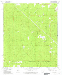
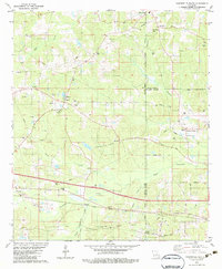
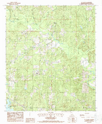
 1988 Marion West1988 Print · USGSThe rural stretches of Union Parish come into focus in the 1980s, revealing a landscape defined by timber and energy. Trace the layout of Oakland, locate local Cem sites, and explore the extent of the local Gas Field and the Lookout Tower.
 - 1988 Map of Farmerville
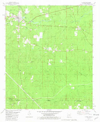
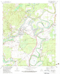
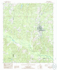
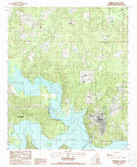 1988 Farmerville1988 Print · USGSFarmerville and the surrounding Union Parish landscape are captured in the late eighties as Bayou D'Arbonne reached its modern form. Researchers can trace the developed shoreline of Lake D'Arbonne State Park and locate area landmarks like the Cem and Gaging Station.
Showing maps 1-25 of 29
Top cities of Union Parish
- Farmerville historical maps
- Bernice historical maps
- Marion historical maps
- Spearsville historical maps
- Lillie historical maps
Frequently asked questions
- What are the different types of historical maps available for Union Parish?
- What is the oldest map of Union Parish?
- Where can I purchase historical maps of Union Parish for my home or office?
- Where can I download high-res historical maps of Union Parish?
- Are there historical topographic maps available for Union Parish?
- Is there historical aerial imagery available for Union Parish?
- Where are historical maps of Union Parish sourced from?