Old Maps of Varnado, Louisiana for Genealogy
Trace your family roots with 17 historic maps of Varnado. These high-res maps reveal old neighborhoods, homesites, landmarks, and streets — helping you uncover where your ancestors lived and how the area evolved over time.
- Explore historic neighborhoods: Identify where your relatives may have lived in the 1800s or 1900s.
- Compare maps over time: Trace the changes in streets, buildings, and landmarks for multi-generational research.
- Perfect for genealogy & ancestry research: Used by family historians and researchers to map out lineage and migration.
These maps are an incredible resource for exploring your personal connection to Varnado's past.
Varnado, LA maps
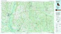
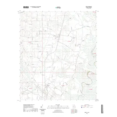
(17)- 1949 Map of Angie
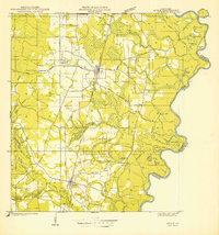 1949 Angie1949 Print · USGSNear the Pearl River in the late 1940s, this area of Washington Parish shows a landscape of timber and rail. Genealogists can locate family-named sites like Pleasant Valley Cem, Wesley Ray High Sch, and the community of Varnado.
 - 1953 Map of Mobile, 1968 Print
 1953 Mobile1968 Print · USGSThe Gulf Coast comes alive in this mid-century survey, from the streets of Mobile to the marshes of New Orleans. Trace family roots in coastal towns like Pass Christian and Bayou La Batre or locate military landmarks including Keesler AFB.3 unique versions available
 - 1957 Map of Mobile
 1957 Mobile1957 Print · USGSThe Gulf Coast in the mid-1950s reveals a bustling corridor of rail-and-river commerce connecting Alabama to Louisiana. Genealogists and historians can trace old settlements and military hubs from Keesler Afb to the coastal reaches of Ship Island and Bogalusa.3 unique versions available
 - 1959 Map of Bogalusa, 1960 Print
 1959 Bogalusa1960 Print · USGSThe Pearl River valley and the industrial hub of Bogalusa are captured here in the late fifties. Genealogists can trace family names through dozens of rural sites like Mitchells Chapel, Old Live Oak Cem, and the Buck Branch School.2 unique versions available
 - 1960 Map of Mobile
 1960 Mobile1960 Print · USGSThe Gulf Coast at the dawn of the sixties shows a landscape of busy ports, military airbases, and barrier islands. Trace the rail lines of the Louisville & Nashville through BILOXI and Pascagoula or find family history in towns like Bayou La Batre and Poplarville.
 - 1963 Map of Mobile
 1963 Mobile1963 Print · USGSThe Gulf Coast at the dawn of the sixties shows a thriving maritime and military corridor from Louisiana to Alabama. Genealogists and historians can trace rail lines like the Louisville & Nashville RR and find landmarks from Brookley AFB to Fort Morgan.
 - 1965 Map of Mobile
 1965 Mobile1965 Print · USGSThe Gulf Coast at mid-century reveals a landscape of expanding ports and vital military installations from Louisiana to Alabama. Genealogists and historians can trace the growth of Biloxi, Pascagoula, and Mobile, alongside the sprawling De Soto National Forest.
 - 1976 Map of Bogalusa NE, 1977 Print
 1976 Bogalusa NE1977 Print · USGSThe timberlands and river bottoms of Washington Parish are captured here in the mid-1970s. Local researchers can trace the rural landscape between Angie and Varnado, including the deep oxbows along the Pearl River.
 - 1982 Map of Angie
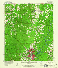
 1982 Angie1982 Print · USGSThe Louisiana-Mississippi border near the Pearl River shows a landscape of small rail-side settlements and rural parishes in the early eighties. Genealogists can locate family landmarks like Bonnie Cem, Marys Chapel, and Wesley Ray Ch along the rail corridor.
 - 1984 Map of Bogalusa
 1984 Bogalusa1984 Print · USGSThe Pearl River basin on the Louisiana-Mississippi border comes into focus in the mid-1980s, showcasing a landscape of river-bottom swamps and timberlands. Local researchers can trace the growth of Bogalusa and Picayune or find rural landmarks like Macedonia Ch and Wheat Swamp.
 - 1984 Map of Mobile
 1984 Mobile1984 Print · USGSThe Gulf Coast at the height of the mid-eighties shows a landscape of rapid industrial growth and military significance. Researchers can trace the sprawling rail lines of the Illinois Central Gulf RR, locate the NASA Test Facility, or study the barrier island chain from Cat Island to Petit Bois Island.3 unique versions available
 - 1994 Map of Bogalusa
 1994 Bogalusa1994 Print · USGSThe timber country and river bottoms of the Louisiana-Mississippi borderlands come alive in the mid-nineties. Genealogists and researchers can trace the rail-and-river geography of Bogalusa, the winding Pearl River, and family settlements like McNeill and Varnado.2 unique versions available
 - 2012 Map of Angie, 2012 Print
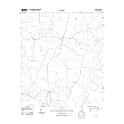 2012 Angie2012 Print · USGSCovers Varnado, including Angie, Pearl River County, and other nearby areas
 - 2015 Map of Angie, 2015 Print
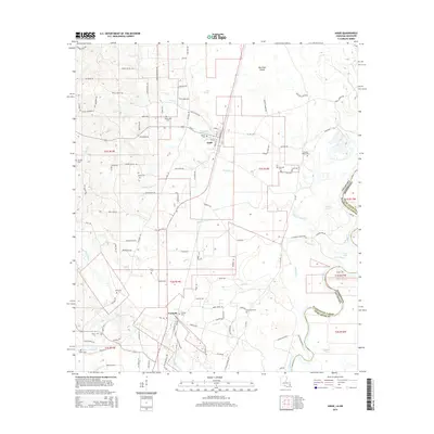 2015 Angie2015 Print · USGSCovers Varnado, including Angie, Pearl River County, and other nearby areas
 - 2018 Map of Angie, 2018 Print
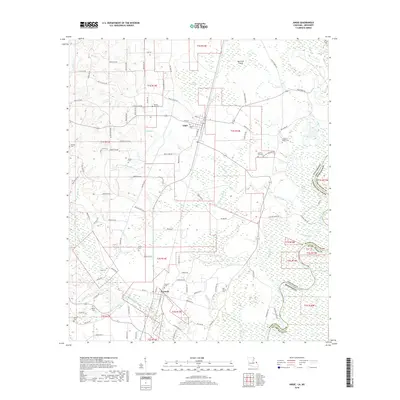 2018 Angie2018 Print · USGSCovers Varnado, including Angie, Pearl River County, and other nearby areas
 - 2020 Map of Angie, 2020 Print
 2020 Angie2020 Print · USGSCovers Varnado, including Angie, Pearl River County, and other nearby areas
 - 2024 Map of Angie, 2024 Print
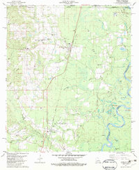
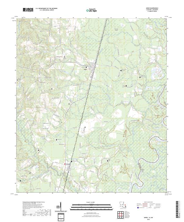 2024 Angie2024 Print · USGSThe Pearl River bottomlands and the settlements of Washington Parish come to life in this contemporary study of the Louisiana-Mississippi border. Researchers can trace family history through several rural burial grounds like Wesley Ray Cem and Mohon Cem, or locate the site of the Leighdon Bluff Ferry.
End of results
Showing maps 1-17 of 17
Top cities near Varnado
Frequently asked questions
- What are the different types of historical maps available for Varnado?
- What is the oldest map of Varnado?
- Where can I purchase historical maps of Varnado for my home or office?
- Where can I download high-res historical maps of Varnado?
- Are there historical topographic maps available for Varnado?
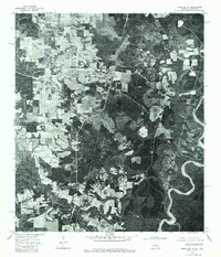
- Is there historical aerial imagery available for Varnado?
- Where are historical maps of Varnado sourced from?