1940s Maps of Turner, Maine
Explore 5 historic maps of Turner from the 1940s. These maps offer a rare glimpse into what life looked like during the 1940s — showing old roads, neighborhoods, homes, and landmarks that have changed or disappeared over time.
Whether you're researching your family's past, planning a metal detecting trip, or studying how Turner's landscape evolved across the 1940s, these high-resolution maps are a powerful tool for exploring the history of this region.
- Focus on a specific era: All maps on this page are from the 1940s, giving you a focused view of this time period.
- See what’s changed: Compare century-old streets, trails, and buildings to today's modern landscape using overlays and satellite layers.
- Research with precision: Use these maps for genealogy, historical research, land use analysis, or educational projects.
- View, download, or print: Maps are fully viewable online in high resolution, and can be downloaded or printed for your own records.
Start exploring Turner's history through authentic maps from the 1940s. This is your window into the past.
Turner, ME maps
(5)- 1940 Map of Poland, 1942 Print
 1940 Poland1942 Print · USGSMaine's river valleys and rail junctions come to life in the 1940s as the region's industrial and rural networks are captured in detail. Genealogists can trace family landmarks like Hebron Sta P O, the Sanitarium, and the busy hub at Mechanic Falls.
 - 1941 Map of Livermore
 1941 Livermore1941 Print · USGSAndroscoggin County at the start of the 1940s is a landscape defined by the river and rail economy between Livermore Falls and Wayne. Genealogists can trace family footprints across numerous rural districts, locating Brettuns Mills and the many schoolhouses like Young Sch and Pike Sch.
 - 1942 Map of Lewiston
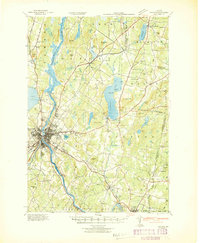 1942 Lewiston1942 Print · USGSLewiston and the Androscoggin River valley are shown in detail during the early 1940s, capturing the area's transition from industrial hubs to rural crossroads. Researchers can locate early schoolhouses like No Name Sch, the campus of Bates College, and vanished rail stops at Golder Siding and Leeds Junc.
 - 1942 Map of Buckfield
 1942 Buckfield1942 Print · USGSOxford County and the upper Androscoggin valley are shown in detail during the early 1940s as the railroad still anchored the local economy. Genealogists and researchers can trace dozens of rural schoolhouses and family landmarks like Mt Oxford Spring, Brettuns Mills, and the Maine Central rail line.
 - 1942 Map of Poland
 1942 Poland1942 Print · USGSSouth-central Maine is captured here in the early 1940s, showing a landscape of rail-linked mill towns and hilltop farms. Genealogists can trace family names at Hebron Sta P O, Danville Corner, and the Empire Grove Campground.
End of results
Showing maps 1-5 of 5
Top cities near Turner
- Lewiston historical maps
- Auburn historical maps
- Lisbon historical maps
- Winthrop historical maps
- Poland historical maps
- Paris historical maps
See more
Top neighborhoods of Turner
- North Turner historical maps
- Skillings Corner historical maps
- Chase Mills historical maps
- Turner Center historical maps
- South Turner historical maps
- Twin Bridges historical maps
See more
Frequently asked questions
- What are the different types of historical maps available for Turner?
- What is the oldest map of Turner?
- Where can I purchase historical maps of Turner for my home or office?
- Where can I download high-res historical maps of Turner?
- Are there historical topographic maps available for Turner?
- Is there historical aerial imagery available for Turner?
- Where are historical maps of Turner sourced from?