1980s Maps of T15 R15 WELS, Maine
Explore 5 historic maps of T15 R15 WELS from the 1980s. These maps offer a rare glimpse into what life looked like during the 1980s — showing old roads, neighborhoods, homes, and landmarks that have changed or disappeared over time.
Whether you're researching your family's past, planning a metal detecting trip, or studying how T15 R15 WELS's landscape evolved across the 1980s, these high-resolution maps are a powerful tool for exploring the history of this region.
- Focus on a specific era: All maps on this page are from the 1980s, giving you a focused view of this time period.
- See what’s changed: Compare century-old streets, trails, and buildings to today's modern landscape using overlays and satellite layers.
- Research with precision: Use these maps for genealogy, historical research, land use analysis, or educational projects.
- View, download, or print: Maps are fully viewable online in high resolution, and can be downloaded or printed for your own records.
Start exploring T15 R15 WELS's history through authentic maps from the 1980s. This is your window into the past.
T15 R15 WELS, ME maps
(5)- 1986 Map of Charles Pond
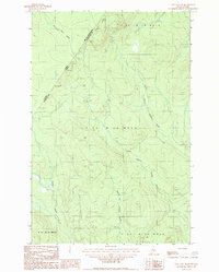
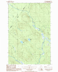 1986 Charles Pond1986 Print · USGSThe northern Maine woods along the Quebec border are shown here in the late twentieth century, dominated by river networks and logging terrain. Researchers can trace the Big Black River meanders or locate the Abandoned Landing Strip and Charles Pond.
 - 1986 Map of St. Pamphile
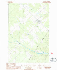 1986 St. Pamphile1986 Print · USGSThe Maine-Quebec borderlands come into focus in the mid-1980s, centered on the frontier settlement of St Pamphile. Researchers can trace international transit points like Canadian Customs and the remote course of the Big Black River.
 - 1986 Map of Ninemile Deadwater
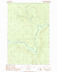 1986 Ninemile Deadwater1986 Print · USGSThe deep Maine woods of northern Aroostook County are captured in the mid-1980s, showing a wilderness of timber townships and winding waterways. Researchers can trace the path of the Big Ninemile Deadwater River and locate remote features like Fivemile Brook and a lonely Gravel Pit.
 - 1987 Map of St. Omer
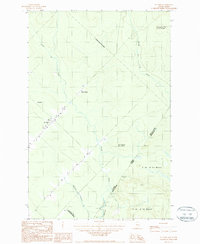 1987 St. Omer1987 Print · USGSThe northern borderlands of Maine and Quebec come alive in the late eighties, documenting the sparse settlements along the international line. Trace the remote outposts at St. Omer and Cote a Deroy or follow the waters of the St Roch R.
 - 1987 Map of East Lake SE
 1987 East Lake SE1987 Print · USGSThe Maine-Quebec borderlands in the late eighties are captured here as a remote timberland and survey zone. Researchers can trace the international line through INTL MON 221 and follow the secluded waters of North Branch Twomile Brook.
End of results
Showing maps 1-5 of 5
Top neighborhoods of T15 R15 WELS
Frequently asked questions
- What are the different types of historical maps available for T15 R15 WELS?
- What is the oldest map of T15 R15 WELS?
- Where can I purchase historical maps of T15 R15 WELS for my home or office?
- Where can I download high-res historical maps of T15 R15 WELS?
- Are there historical topographic maps available for T15 R15 WELS?
- Is there historical aerial imagery available for T15 R15 WELS?
- Where are historical maps of T15 R15 WELS sourced from?