1980s Maps of Hancock County, Maine
Explore 63 historic maps of Hancock County from the 1980s. These maps offer a rare glimpse into what life looked like during the 1980s — showing old roads, neighborhoods, homes, and landmarks that have changed or disappeared over time.
Whether you're researching your family's past, planning a metal detecting trip, or studying how Hancock County's landscape evolved across the 1980s, these high-resolution maps are a powerful tool for exploring the history of this region.
- Focus on a specific era: All maps on this page are from the 1980s, giving you a focused view of this time period.
- See what’s changed: Compare century-old streets, trails, and buildings to today's modern landscape using overlays and satellite layers.
- Research with precision: Use these maps for genealogy, historical research, land use analysis, or educational projects.
- View, download, or print: Maps are fully viewable online in high resolution, and can be downloaded or printed for your own records.
Start exploring Hancock County's history through authentic maps from the 1980s. This is your window into the past.
Hancock County, ME maps
(63)- 1981 Map of Salsbury Cove
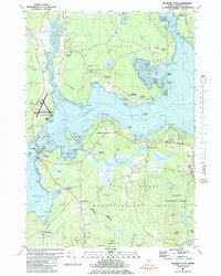 1981 Salsbury Cove1981 Print · USGSHancock County's coastline meets the northern reaches of Mount Desert Island in the early 1980s. Local researchers can trace family landmarks and coastal hamlets like Salsbury Cove, Lamoine Corner, and the rural Mtn View Ch.2 unique versions available
 - 1981 Map of Penobscot
 1981 Penobscot1981 Print · USGSThe coastal waters of the Bagaduce River and Northern Bay define this corner of Maine in the early eighties. Researchers can trace historic family burial sites like Leach Cem or locate old settlements at South Penobscot and North Brooksville.2 unique versions available
 - 1981 Map of Brooklin
 1981 Brooklin1981 Print · USGSThe Hancock County coast at the start of the 1980s reveals a landscape of tidal marshes and tight-knit maritime villages. Researchers can trace ancestral roots through sites like Mt Ephraim Cem and the older Rural Cem, or locate family landmarks at Flye Point and Haven.
 - 1981 Map of Blue Hill
 1981 Blue Hill1981 Print · USGSCoastal Maine's maritime and industrial character is preserved here in the early eighties. Researchers can trace family history through the Early Settlers Cemetery or locate landmarks like Stevens Academy and the old Blue Hill Airport.2 unique versions available
 - 1981 Map of Bartlett Island, 1982 Print
 1981 Bartlett Island1982 Print · USGSMount Desert Island's western coastline and the surrounding islands of Blue Hill Bay are captured here in the early eighties. Local historians can trace family names and early sites at Kelleytown, St Andrew by the Lake Ch, and the Murphy Cem.
 - 1981 Map of Ellsworth, 1982 Print
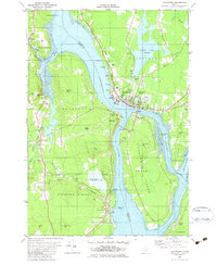
 1981 Ellsworth1982 Print · USGSThe riverfront and rail lines of this Hancock County hub were well-established by the early eighties. Genealogists and local historians can trace the foundations of Ellsworth through its community landmarks, from the Juniper Cem to the Maine Central RR tracks.
 - 1981 Map of Branch Lake, 1982 Print
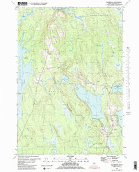
 1981 Branch Lake1982 Print · USGSHancock County’s lakelands are captured here in the early 1980s, documenting the rural communities of North Ellsworth and West Surry. Researchers can trace the Maine Central rail line, locate small family plots like Gott Cem, and explore the shoreline of Branch Lake.2 unique versions available
 - 1981 Map of Eastbrook, 1982 Print
 1981 Eastbrook1982 Print · USGSHancock County’s inland ridges and heaths are meticulously documented in this late-twentieth-century study of the Eastbrook and Waltham vicinity. Researchers can locate family burial sites at Sunnyside Cem, the old Cave Hill Sch, and landmarks along Waltham Ridge.2 unique versions available
 - 1981 Map of Beech Hill Pond, 1982 Print
 1981 Beech Hill Pond1982 Print · USGSCoastal Maine's interior lake country comes into focus in the early eighties as local roads began to trace the shorelines of Beech Hill Pond and Green Lake. Genealogists can locate family sites like Pyles Cem or the Beech Hill Sch while tracing the East Br Union R through the woods.2 unique versions available
 - 1981 Map of Newbury Neck, 1982 Print
 1981 Newbury Neck1982 Print · USGSCoastal Hancock County at the start of the 1980s reveals a landscape of wooded peninsulas and traditional shoreline communities. Genealogists can locate family burial grounds like Whittemore Cem and trace old roads through South Surry and West Trenton.
 - 1981 Map of Sargentville, 1982 Print
 1981 Sargentville1982 Print · USGSThe Maine coastline near the mouth of the Bagaduce River was a hub of seafaring and small-town life in the early eighties. Genealogists and historians can trace local family roots at Forest Home Cem, Ecce-mocin Ch, and the old Quarry on Little Deer Isle.2 unique versions available
 - 1981 Map of Hancock, 1982 Print
 1981 Hancock1982 Print · USGSCoastal Hancock County and the Taunton Bay shoreline appear in detail during the early eighties as the local economy balanced rail transport and maritime life. Genealogists and researchers can trace family landmarks like Abbott Cem, the Hancock Sch, and the winding path of the Maine Central Railroad.
 - 1982 Map of Brewer Lake
 1982 Brewer Lake1982 Print · USGSHancock County's landscape of ridges and ponds is captured here in the early eighties as rural life centered around towns like Dedham and East Holden. Genealogists can locate several local burial grounds, including Union Cem and Copeland Hill Cem, and trace the path of the Maine Central railroad.
 - 1982 Map of Hampden
 1982 Hampden1982 Print · USGSThe Penobscot River valley in the early eighties shows a landscape of growing riverside towns and historic upland settlements. Genealogists can locate family landmarks from Dorothea Dix Park to several burying grounds including Riverview Cem and Evergreen Cem.
 - 1982 Map of Green Lake
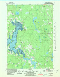
 1982 Green Lake1982 Print · USGSHancock County’s lakelands are shown here in the early eighties, centered on the vacation community of Lucerne-In-Maine. Genealogists and researchers can trace family landmarks like Wilson Corner, Eastern Cem, and Our Lady of the Lake Chapel set against the granite heights of Eagle Bluff.2 unique versions available
 - 1982 Map of Bucksport
 1982 Bucksport1982 Print · USGSThe Penobscot River narrows into a vital maritime corridor at Bucksport in the early eighties. Researchers can trace the layout of Verona Island, the historic batteries of Fort Knox, and family sites at Silver Lake Cem or South Orland.2 unique versions available
 - 1982 Map of Tunk Mountain, 1983 Print
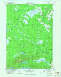 1982 Tunk Mountain1983 Print · USGSCoastal Maine's interior wetlands and granite peaks are documented in the early eighties as industry and nature intersected in the Deblois region. Genealogists and historians can trace family-named sites like Colson Branch Hill, the local Cem, and the old Spring River Dam.2 unique versions available
 - 1982 Map of Molasses Pond, 1983 Print
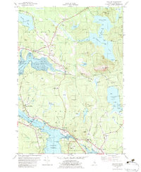
 1982 Molasses Pond1983 Print · USGSHancock County’s intricate interior wetlands and ridges are captured here during the early eighties. Researchers can trace land use through the Lyle Frost Wildlife Management Area and locate family landmarks like Crimmins Cem or Macomber Mill Str.
 - 1982 Map of Bar Harbor, 1983 Print
 1982 Bar Harbor1983 Print · USGSCoastal Maine in the early eighties reveals a bustling maritime landscape centered on the Bar Harbor waterfront and the protected lands of Acadia National Park. Genealogists and historians can trace local landmarks like the Holy Redeemer Ch, the Bragdon Cem, and the old Sorrento Sch.2 unique versions available
 - 1982 Map of North Haven East, 1983 Print
 1982 North Haven East1983 Print · USGSThe Fox Islands archipelago in the early eighties highlights a seafaring community connected by the Fox Islands Thorofare and the North Haven Ferry. Genealogists can trace family lines through the Seaview Cem or explore the landing at The Wood Landing.
 - 1982 Map of Sullivan, 1983 Print
 1982 Sullivan1983 Print · USGSCoastal Hancock County in the early eighties shows a landscape shaped by tidal bays and the MAINE CENTRAL RAILROAD. Genealogists and historians can trace local family roots through sites like York Hill Cemetery, Sullivan Harbor Church, and the many Quarries near North Sullivan.2 unique versions available
 - 1982 Map of Tunk Lake, 1983 Print
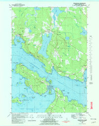
 1982 Tunk Lake1983 Print · USGSHancock and Washington Counties are captured in the early 1980s, centered on the vast waters of Tunk Lake. Researchers can trace the path of the Maine Central railroad and locate historical sites like Big Chief Camps or Goodwin Siding.
 - 1982 Map of Orland, 1983 Print
 1982 Orland1983 Print · USGSHancock County’s coastal interior is captured here in the early eighties, showing the transition from riverfront settlements to inland lakes. Researchers can trace ancestral sites at Back Ridge Cem, visit East Orland, or locate the Craig Brook National Fish Hatchery.
 - 1983 Map of Isle Au Haut West
 1983 Isle Au Haut West1983 Print · USGSThe coastal waters of Knox County in the early 1980s reveal a landscape of secluded island life and maritime heritage. Genealogists and historians can locate family landmarks like Turners Cem or trace the coastline past the Robinson Point Lighthouse and Saddleback Ledge Lighthouse.
 - 1983 Map of Johns Island
 1983 Johns Island1983 Print · USGSCoastal Hancock County in the early eighties is mapped here as an intricate network of remote islands and navigational ledges. Maritime researchers can trace the shorelines of Marshall Island, locate Acadia National Park boundaries on Heron I, and find Steamboat Beach in Frenchboro.
Showing maps 1-25 of 63
Top cities of Hancock County
- Ellsworth historical maps
- Bar Harbor historical maps
- Bucksport historical maps
- Blue Hill historical maps
- Hancock historical maps
- Orland historical maps
See more
Frequently asked questions
- What are the different types of historical maps available for Hancock County?
- What is the oldest map of Hancock County?
- Where can I purchase historical maps of Hancock County for my home or office?
- Where can I download high-res historical maps of Hancock County?
- Are there historical topographic maps available for Hancock County?
- Is there historical aerial imagery available for Hancock County?
- Where are historical maps of Hancock County sourced from?