1950s Maps of Hancock County, Maine
Explore 23 historic maps of Hancock County from the 1950s. These maps offer a rare glimpse into what life looked like during the 1950s — showing old roads, neighborhoods, homes, and landmarks that have changed or disappeared over time.
Whether you're researching your family's past, planning a metal detecting trip, or studying how Hancock County's landscape evolved across the 1950s, these high-resolution maps are a powerful tool for exploring the history of this region.
- Focus on a specific era: All maps on this page are from the 1950s, giving you a focused view of this time period.
- See what’s changed: Compare century-old streets, trails, and buildings to today's modern landscape using overlays and satellite layers.
- Research with precision: Use these maps for genealogy, historical research, land use analysis, or educational projects.
- View, download, or print: Maps are fully viewable online in high resolution, and can be downloaded or printed for your own records.
Start exploring Hancock County's history through authentic maps from the 1950s. This is your window into the past.
Hancock County, ME maps
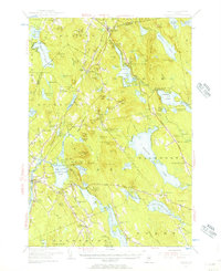
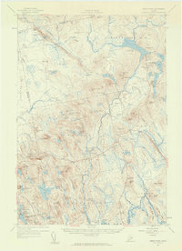
(23)- 1950 Map of Petit Manan
 1950 Petit Manan1950 Print · USGSCoastal Washington and Hancock counties are seen here at mid-century, defined by lobster harbors and the shifting tides of the Atlantic. Researchers can trace family names and local landmarks from Corea to Dyer Harbor, including the Corea Cem and Long Mill Cove.
 - 1950 Map of Cherryfield
 1950 Cherryfield1950 Print · USGSThe Narraguagus River valley and the coastal harbors of Washington County are shown here in the years following World War II. Local historians can trace the Maine Central railroad line through Unionville and Cherryfield, or locate family sites near Evergreen Cem and Steuben Harbor.
 - 1950 Map of Petit Manan
 1950 Petit Manan1950 Print · USGSThe Downeast shoreline around Corea and Pigeon Hill is captured here at the mid-century, before modern development changed the coast. Trace family roots at Corea Cem and explore the historic Carrying Place between the harbor and the sea.
 - 1953 Map of Wabassus Lake, 1984 Print
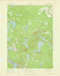
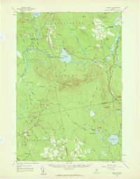
 1953 Wabassus Lake1984 Print · USGSMaine's wilderness townships come to life in this mid-century survey of the interconnected waterways north of the Machias River. Researchers can trace historic forest service landmarks like the State Forest Service Camp or locate the village of Grand Lake Stream and its local cemetery.
 - 1954 Map of Cherryfield
 1954 Cherryfield1954 Print · USGSThe Narraguagus River valley and the coastal reaches of Washington County are shown here in the mid-fifties. Researchers can trace the Maine Central rail line through rural outposts like Unionville and Smithville or locate the Evergreen Cem near the riverbanks.
 - 1954 Map of Millinocket, 1968 Print
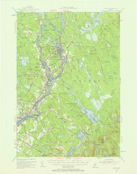
 1954 Millinocket1968 Print · USGSMaine's North Woods and the Penobscot Valley are captured here during the mid-century era of logging and rail dominance. You can trace the path of the Bangor and Aroostook Railroad through timber towns like Millinocket, Mattawamkeag, and Silver Ridge.3 unique versions available
 - 1955 Map of Orland, 1956 Print
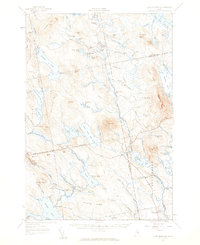
 1955 Orland1956 Print · USGSCoastal Maine in the mid-fifties is captured here as a landscape of interconnected ponds and granite ridges. Genealogists and historians can trace family-named landmarks like Condon Hill, locate the U S Fish Hatchery, and find the Annear Copper Mine.4 unique versions available
 - 1955 Map of Orono, 1957 Print
 1955 Orono1957 Print · USGSThe Penobscot river valley thrived as a center of education and industry in the mid-fifties, anchored by Indian Island and the university. Genealogists and historians can trace family-named sites from French Settlement to Clewleyville Corners and the Old Gold Mine.4 unique versions available
 - 1955 Map of Bucksport, 1957 Print
 1955 Bucksport1957 Print · USGSThe Penobscot River valley thrives as a rail and maritime corridor during the mid-fifties, anchored by the industrial activities at Mt Waldo. Genealogists and historians can locate legacy family sites including Wiswell Cem, Nealys Corner, and the historic Fort Knox State Park.4 unique versions available
 - 1956 Map of Bar Harbor, 1960 Print
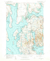
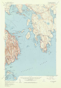 1956 Bar Harbor1960 Print · USGSThe Maine coast in the mid-1950s reveals a landscape defined by seafaring villages and the protected peaks of Acadia National Park. Genealogists and historians can trace coastal life from the streets of Bar Harbor to remote island settlements like Islesford and Gerrishville.3 unique versions available
 - 1956 Map of Mount Desert, 1960 Print
 1956 Mount Desert1960 Print · USGSMount Desert Island and the surrounding Maine coast are shown here in the mid-fifties, before modern expansion altered the local landscape. Genealogists and historians can trace coastal heritage through landmarks like Somesville, Federated Ch, and family sites like Marlboro Cem.4 unique versions available
 - 1956 Map of Bangor, 1966 Print
 1956 Bangor1966 Print · USGSMid-century Maine comes alive in this survey of the rugged coast and river valleys during the 1950s. Genealogists and historians can trace the vital rail corridors of the Maine Central RR connecting timber towns like Old Town to the coast at Bar Harbor.3 unique versions available
 - 1956 Map of Bath, 1974 Print
 1956 Bath1974 Print · USGSCoastal Maine in the mid-fifties reveals a landscape of deep-water harbors and island outposts as the region transitioned from industrial roots to a summer destination. Genealogists can trace maritime families in Boothbay Harbor, Tenants Harbor, and on remote Monhegan Island.
 - 1957 Map of Bath
 1957 Bath1957 Print · USGSThe Maine coast in the mid-fifties is captured here, from the shipbuilding hubs of Bath and Brunswick to the granite reaches of Rockland. Researchers can trace the Maine Central RR line and remote island outposts like Monhegan Island and Matinicus Isle.
 - 1957 Map of Tunk Lake, 1959 Print
 1957 Tunk Lake1959 Print · USGSCoastal Maine in the late 1950s shows a landscape defined by the Maine Central RR and tidal waters like Hog Bay. Local historians can trace family locations near Bayview Cem, the Union Ch, and settlements from Deblois to East Sullivan.4 unique versions available
 - 1957 Map of Ellsworth, 1959 Print
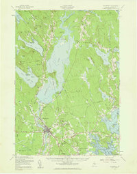 1957 Ellsworth1959 Print · USGSHancock County at the end of the fifties shows the critical transition from rail-dependent industry to the modern highway era. Researchers can trace historic family burial sites and rural schoolhouses, including Hillside Cem, Stetson Sch, and the junctions of the Maine Central Railroad.3 unique versions available
 - 1957 Map of Blue Hill, 1959 Print
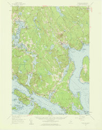 1957 Blue Hill1959 Print · USGSCoastal Hancock County in the late fifties reveals a maritime world of interconnected bays and small village centers. Genealogists and historians can trace family roots through sites like Number Three Chapel, Forest Home Cem, and the old docks at South Blue Hill.4 unique versions available
 - 1957 Map of Great Pond, 1959 Print
 1957 Great Pond1959 Print · USGSHancock County's interior townships are shown here in the late fifties as military recreation and training sites integrated with traditional rural settlements. Researchers can locate the Hadley Cem and several community schools like Monticello Sch and Caruso Sch.4 unique versions available
 - 1957 Map of Saponac, 1959 Print
 1957 Saponac1959 Print · USGSPenobscot and Hancock counties are shown here in the late fifties, during a period of rural stability in the Maine north woods. Researchers can locate family landmarks like Mt Repose Cem, the Thirty-Nine Tannery, and the Corner Sch in Lowell.4 unique versions available
 - 1957 Map of Lead Mountain, 1959 Print
 1957 Lead Mountain1959 Print · USGSThe wild lake country of Down East Maine is shown here in the late fifties, featuring the scattered outposts and high ridges of Washington and Hancock Counties. Genealogists and researchers can trace local landmarks like Beddington, Dog Corners, and the prominent Lookout Tower atop Lead Mtn.3 unique versions available
 - 1957 Map of Fredericton, 1981 Print
 1957 Fredericton1981 Print · USGSThe New Brunswick and Maine borderlands come into focus in the mid-fifties, dominated by the Saint John River and massive military tracts. Genealogists can locate riverfront hamlets like Maugerville or inland sites like Scotch Settlement along the Canadian Pacific rail line.
 - 1958 Map of Bath
 1958 Bath1958 Print · USGSCoastal Maine in the late fifties reveals a landscape of industrial river towns and remote island outposts. Genealogists and historians can trace the Maine Central RR through Bath, explore the islands of Muscongus Bay, or locate seafaring families at Pemaquid Point.
 - 1958 Map of Millinocket
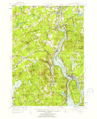
 1958 Millinocket1958 Print · USGSMaine's North Woods and the Penobscot river valley are captured here in the mid-1950s, showing a landscape of timber, rail, and wild waters. Researchers can trace the legacy of the Canadian Pacific railroad and find historic settlements like Millinocket, Sherman Station, and Mattawamkeag.
End of results
Showing maps 1-23 of 23
Top cities of Hancock County
- Ellsworth historical maps
- Bar Harbor historical maps
- Bucksport historical maps
- Blue Hill historical maps
- Hancock historical maps
- Orland historical maps
See more
Frequently asked questions
- What are the different types of historical maps available for Hancock County?
- What is the oldest map of Hancock County?
- Where can I purchase historical maps of Hancock County for my home or office?
- Where can I download high-res historical maps of Hancock County?
- Are there historical topographic maps available for Hancock County?
- Is there historical aerial imagery available for Hancock County?
- Where are historical maps of Hancock County sourced from?