Old Maps of Cushing, Maine for Hiking & Exploration
Hike through history with 47 historic maps of Cushing. Explore old trails, ghost towns, and forgotten backroads — perfect for outdoor adventurers and local explorers.
- Rediscover forgotten places: Map out old mining camps, roads, and footpaths that no longer exist on modern maps.
- Layer with modern tools: Combine with LiDAR or satellite views to plan hikes through historical terrain.
- Made for exploration: Popular among hikers, overlanders, and local history lovers.
Use these maps to find adventure and explore the hidden past of Cushing.
Cushing, ME maps
(47)- 1904 Map of Monhegan, 1958 Print
 1904 Monhegan1958 Print · USGSThe Maine coast near Muscongus Bay is captured here during the heyday of coastal steamboats and lighthouse keepers. Genealogists and historians can trace families across Louds Island, Bremen Long Island, and the remote fishing community on Monhegan.
 - 1904 Map of Tenants Harbor, 1960 Print
 1904 Tenants Harbor1960 Print · USGSCoastal Maine at the turn of the century reveals a seafaring landscape shaped by granite islands and protected harbors. Genealogists and historians can trace old coastal settlements like Martinsville and Elmore or navigate the intricate Muscle Ridge Channel.
 - 1904 Map of Rockland, 1961 Print
 1904 Rockland1961 Print · USGSCoastal Knox County comes alive in this early twentieth-century survey of the harbor towns and the rocky Penobscot Bay shoreline. Trace the routes of the Maine Central RR and ELECTRIC lines to historic settlements like Blackinton Corners and Sharkeyville.
 - 1906 Map of Tennant Harbor
 1906 Tennant Harbor1906 Print · USGSThe coastal waters of Knox County were a bustling corridor for maritime trade in the early 1900s. Genealogists and historians can trace the foundations of Tennant Harbor and Martinsville, while mapping the precise locations of offshore hazards like Roaring Bull and Metinic Island.4 unique versions available
 - 1906 Map of Monhegan
 1906 Monhegan1906 Print · USGSThe Maine coast at the turn of the century reveals a seafaring landscape of island outposts and sheltered harbors. Trace early maritime routes and family-named landmarks from Port Clyde to the isolated Monhegan Island.5 unique versions available
 - 1906 Map of Rockland
 1906 Rockland1906 Print · USGSCoastal Knox County comes alive in the first decade of the century, showing a bustling network of harbors and early transit systems. Genealogists and historians can trace family roots through crossroads like Blackinton Corners or investigate the old Wattons Mill and the Electric RR lines.7 unique versions available
 - 1913 Map of Waldoboro
 1913 Waldoboro1913 Print · USGSCoastal Lincoln and Knox counties come alive in this pre-war survey, showing a landscape of tightly-knit villages and rural school districts connected by the river and rail. Researchers can trace ancestral footprints at the Old Dutch Church, Winslows Mills, and the Benners Corner Cem.2 unique versions available
 - 1915 Map of Waldoboro
 1915 Waldoboro1915 Print · USGSCoastal Lincoln County is surveyed here in the early twentieth century, showing a landscape defined by tidal rivers and small farming hamlets. Genealogists can locate family-named sites like Flanders Corner and rural institutions such as the Branch School and Broad Cove PO.5 unique versions available
 - 1941 Map of Rockland
 1941 Rockland1941 Print · USGSThe Knox County shoreline during the early 1940s features a detailed look at maritime life and coastal industry. Genealogists and historians can trace the foundations of Rockland, locate the Rockland Breakwater Lighthouse, and explore villages like South Thomaston and Wattons Mill.
 - 1941 Map of Waldoboro
 1941 Waldoboro1941 Print · USGSThe Medomak River valley and its surrounding coastal hills are captured here just as the war began. You can trace early twentieth-century rail connections at Glendon Station, find family-named crossroads like Whitney Corner, and locate local landmarks such as Winslows Mills.
 - 1948 Map of Bangor
 1948 Bangor1948 Print · USGSThe Maine coast and its industrial river valleys are captured here shortly after the war, showing the vital shipping and rail hubs of the late 1940s. Genealogists and historians can trace the tracks of the Maine Central RR connecting Bangor, Augusta, and Old Town.
 - 1948 Map of Bath
 1948 Bath1948 Print · USGSMid-coast Maine’s intricate shoreline and island outposts are captured here just after the war. Researchers can trace historic maritime settlements from Bath to Friendship and locate remote landmarks like Monhegan Island and Pemaquid Point.2 unique versions available
 - 1950 Map of Waldoboro
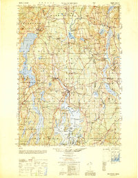 1950 Waldoboro1950 Print · USGSThe Medomak River valley and the coastal hills of Lincoln County are captured here in the mid-century, prior to modern suburban expansion. Genealogists and historians can locate old landmarks like Nobleboro Station, Winslow Mills, and numerous neighborhood schools like Duckpuddle Sch.
 - 1955 Map of Thomaston, 1959 Print
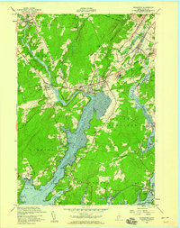 1955 Thomaston1959 Print · USGSThe Knox County coast is captured here in the mid-1950s, centered on the historic riverfront at Thomaston. Genealogists and historians can trace family burial sites like The Village Cemetery or locate landmarks such as the State Prison Farm.5 unique versions available
 - 1955 Map of Tenants Harbor, 1959 Print
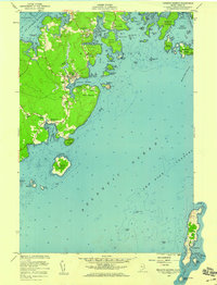 1955 Tenants Harbor1959 Print · USGSThe Knox County shoreline in the mid-fifties remains a world of working harbors and seafaring history. Genealogists and historians can trace family locations near Tenants Harbor, Martinsville, and the remote Metinic Island, or locate landmarks like Ridge Ch and Seaside Cem.5 unique versions available
 - 1955 Map of Friendship, 1959 Print
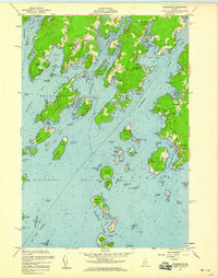 1955 Friendship1959 Print · USGSThe Maine coast near Friendship and Port Clyde is captured here during the mid-fifties, showing a landscape of working harbors and tidal rivers. Genealogists and historians can trace coastal family sites near Harbor Cem or the U S Coast Guard Station at the edge of the Georges Islands.3 unique versions available
 - 1956 Map of Bangor, 1966 Print
 1956 Bangor1966 Print · USGSMid-century Maine comes alive in this survey of the rugged coast and river valleys during the 1950s. Genealogists and historians can trace the vital rail corridors of the Maine Central RR connecting timber towns like Old Town to the coast at Bar Harbor.3 unique versions available
 - 1956 Map of Bath, 1974 Print
 1956 Bath1974 Print · USGSCoastal Maine in the mid-fifties reveals a landscape of deep-water harbors and island outposts as the region transitioned from industrial roots to a summer destination. Genealogists can trace maritime families in Boothbay Harbor, Tenants Harbor, and on remote Monhegan Island.
 - 1957 Map of Bath
 1957 Bath1957 Print · USGSThe Maine coast in the mid-fifties is captured here, from the shipbuilding hubs of Bath and Brunswick to the granite reaches of Rockland. Researchers can trace the Maine Central RR line and remote island outposts like Monhegan Island and Matinicus Isle.
 - 1958 Map of Bath
 1958 Bath1958 Print · USGSCoastal Maine in the late fifties reveals a landscape of industrial river towns and remote island outposts. Genealogists and historians can trace the Maine Central RR through Bath, explore the islands of Muscongus Bay, or locate seafaring families at Pemaquid Point.
 - 1960 Map of Bangor
 1960 Bangor1960 Print · USGSCentral Maine in the sixties reveals a landscape of river-powered industry and sprawling coastal island chains. Researchers can trace the rail corridors of the Maine Central or locate mid-century aviation landmarks like Dow Air Force Base.
 - 1961 Map of Bangor
 1961 Bangor1961 Print · USGSMid-century Maine comes alive through its busy river ports and rocky archipelagoes during a period of steady maritime and rail commerce. Researchers can trace the path of the Maine Central railroad and locate coastal landmarks from Acadia National Park to Vinalhaven Island.
 - 1963 Map of Bath
 1963 Bath1963 Print · USGSThe Maine Midcoast in the early sixties remains a world of tidal rivers and jagged peninsulas tied to the sea. Genealogy and local history researchers can trace the rail lines of the Maine Central RR and locate offshore communities like Matinicus Island and Monhegan.2 unique versions available
 - 1965 Map of Bath
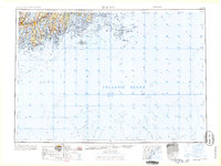 1965 Bath1965 Print · USGSThe Midcoast Maine shoreline and its archipelago come alive in the mid-1960s, showing the region's deep reliance on river and rail. Researchers can trace historic harbor towns like Boothbay Harbor and Damariscotta, and locate coastal landmarks from Pemaquid Point to the Fort Popham Military Res.
 - 1965 Map of Waldoboro East, 1968 Print
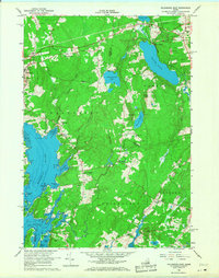 1965 Waldoboro East1968 Print · USGSCoastal Maine in the mid-1960s reveals a landscape defined by tidal rivers and the Maine Central rail line. Genealogists and local historians can trace small settlements and family landmarks from South Waldoboro to the Cushing Sch and Warren Station.3 unique versions available
Showing maps 1-25 of 47
Top cities near Cushing
- Rockland historical maps
- Warren historical maps
- Camden historical maps
- Rockport historical maps
- Bristol historical maps
- Thomaston historical maps
See more
Top neighborhoods of Cushing
Frequently asked questions
- What are the different types of historical maps available for Cushing?
- What is the oldest map of Cushing?
- Where can I purchase historical maps of Cushing for my home or office?
- Where can I download high-res historical maps of Cushing?
- Are there historical topographic maps available for Cushing?
- Is there historical aerial imagery available for Cushing?
- Where are historical maps of Cushing sourced from?