Old Maps of Bethel, Maine for Genealogy
Trace your family roots with 24 historic maps of Bethel. These high-res maps reveal old neighborhoods, homesites, landmarks, and streets — helping you uncover where your ancestors lived and how the area evolved over time.
- Explore historic neighborhoods: Identify where your relatives may have lived in the 1800s or 1900s.
- Compare maps over time: Trace the changes in streets, buildings, and landmarks for multi-generational research.
- Perfect for genealogy & ancestry research: Used by family historians and researchers to map out lineage and migration.
These maps are an incredible resource for exploring your personal connection to Bethel's past.
Bethel, ME maps
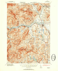
(24)- 1911 Map of Bryant Pond, 1953 Print
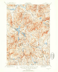 1911 Bryant Pond1953 Print · USGSCovers Bethel, including Paris, Norway, and other nearby areas3 unique versions available
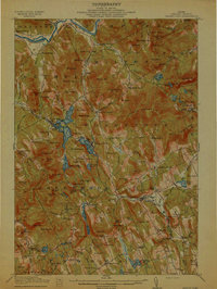
 - 1914 Map of Bethel
 1914 Bethel1914 Print · USGSCovers Bethel, including Waterford, Lovell, and other nearby areas5 unique versions available
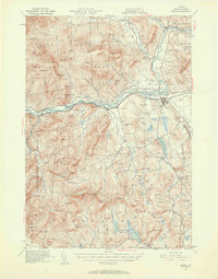
 - 1914 Map of Bryant Pond
 1914 Bryant Pond1914 Print · USGSCovers Bethel, including Paris, Norway, and other nearby areas4 unique versions available
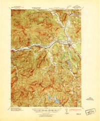
 - 1940 Map of Bethel, 1958 Print
 1940 Bethel1958 Print · USGSCovers Bethel, including Waterford, Lovell, and other nearby areas2 unique versions available
 - 1941 Map of Bethel
 1941 Bethel1941 Print · USGSCovers Bethel, including Waterford, Lovell, and other nearby areas
 - 1942 Map of Bryant Pond
 1942 Bryant Pond1942 Print · USGSCovers Bethel, including Paris, Norway, and other nearby areas
 - 1950 Map of Lewiston
 1950 Lewiston1950 Print · USGSCovers Bethel, including Lewiston, Auburn, and other nearby areas2 unique versions available
 - 1953 Map of Bethel
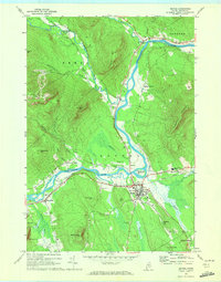
 1953 Bethel1953 Print · USGSCovers Bethel, including Waterford, Lovell, and other nearby areas2 unique versions available
 - 1956 Map of Lewiston, 1975 Print
 1956 Lewiston1975 Print · USGSCovers Bethel, including Lewiston, Auburn, and other nearby areas
 - 1961 Map of Lewiston
 1961 Lewiston1961 Print · USGSCovers Bethel, including Lewiston, Auburn, and other nearby areas
 - 1962 Map of Lewiston
 1962 Lewiston1962 Print · USGSCovers Bethel, including Lewiston, Auburn, and other nearby areas
 - 1967 Map of Bryant Pond, 1969 Print
 1967 Bryant Pond1969 Print · USGSCovers Bethel, including Rumford, Woodstock, and other nearby areas3 unique versions available
 - 1969 Map of Lewiston
 1969 Lewiston1969 Print · USGSCovers Bethel, including Lewiston, Auburn, and other nearby areas
 - 1970 Map of Gilead, 1972 Print
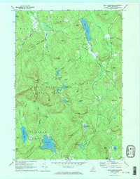
 1970 Gilead1972 Print · USGSCovers Bethel, including Newry, Gilead, and other nearby areas
 - 1970 Map of East Stoneham, 1972 Print
 1970 East Stoneham1972 Print · USGSCovers Bethel, including Waterford, Lovell, and other nearby areas2 unique versions available
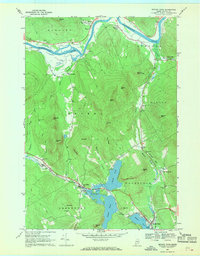
 - 1970 Map of Bethel, 1972 Print
 1970 Bethel1972 Print · USGSCovers Bethel, including Greenwood, Newry, and other nearby areas2 unique versions available
 - 1986 Map of Lewiston
 1986 Lewiston1986 Print · USGSCovers Bethel, including Lewiston, Auburn, and other nearby areas2 unique versions available
 - 1995 Map of Gilead, 2000 Print
 1995 Gilead2000 Print · USGSCovers Bethel, including Newry, Gilead, and other nearby areas
 - 1995 Map of Bethel, 2000 Print
 1995 Bethel2000 Print · USGSCovers Bethel, including Greenwood, Newry, and other nearby areas
 - 1995 Map of East Stoneham, 2000 Print
 1995 East Stoneham2000 Print · USGSCovers Bethel, including Waterford, Lovell, and other nearby areas
 - 2024 Map of Bethel, 2024 Print
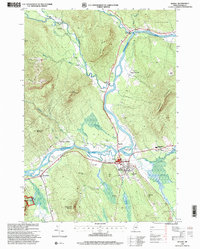
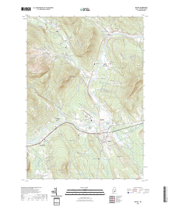 2024 Bethel2024 Print · USGSCovers Bethel, including Greenwood, Newry, and other nearby areas
 - 2024 Map of East Stoneham, 2024 Print
 2024 East Stoneham2024 Print · USGSCovers Bethel, including Waterford, Lovell, and other nearby areas
 - 2024 Map of Bryant Pond, 2024 Print
 2024 Bryant Pond2024 Print · USGSCovers Bethel, including Rumford, Woodstock, and other nearby areas
 - 2024 Map of Gilead, 2024 Print
 2024 Gilead2024 Print · USGSCovers Bethel, including Newry, Gilead, and other nearby areas
End of results
Showing maps 1-24 of 24
Top cities near Bethel
- Paris historical maps
- Norway historical maps
- Rumford historical maps
- Oxford historical maps
- Mexico historical maps
- West Paris historical maps
See more
Top neighborhoods of Bethel
- West Bethel historical maps
- Mayville historical maps
- Middle Intervale historical maps
- North Bethel historical maps
- Northwest Bethel historical maps
- East Bethel historical maps
Frequently asked questions
- What are the different types of historical maps available for Bethel?
- What is the oldest map of Bethel?
- Where can I purchase historical maps of Bethel for my home or office?
- Where can I download high-res historical maps of Bethel?
- Are there historical topographic maps available for Bethel?
- Is there historical aerial imagery available for Bethel?
- Where are historical maps of Bethel sourced from?