2000s (21st Century) Maps of Newry, Maine
Explore 26 historic maps of Newry from the 2000s (21st Century). These maps offer a rare glimpse into what life looked like during the 2000s — showing old roads, neighborhoods, homes, and landmarks that have changed or disappeared over time.
Whether you're researching your family's past, planning a metal detecting trip, or studying how Newry's landscape evolved across the 2000s, these high-resolution maps are a powerful tool for exploring the history of this region.
- Focus on a specific era: All maps on this page are from the 2000s, giving you a focused view of this time period.
- See what’s changed: Compare century-old streets, trails, and buildings to today's modern landscape using overlays and satellite layers.
- Research with precision: Use these maps for genealogy, historical research, land use analysis, or educational projects.
- View, download, or print: Maps are fully viewable online in high resolution, and can be downloaded or printed for your own records.
Start exploring Newry's history through authentic maps from the 2000s. This is your window into the past.
Newry, ME maps
(26)- 2000 Map of Old Speck Mountain, 2001 Print
 2000 Old Speck Mountain2001 Print · USGSOxford County at the turn of the millennium is captured here in this survey of the northern Mahoosucs. Hikers and historians can trace the Appalachian Trail through Grafton Notch State Park to landmarks like Screw Auger Falls and the remote outpost at Ketchum.
 - 2011 Map of Old Speck Mountain, 2011 Print
 2011 Old Speck Mountain2011 Print · USGSCovers Newry, including Ketchum, Grafton Township, and other nearby areas
 - 2011 Map of Puzzle Mountain, 2011 Print
 2011 Puzzle Mountain2011 Print · USGSCovers Newry, including Andover, Hanover, and other nearby areas
 - 2011 Map of East Andover, 2011 Print
 2011 East Andover2011 Print · USGSCovers Newry, including Rumford, Andover, and other nearby areas
 - 2012 Map of Gilead, 2012 Print
 2012 Gilead2012 Print · USGSCovers Newry, including Bethel, Gilead, and other nearby areas
 - 2012 Map of Bethel, 2012 Print
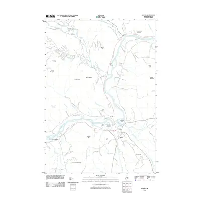 2012 Bethel2012 Print · USGSCovers Newry, including Bethel, Greenwood, and other nearby areas
 - 2014 Map of Old Speck Mountain, 2014 Print
 2014 Old Speck Mountain2014 Print · USGSCovers Newry, including Ketchum, Grafton Township, and other nearby areas
 - 2014 Map of Gilead, 2014 Print
 2014 Gilead2014 Print · USGSCovers Newry, including Bethel, Gilead, and other nearby areas
 - 2014 Map of Bethel, 2014 Print
 2014 Bethel2014 Print · USGSCovers Newry, including Bethel, Greenwood, and other nearby areas
 - 2014 Map of Puzzle Mountain, 2014 Print
 2014 Puzzle Mountain2014 Print · USGSCovers Newry, including Andover, Hanover, and other nearby areas
 - 2014 Map of East Andover, 2014 Print
 2014 East Andover2014 Print · USGSCovers Newry, including Rumford, Andover, and other nearby areas
 - 2018 Map of Bethel, 2018 Print
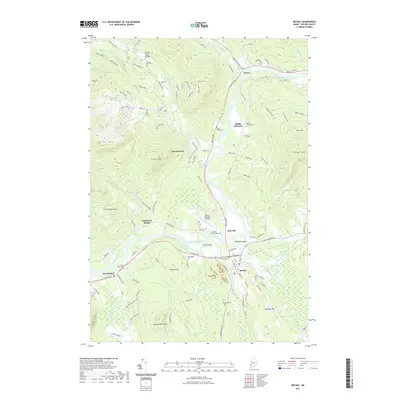
 2018 Bethel2018 Print · USGSCovers Newry, including Bethel, Greenwood, and other nearby areas
 - 2018 Map of East Andover, 2018 Print
 2018 East Andover2018 Print · USGSCovers Newry, including Rumford, Andover, and other nearby areas
 - 2018 Map of Puzzle Mountain, 2018 Print
 2018 Puzzle Mountain2018 Print · USGSCovers Newry, including Andover, Hanover, and other nearby areas
 - 2018 Map of Gilead, 2018 Print
 2018 Gilead2018 Print · USGSCovers Newry, including Bethel, Gilead, and other nearby areas
 - 2018 Map of Old Speck Mountain, 2018 Print
 2018 Old Speck Mountain2018 Print · USGSCovers Newry, including Ketchum, Grafton Township, and other nearby areas
 - 2021 Map of Puzzle Mountain, 2021 Print
 2021 Puzzle Mountain2021 Print · USGSCovers Newry, including Andover, Hanover, and other nearby areas
 - 2021 Map of East Andover, 2021 Print
 2021 East Andover2021 Print · USGSCovers Newry, including Rumford, Andover, and other nearby areas
 - 2021 Map of Bethel, 2021 Print
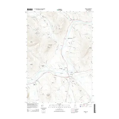
 2021 Bethel2021 Print · USGSCovers Newry, including Bethel, Greenwood, and other nearby areas
 - 2021 Map of Old Speck Mountain, 2021 Print
 2021 Old Speck Mountain2021 Print · USGSCovers Newry, including Ketchum, Grafton Township, and other nearby areas
 - 2021 Map of Gilead, 2021 Print
 2021 Gilead2021 Print · USGSCovers Newry, including Bethel, Gilead, and other nearby areas
 - 2024 Map of Bethel, 2024 Print
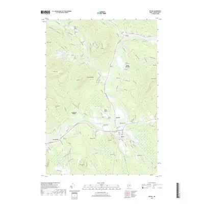
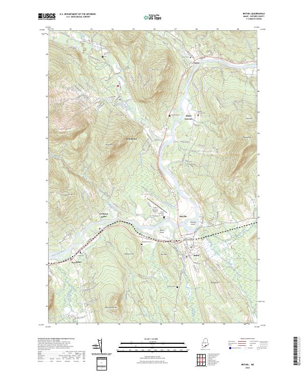 2024 Bethel2024 Print · USGSOxford County mountain communities and the winding Androscoggin River are documented in this contemporary survey. Researchers can trace ancestral sites at Grafton Cem and Skillingston Cem or locate the historic St Lawrence & Atlantic RR line.
 - 2024 Map of Puzzle Mountain, 2024 Print
 2024 Puzzle Mountain2024 Print · USGSOxford County’s high ridges and river valleys are captured in this modern survey of the Newry region. Genealogists and hikers can trace local landmarks like Powers Cem and the peaks of Puzzle Mtn or Plumbago Mtn above the Bear River.
 - 2024 Map of Old Speck Mountain, 2024 Print
 2024 Old Speck Mountain2024 Print · USGSThe Mahoosuc Range and Grafton Notch are documented in this 2024 survey of Oxford County. Trace the Appalachian National Scenic Trail past Speck Pond to the remote settlement of Ketchum and Screw Auger Falls Gorge.
 - 2024 Map of East Andover, 2024 Print
 2024 East Andover2024 Print · USGSThe Ellis River valley in Oxford County is captured here in its modern rural character. Local historians can trace family burial sites from Woodlawn Cem down to Rumford Point Cem, alongside landmarks like Covered Bridge Rd.
Showing maps 1-25 of 26
Top cities near Newry
- Norway historical maps
- Rumford historical maps
- Mexico historical maps
- Bethel historical maps
- West Paris historical maps
- Woodstock historical maps
See more
Top neighborhoods of Newry
Frequently asked questions
- What are the different types of historical maps available for Newry?
- What is the oldest map of Newry?
- Where can I purchase historical maps of Newry for my home or office?
- Where can I download high-res historical maps of Newry?
- Are there historical topographic maps available for Newry?
- Is there historical aerial imagery available for Newry?
- Where are historical maps of Newry sourced from?