1990s Maps of Stow, Maine
Explore 5 historic maps of Stow from the 1990s. These maps offer a rare glimpse into what life looked like during the 1990s — showing old roads, neighborhoods, homes, and landmarks that have changed or disappeared over time.
Whether you're researching your family's past, planning a metal detecting trip, or studying how Stow's landscape evolved across the 1990s, these high-resolution maps are a powerful tool for exploring the history of this region.
- Focus on a specific era: All maps on this page are from the 1990s, giving you a focused view of this time period.
- See what’s changed: Compare century-old streets, trails, and buildings to today's modern landscape using overlays and satellite layers.
- Research with precision: Use these maps for genealogy, historical research, land use analysis, or educational projects.
- View, download, or print: Maps are fully viewable online in high resolution, and can be downloaded or printed for your own records.
Start exploring Stow's history through authentic maps from the 1990s. This is your window into the past.
Stow, ME maps
(5)- 1995 Map of Speckled Mountain, 2000 Print
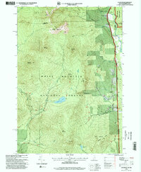
 1995 Speckled Mountain2000 Print · USGSOxford County, Maine, is shown in the mid-1990s as a landscape of protected wilderness and mountain trails within the White Mountain National Forest. Researchers can trace the settlement at Hastings, locate a local Cemetery, and follow the Highwater Trail past Kees Falls.
 - 1995 Map of North Conway East, 2000 Print
 1995 North Conway East2000 Print · USGSThe eastern White Mountains meet the Maine border in the 1990s, centering on the outdoor-recreation hub of North Conway. Local historians can trace the Conway Scenic Railway, explore the footpaths of the Weeks Brook Trail, or locate landmarks like Redstone Ledge and Mineral Spring.
 - 1995 Map of Center Lovell, 2000 Print
 1995 Center Lovell2000 Print · USGSThe Kezar Lake region of Oxford County appears in detail during the mid-nineties, showing the balance between the White Mountain wilderness and lakeside village life. Researchers can locate family landmarks like Smith Cem, Lord Cem, and the old Bemis Cem - Bradley Church.
 - 1995 Map of Wild River, 2000 Print
 1995 Wild River2000 Print · USGSThe White Mountains come alive in the 1990s as this map traces the intricate trail networks and wilderness reaches across the New Hampshire and Maine state line. Researchers can locate remote landmarks like the Brickett Place or trace the Appalachian Trail as it passes Middle Moriah Mountain.
 - 1995 Map of Chatham, 2000 Print
 1995 Chatham2000 Print · USGSChatham and the White Mountain high country are captured here in the mid-1990s as a haven for hikers and remote settlers. Researchers can trace the trails and summits of Sable Mountain or locate the Cold River AMC Camp and local cemeteries.
End of results
Showing maps 1-5 of 5
Top cities near Stow
- Bridgton historical maps
- Conway historical maps
- Fryeburg historical maps
- Bartlett historical maps
- Gorham historical maps
- Bethel historical maps
See more
Top neighborhoods of Stow
Frequently asked questions
- What are the different types of historical maps available for Stow?
- What is the oldest map of Stow?
- Where can I purchase historical maps of Stow for my home or office?
- Where can I download high-res historical maps of Stow?
- Are there historical topographic maps available for Stow?
- Is there historical aerial imagery available for Stow?
- Where are historical maps of Stow sourced from?