Old Maps of Stow, Maine for Metal Detecting
Plan your next treasure hunt with 64 historic maps of Stow. Find old homesites, ghost towns, trails, and gathering spots that may be lost to time — perfect for identifying promising metal detecting locations.
- Locate forgotten sites: Uncover places like long-lost settlements, abandoned rail lines, or gathering spots.
- Plan better hunts: Use map overlays combined with LiDAR or satellite views to narrow in on historically rich areas.
- Made for detectorists: Thousands of hobbyists use these maps to discover relics, coins, and hidden history.
Use these historic maps to boost your research and find new opportunities beneath the surface of Stow.
Stow, ME maps
(64)- 1893 Map of Gorham
 1893 Gorham1893 Print · USGSThe northern White Mountains at the height of the 1890s show a landscape shaped by early tourism and the timber industry. Genealogists and hikers can trace historic routes like Madison Path and locate vanished landmarks such as Glen House or the rail yards at Berlin Fall.8 unique versions available
 - 1894 Map of North Conway
 1894 North Conway1894 Print · USGSThe Saco River valley and the eastern White Mountains were at a pivotal moment in the 1890s as rail travel and local industry expanded. Genealogists and hikers can trace old routes near North Conway, the granite works at Redstone, and landmarks like Cathedral Ledge.
 - 1896 Map of North Conway
 1896 North Conway1896 Print · USGSCarroll County and the surrounding New Hampshire-Maine borderlands are captured here during the peak of the Victorian mountain tourism and rail era. Researchers can trace the dual rail lines serving North Conway and locate long-standing settlements like Jackson, Redstone, and Lower Bartlett.9 unique versions available
 - 1896 Map of Gorham
 1896 Gorham1896 Print · USGSThe White Mountains were a bustling hub of rail activity and early tourism in the 1890s as industry met the wilderness. Genealogists and hikers can trace the original routes of the Grand Trunk Railroad, find the historic Glen House, and locate landmarks like Berlin Falls.
 - 1909 Map of Fryeburg, 1960 Print
 1909 Fryeburg1960 Print · USGSOxford County and the borderlands of Maine and New Hampshire were defined by the shifting waters of the Saco and the Kezar at the century's turn. Genealogists can trace family homesteads near the Battle Monument or locate rural schoolhouses like Foxboro School and Menotomy School.3 unique versions available
 - 1911 Map of Fryeburg
 1911 Fryeburg1911 Print · USGSOxford County at the start of the century shows a landscape of lake-fed valleys and the bustling rail corridor of the Maine Central RR. Genealogists and historians can trace old school districts like Foxboro School, local landmarks like the Battle Monument, and early settlements at Slab City and Lynchville.6 unique versions available
 - 1914 Map of Bethel
 1914 Bethel1914 Print · USGSOxford County mountain life and river valley commerce converge in this pre-World War I survey of the Bethel region. Genealogists and historians can trace old homestead paths to the Town House, several rural schoolhouses like Dresser School, and the path of the Grand Trunk R R.5 unique versions available
 - 1937 Map of Gorham
 1937 Gorham1937 Print · USGSNew Hampshire's high peaks and river valleys are shown in detail during the late 1930s as the regional economy balanced rail industry with forest conservation. Genealogists and hikers can trace the Appalachian Trail, locate Civilian Conservation Corps sites like CCC Camp Gorham, and study the industrial corridors of the Grand Trunk Railway.6 unique versions available
 - 1940 Map of Bethel, 1958 Print
 1940 Bethel1958 Print · USGSOxford County at the dawn of the 1940s reveals a landscape of river-valley farming and mountain timberlands. Genealogists and local historians can locate early district schools like Sunday River Sch, the Town House in Albany, and mountain notches like Tyler Notch.2 unique versions available
 - 1941 Map of Bethel
 1941 Bethel1941 Print · USGSOxford County was a landscape of mountain ridges and narrow river valleys just before the mid-century, centered on the Androscoggin River. Genealogists can trace family names and rural landmarks like the Bethel Cem, Mason School, and the village at Town House.
 - 1941 Map of Fryeburg
 1941 Fryeburg1941 Print · USGSOxford County and the Maine-New Hampshire borderlands are captured here just before the war, showcasing a landscape of isolated hills and interconnected lakes. Genealogists can locate family-named landmarks like Mc Daniels Hill and numerous rural schools including Plummer Sch and Black Mountain Sch.
 - 1942 Map of Gorham
 1942 Gorham1942 Print · USGSIn the early 1940s, the high peaks of the New Hampshire border region were already a hub for hikers and rail travel. Trace the historical routes of the Appalachian Trail and find landmarks like the Mascot Mine, the Glen House, and the Grand Trunk railroad.3 unique versions available
 - 1942 Map of North Conway, 1956 Print
 1942 North Conway1956 Print · USGSThe Saco River valley at the onset of the 1940s shows a landscape balancing timber heritage with growing mountain tourism. Researchers can trace historic rail lines like the Maine Central RR, locate the Eastman Sch, or find early wilderness outposts like the Black Mtn Cabin.4 unique versions available
 - 1945 Map of North Conway
 1945 North Conway1945 Print · USGSThe Mount Washington Valley comes alive in the mid-1940s, showing the early infrastructure of the White Mountains' famous resort villages. Genealogists and historians can locate family landmarks like the Eastman Sch, the Panno Place, and the rail junction at Intervale.3 unique versions available
 - 1950 Map of Lewiston
 1950 Lewiston1950 Print · USGSThe Maine and New Hampshire borderlands come alive in this post-war survey of the White Mountains and Androscoggin valley. Genealogists and historians can trace rail lines like the Maine Central Railroad and find high-altitude landmarks from Mount Washington to Bretton Woods.2 unique versions available
 - 1953 Map of Bethel
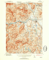 1953 Bethel1953 Print · USGSThe Androscoggin River valley is captured here in the early 1950s, showing the agricultural and mountain landscape of Oxford County. Local historians can trace old community hubs like Bethel, Gilead, and Hanover, along with numerous rural schoolhouses such as Chapman Sch and Peabody Sch.2 unique versions available
 - 1956 Map of Lewiston, 1975 Print
 1956 Lewiston1975 Print · USGSThe Northern New England interior is documented here in the mid-fifties, from the industrial Androscoggin River to the high peaks of the White Mountains. Trace the Grand Trunk Railway through mountain passes or locate family landmarks near Sabbathday Lake and Bretton Woods.
 - 1961 Map of Lewiston
 1961 Lewiston1961 Print · USGSWestern Maine and the White Mountains appear here during the early sixties, showing the industrial river towns and vast timberlands before the modern interstate era. Genealogists and historians can trace the Grand Trunk RR through Berlin or locate landmarks like Old Speck Mountain and Elephant Mountain.
 - 1962 Map of Lewiston
 1962 Lewiston1962 Print · USGSThe industrial river valleys and high peaks of Maine and New Hampshire define the region in the early sixties. Trace the rail-and-river network from Lewiston to the White Mountains, passing through mill towns like Berlin and Rumford.
 - 1963 Map of Center Lovell, 1965 Print
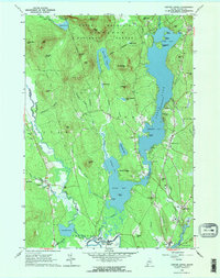 1963 Center Lovell1965 Print · USGSOxford County at the start of the 1960s shows a landscape of deep glacial lakes and forested peaks within the White Mountain National Forest. Researchers can locate historic family sites like the Smith Cem and Lord Cem, or trace the winding Old Course Saco River.2 unique versions available
 - 1963 Map of Fryeburg, 1965 Print
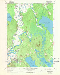 1963 Fryeburg1965 Print · USGSOxford County settlement and the meandering Saco River define this mid-century survey of the Maine-New Hampshire border. Genealogists and local historians can locate numerous family burial grounds like Riverside Cem and Wiley Cem, along with landmarks like Fryeburg Academy.2 unique versions available
 - 1969 Map of Lewiston
 1969 Lewiston1969 Print · USGSThe northern New England highlands come into focus during the mid-fifties, showing the vital rail and river networks connecting industrial centers to the deep woods. Researchers can trace the path of the Grand Trunk RR or locate landmarks like Mt Washington and Rangeley Lake.
 - 1970 Map of Speckled Mountain, 1972 Print
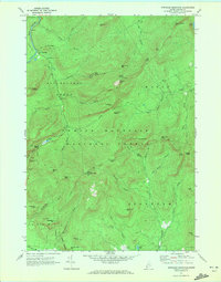 1970 Speckled Mountain1972 Print · USGSThe Maine backcountry in the early seventies reveals a landscape transition from timber extraction to forest recreation. Researchers can trace the layout of the Speckled Mtn Lookout Tower, the Hastings settlement, and several scenic Cold River Overlook sites.4 unique versions available
 - 1970 Map of Wild River, 1972 Print
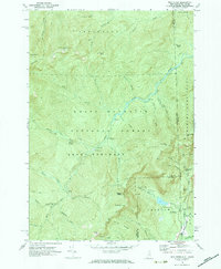 1970 Wild River1972 Print · USGSThe New Hampshire and Maine borderlands are shown here in the early 1970s, focused on the drainage of the Wild River. Trace the high-country Appalachian Trail and find backcountry landmarks like the Spruce Brook Shelter and Brickett Place.3 unique versions available
 - 1986 Map of Lewiston
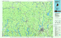 1986 Lewiston1986 Print · USGSMaine’s industrial river valleys and western mountain foothills are captured here in the mid-eighties as rail and road networks tied the region together. Genealogists and historians can trace the development of mill towns and lakefront settlements from Lisbon to Bethel, following the Androscoggin River and the path of the Maine Central Railroad.2 unique versions available
Showing maps 1-25 of 64
Top cities near Stow
- Bridgton historical maps
- Conway historical maps
- Fryeburg historical maps
- Bartlett historical maps
- Gorham historical maps
- Bethel historical maps
See more
Top neighborhoods of Stow
Frequently asked questions
- What are the different types of historical maps available for Stow?
- What is the oldest map of Stow?
- Where can I purchase historical maps of Stow for my home or office?
- Where can I download high-res historical maps of Stow?
- Are there historical topographic maps available for Stow?
- Is there historical aerial imagery available for Stow?
- Where are historical maps of Stow sourced from?