1980s Maps of Stacyville, Maine
Explore 5 historic maps of Stacyville from the 1980s. These maps offer a rare glimpse into what life looked like during the 1980s — showing old roads, neighborhoods, homes, and landmarks that have changed or disappeared over time.
Whether you're researching your family's past, planning a metal detecting trip, or studying how Stacyville's landscape evolved across the 1980s, these high-resolution maps are a powerful tool for exploring the history of this region.
- Focus on a specific era: All maps on this page are from the 1980s, giving you a focused view of this time period.
- See what’s changed: Compare century-old streets, trails, and buildings to today's modern landscape using overlays and satellite layers.
- Research with precision: Use these maps for genealogy, historical research, land use analysis, or educational projects.
- View, download, or print: Maps are fully viewable online in high resolution, and can be downloaded or printed for your own records.
Start exploring Stacyville's history through authentic maps from the 1980s. This is your window into the past.
Stacyville, ME maps
(5)- 1985 Map of Millinocket, 1986 Print
 1985 Millinocket1986 Print · USGSThe North Maine Woods were a landscape of industrial timber and wilderness recreation in the mid-eighties. Genealogists and researchers can trace local settlements and rail stops like Sherman Mills, Wytopitlock, and the Old Long A Siding near the Penobscot River.2 unique versions available
 - 1989 Map of Stacyville
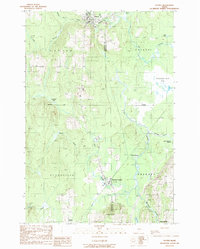
 1989 Stacyville1989 Print · USGSPenobscot County’s river-driven geography is recorded here in the late eighties, focusing on the townships surrounding the East Branch. Genealogists and river historians can locate the Stacyville settlement and trace the specific logans of the East Branch Penobscot River, including Spring Logan and Beer Logan.
 - 1989 Map of Patten
 1989 Patten1989 Print · USGSUpper Penobscot County was defined by its rail junctions and vast wetlands in the late twentieth century. Genealogists and historians can trace the residents of Patten and Sherman Station or locate remote points like Siberia and Stafford Hill.
 - 1989 Map of Benedicta
 1989 Benedicta1989 Print · USGSThe borderlands of Penobscot and Aroostook counties come into focus in the late 1980s as Interstate 95 cuts through the Maine wilderness. Researchers can trace historic river landings like High Landing and Gantners Landing or locate family landmarks such as Mc Avoy Pond.
 - 1989 Map of Lookout Mountain
 1989 Lookout Mountain1989 Print · USGSNorth of the Penobscot forks in the 1980s, this area shows a landscape of timberlands and river camps. Researchers can trace the Monument Line and locate isolated outposts like Lunksoos Camp, Hunt Farm, and the winding Seboeis River.
End of results
Showing maps 1-5 of 5
Top cities near Stacyville
- Millinocket historical maps
- Patten historical maps
- Sherman historical maps
- Island Falls historical maps
- Crystal historical maps
- Dyer Brook historical maps
See more
Top neighborhoods of Stacyville
Frequently asked questions
- What are the different types of historical maps available for Stacyville?
- What is the oldest map of Stacyville?
- Where can I purchase historical maps of Stacyville for my home or office?
- Where can I download high-res historical maps of Stacyville?
- Are there historical topographic maps available for Stacyville?
- Is there historical aerial imagery available for Stacyville?
- Where are historical maps of Stacyville sourced from?