Old Maps of T4 R7 WELS, Maine for Academic Research
Study the evolution of T4 R7 WELS with 39 high-resolution historic maps. Whether you're teaching, researching, or modeling changes in land use, these maps provide essential visual documentation of urban, environmental, and geographic change.
- Analyze long-term change: Track patterns in development, transportation, and natural features.
- Ideal for environmental or urban studies: Support academic projects with primary historical map data.
- Use in the classroom or lab: Educators and researchers rely on these maps to bring historical context to life.
These maps are a powerful tool for teaching, research, and visualizing how T4 R7 WELS has changed over the decades.
T4 R7 WELS, ME maps
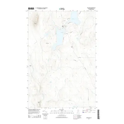
(39)- 1953 Map of Stacyville, 1956 Print
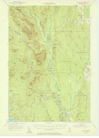 1953 Stacyville1956 Print · USGSThe North Woods of Penobscot County come into focus during the early 1950s, showing a landscape of logging camps and mountain lookouts. Researchers can locate remote sites like Hunt Farm, the Fire Tower on Deasey Mtn, and the old Deasey Dam along the riverbanks.4 unique versions available
 - 1954 Map of Shin Pond, 1956 Print
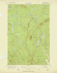 1954 Shin Pond1956 Print · USGSThe Maine North Woods in the 1950s remained a landscape of isolated timber farms and sporting camps. Researchers can trace the early logging infrastructure and river camps at Seboeis Farm, Bowlin Camps, and the settlement at Allsbury.4 unique versions available
 - 1954 Map of Presque Isle, 1968 Print
 1954 Presque Isle1968 Print · USGSNorth Woods logging and rail history come alive in this mid-century survey of the Maine-Quebec borderlands. Genealogists and historians can trace the Bangor and Aroostook railroad through timber hubs like Ashland, Smyrna Mills, and Presque Isle.2 unique versions available
 - 1954 Map of Millinocket, 1968 Print
 1954 Millinocket1968 Print · USGSMaine's North Woods and the Penobscot Valley are captured here during the mid-century era of logging and rail dominance. You can trace the path of the Bangor and Aroostook Railroad through timber towns like Millinocket, Mattawamkeag, and Silver Ridge.3 unique versions available
 - 1958 Map of Presque Isle
 1958 Presque Isle1958 Print · USGSThe Aroostook timber and potato country is captured here during the late fifties, showing the vital rail-to-river network of Northern Maine. Genealogists and historians can trace the Bangor & Aroostook RR through Mapleton and Ashland, or locate remote sites like Chamberlain Farm and Seven Islands.
 - 1958 Map of Millinocket
 1958 Millinocket1958 Print · USGSMaine's North Woods and the Penobscot river valley are captured here in the mid-1950s, showing a landscape of timber, rail, and wild waters. Researchers can trace the legacy of the Canadian Pacific railroad and find historic settlements like Millinocket, Sherman Station, and Mattawamkeag.
 - 1960 Map of Presque Isle
 1960 Presque Isle1960 Print · USGSNorthern Maine during the mid-century was a land of timber, rails, and strategic airfields. Genealogists and historians can trace the growth of Presque Isle and Ashland or explore the remote northern reaches of Baxter State Park and Presque Isle AFB.3 unique versions available
 - 1960 Map of Millinocket
 1960 Millinocket1960 Print · USGSThe Maine North Woods and Penobscot River valley are captured at mid-century during the height of the paper milling era. Researchers can trace the Appalachian Trail near Mount Katardin or locate family roots in towns like Dover-Foxcroft and Milo.3 unique versions available
 - 1975 Map of Stacyville NW, 1980 Print
 1975 Stacyville NW1980 Print · USGSPenobscot County, Maine, is captured in the mid-1970s through this aerial orthophotograph focused on the upper Penobscot watershed. Researchers can trace the winding East Branch Penobscot River and the confluence of the Wassataquoik Stream near Lunksoos Mountain.
 - 1975 Map of Stacyville NE, 1980 Print
 1975 Stacyville NE1980 Print · USGSPenobscot County timberlands are seen in detail in the mid-1970s, revealing the dense woods and waterways of this remote Maine landscape. You can locate Lunksoos Camp and trace the paths of the local River and Stream.
 - 1975 Map of Shin Pond SW, 1980 Print
 1975 Shin Pond SW1980 Print · USGSThe Maine timberlands near Penobscot are seen here in the mid-seventies through detailed aerial photo-imagery. Local historians and land researchers can trace the natural shorelines of Jerry Pond and Bowlin Pond as they appeared decades ago.
 - 1975 Map of Shin Pond SE, 1980 Print
 1975 Shin Pond SE1980 Print · USGSPenobscot County timberlands are seen from the air in the mid-1970s, providing a clear visual record of the Maine wilderness. Researchers can trace the exact shorelines of Shin Pond and the winding network of early logging roads through the deep forest.
 - 1985 Map of Oakfield
 1985 Oakfield1985 Print · USGSAroostook County in the 1980s displays a balance between the timber-and-rail industry and the protected wilderness of the North Woods. Genealogists and local historians can trace family-named hubs like Smyrna Mills, Island Falls, and Knowles Corner along the Bangor and Aroostook railroad line.
 - 1985 Map of Millinocket, 1986 Print
 1985 Millinocket1986 Print · USGSThe North Maine Woods were a landscape of industrial timber and wilderness recreation in the mid-eighties. Genealogists and researchers can trace local settlements and rail stops like Sherman Mills, Wytopitlock, and the Old Long A Siding near the Penobscot River.2 unique versions available
 - 1986 Map of Shin Pond
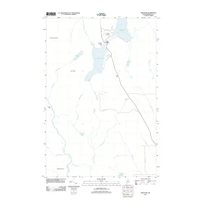
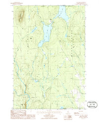 1986 Shin Pond1986 Print · USGSPenobscot County’s wilderness is captured in the mid-1980s, centered on the waterway connecting Upper Shin Pond and Lower Shin Pond. Researchers can trace the timber-rich terrain of M O U N T C H A S E and landmarks like Sugarloaf Mountain and Peaked Mtn.2 unique versions available
 - 1986 Map of Bowlin Brook
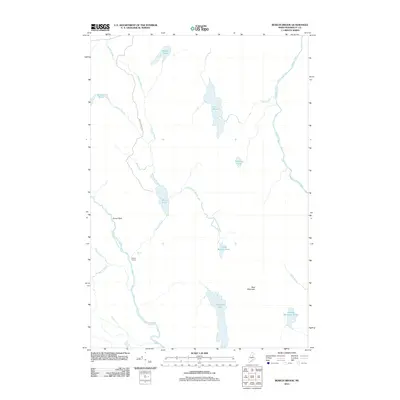
 1986 Bowlin Brook1986 Print · USGSPenobscot County, Maine, was a landscape of remote timberlands and sporting camps in the 1980s. Local researchers can trace the riverways and landmarks like Bowlin Camps, Grand Pitch Falls, and the Seboeis River.
 - 1989 Map of Deasey Mountain
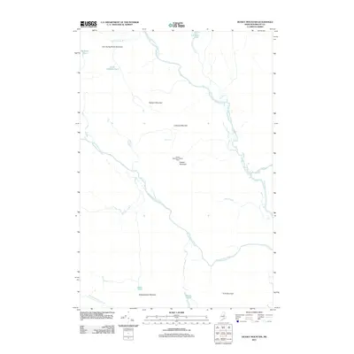
 1989 Deasey Mountain1989 Print · USGSPenobscot County, Maine, is shown in the late 1980s as a wild landscape of intersecting rivers and prominent peaks. Researchers can trace the rugged topography of Deasey Mountain and the confluence of the East Branch Penobscot River with Wassataquoik Stream.2 unique versions available
 - 1989 Map of Lookout Mountain
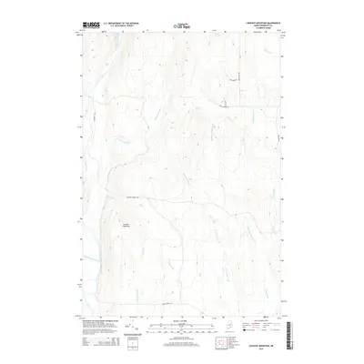
 1989 Lookout Mountain1989 Print · USGSNorth of the Penobscot forks in the 1980s, this area shows a landscape of timberlands and river camps. Researchers can trace the Monument Line and locate isolated outposts like Lunksoos Camp, Hunt Farm, and the winding Seboeis River.
 - 1994 Map of Oakfield
 1994 Oakfield1994 Print · USGSAroostook County's North Woods and rural settlements are shown here in the mid-1990s, capturing the region's transition from forest to farmland. Trace the path of the Bangor and Aroostook RR through Smyrna Mills or locate landings on Millinocket Lake.
 - 2011 Map of Lookout Mountain, 2011 Print
 2011 Lookout Mountain2011 Print · USGSCovers T4 R7 WELS, including Patten, Stacyville, and other nearby areas
 - 2011 Map of Deasey Mountain, 2011 Print
 2011 Deasey Mountain2011 Print · USGSCovers T4 R7 WELS, including T3 R7 WELS, T4 R8 WELS, and other nearby areas
 - 2011 Map of Bowlin Brook, 2011 Print
 2011 Bowlin Brook2011 Print · USGSCovers T4 R7 WELS, including T5 R8 WELS, T4 R8 WELS, and other nearby areas
 - 2011 Map of Shin Pond, 2011 Print
 2011 Shin Pond2011 Print · USGSCovers T4 R7 WELS, including Patten, Mount Chase, and other nearby areas
 - 2014 Map of Lookout Mountain, 2014 Print
 2014 Lookout Mountain2014 Print · USGSCovers T4 R7 WELS, including Patten, Stacyville, and other nearby areas
 - 2014 Map of Shin Pond, 2014 Print
 2014 Shin Pond2014 Print · USGSCovers T4 R7 WELS, including Patten, Mount Chase, and other nearby areas
Showing maps 1-25 of 39
Top cities near T4 R7 WELS
- Patten historical maps
- Sherman historical maps
- Stacyville historical maps
- Crystal historical maps
- Mount Chase historical maps
- Hersey historical maps
See more
Frequently asked questions
- What are the different types of historical maps available for T4 R7 WELS?
- What is the oldest map of T4 R7 WELS?
- Where can I purchase historical maps of T4 R7 WELS for my home or office?
- Where can I download high-res historical maps of T4 R7 WELS?
- Are there historical topographic maps available for T4 R7 WELS?
- Is there historical aerial imagery available for T4 R7 WELS?
- Where are historical maps of T4 R7 WELS sourced from?